Coordinated access to space data more important than ever
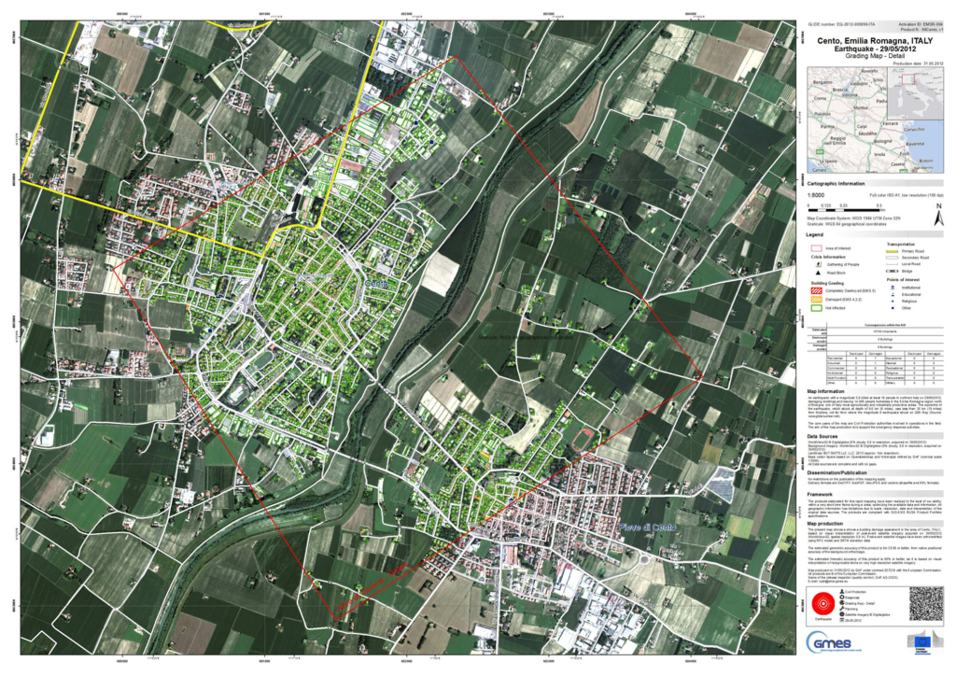
In May 2012, two earthquakes struck Italy’s Emilia-Romagna region, claiming at least 27 lives and causing widespread damage. Through GMES, damage assessment maps derived from satellite data were promptly produced to assist emergency response activities.
The maps were created by integrating pre- and post-earthquake satellite data to show changes that indicated potentially hazardous areas or damaged buildings.
Within hours of the tremors, the maps were uploaded to the Italian Civil Protection web platform and made accessible everyone involved in the emergency management effort.
Coordinated by the European Commission, the aim of the Global Monitoring for Environment and Security (GMES) programme is to provide an increasingly broad user community with accurate, timely and easily accessible information collected from Earth-observing satellites and in-situ sensors.
GMES will improve the management of the environment, understand and mitigate the effects of climate change and support decision-making in emergency and crisis situations – like northern Italy’s earthquake.
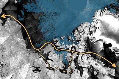
Monitoring marine environments is another service of GMES as it provides regular and systematic reference information on the state of oceans and seas. This also involves operational sea-ice monitoring in polar regions for the safe passage of ships.
Ice, coupled with long periods of darkness during winter months, poses a threat to ships that cross these treacherous waters. Within GMES, satellite radar readings are processed to provide near-realtime information about changing sea-ice conditions and iceberg distribution for navigation.
The GMES land services are also crucial for the operational monitoring of the environmental and ecological conditions of our planet, establishing annual statistics of land-cover change based on variables related to the vegetation, the energy budget and the water cycle.
For these objectives, GMES Services rely on a wide range of satellite data from over 40 European and international space missions, along with other environmental datasets.
The programme’s Space Component data generation is currently in its ‘Data Warehouse phase’. This entails compiling large datasets, such as high-resolution optical coverage of Europe, sea-ice monitoring data, systematic ocean colour data and data for atmospheric composition monitoring.
In addition, ‘flexible’ datasets that can be used for events not known in advance (like emergency mapping during crisis situations) are also being gathered.
Prior to this phase, Space Component data underwent a ‘Data Access Grant phase’, when thousands of Earth observation products from hundreds of datasets were downloaded by GMES Services.

Veronique Amans, the ESA Data Access Operations Manager, has seen the Data Access Service evolving over the past years towards a more operational service.
“Today, we serve a number of GMES users far above original expectations, and satisfying their stringent needs for Earth observation data is a daily challenge,” she said.
“The evermore increasing usage of multiple satellite data represents a major achievement accomplished through the GSC-DA system for the monitoring of our fragile Earth.”
With the upcoming era of the Sentinel missions, the coordinating role of ESA in the collection and assessment of the ever-growing quantities of data from the expanding fleet of satellites will become increasingly important for the success of the GMES programme.