Landmark navigation system wins Copernicus Masters award
A navigation system for self-driving vehicles that uses satellite radar data has won the top prize in the European Earth-monitoring competition.
In its third year, the Copernicus Masters competition – previously known as the GMES Masters – received more than 140 business proposals from teams in 23 European countries.
The competition seeks innovative solutions for business and society based on Earth observation data, while fostering creative product development and entrepreneurship in Europe.
The 2013 winners were announced on Tuesday at an event in Munich, Germany.
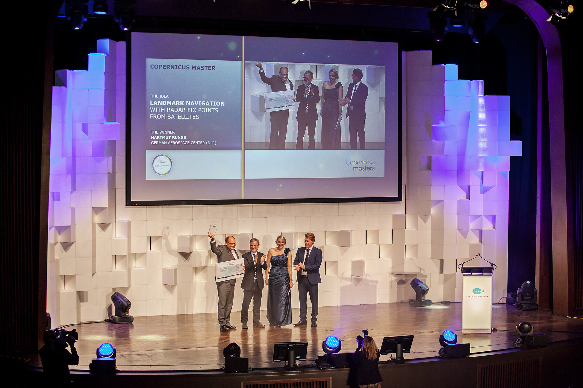
Volker Liebig, Director of ESA’s Earth Observation Programmes, presented the Copernicus Master prize to Hartmut Runge from the DLR German Aerospace Center for his project, Landmark Navigation with Radar Fix Points from Satellites.
The overall winner’s idea also won the BMW ConnectedDrive Challenge.
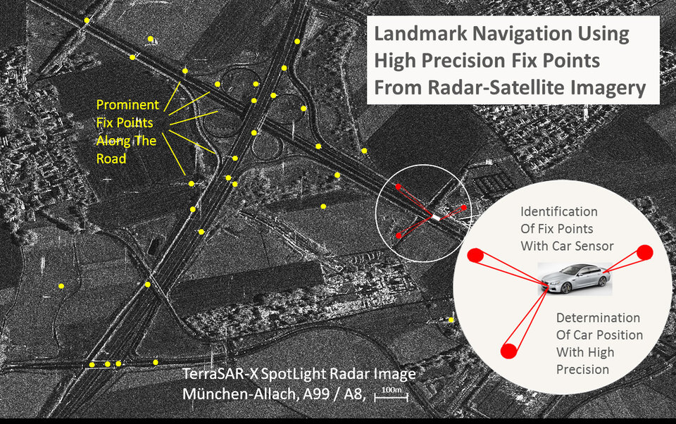
The idea is for a new vehicle navigation system that works independently of global navigation satellite systems (GNSS). It will navigate by landmarks that are easily visible from the vehicle, whose positions are derived precisely from radar remote-sensing satellites like TerraSAR-X and Sentinel-1.
The combination of this technique with GNSS will lead to higher system integrity and reliability, which is important in applications requiring a high level of safety.
“The interdisciplinary idea utilises Earth observation methods to provide a solution for a challenge the automobile industry really faces,” said Benjamin Krebs from innovation management BMW ConnectedDrive at BMW Group.
“We’re excited by the high level of innovation evident in this vision and are looking forward to evaluating the next concrete steps here at BMW Group together with Mr Runge.”

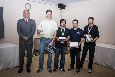
Josef Aschbacher, Head of the Copernicus Space Office, presented the ESA App Challenge prize for the mobile application Cheetah – Taking on a Billion-dollar Problem in Africa.
The winning team, consisting of Alain van Hanegem, Alexander Popp, Stephen Trainor and Valentijn Venus, began developing the app during the week-long ESA App Camp in Frascati, Italy, in June. The app combines crowdsourcing with Earth observation data to assist in global food security with particular focus on the production and transportation of crops in Africa.
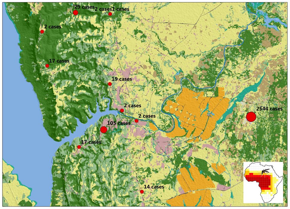
EyeOnMalaria from Dr Jonas Franke and his team at RSS Remote Sensing Solutions GmbH (Germany) won the Ideas Challenge.
The online service aims to provide maps of environments’ aptitude for malaria transmission, which would directly support targeted malaria control at the necessary times and locations while raising public awareness of the malaria season.
The prize for the European Space Imaging High-Res Challenge went to Györk Fülöp from Corvinus University of Budapest. His CAMEA – Certification of Agronomy for Marketing Environmentally Friendly Agriculture project aims to set up a certification service for environmentally friendly agronomic activities that produce crops with a smaller ecological footprint.
Kaupo Voormansik and his team from Estonia’s University of Tartu won the prize in the DLR Environmental Challenge for Urban Analyser: Your City Development Tool.
The proposed service offers high-resolution information about urban area growth based on Sentinel-1 data to aid in planning policies for environmental protection and infrastructure development.
WaveCERT – Wave + Current Energy Reporting Tool was the winning submission to the Astrium Radar Challenge. The tool, created by Steve Lee and his team from the UK’s Stevenson Astrosat Ltd, provides satellite-based data to predict, monitor and survey tidal and wave potential anywhere in the world.
A satellite-based service for mapping global seafloor topography, called Operational Satellite-Derived Bathymetry Service, was chosen as the winner of the T-Systems Cloud Computing Challenge. The service was submitted by Dr Thomas Heege and his team at EOMAP GmbH & Co. KG (Germany).

Taking home the prize for the GEO Illustration Challenge was German student Alexander Popp for his artistic illustration of humanity’s footprint on Earth using satellite data. The image, called ‘Acqua Alta’ or ‘high water’, shows a satellite image of Venice in the form of a human footprint.
Julie Maguire from the Daithi O’Murchu Marine Research Station in Ireland won the Best Service Challenge for her HAB Forecast – Harmful Algal Bloom Forecast. The service provides a weekly web bulletin alerting fish farmers and regulators to these harmful blooms.
Started in 2011 by ESA, the Bavarian Ministry of Economic Affairs, DLR, Anwendungszentrum Oberpfaffenhofen and T-Systems GmbH, the competition is supported by the European Commission, European Space Imaging GmbH, Astrium GEO-Information Services, BMW Group and GEO magazine.