
Earth from Space: An icy Aral Sea
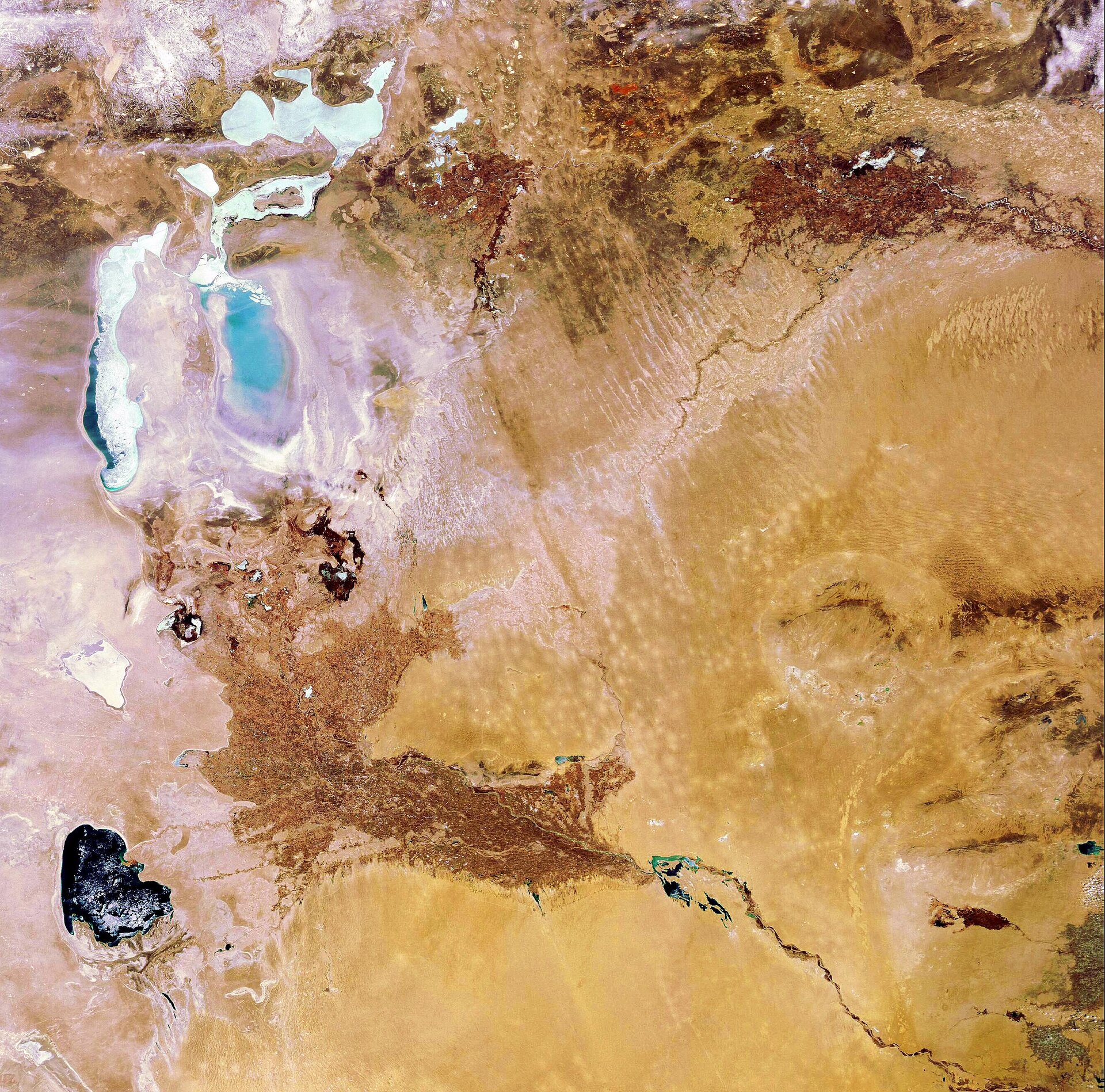
This Envisat image features an ice-covered Aral Sea, located on the border between Kazakhstan and Uzbekistan in Central Asia. This body of water is actually a lake rather than a sea.
Once the world’s fourth-largest lake, the Aral Sea has been steadily shrinking over the past 50 years. In the 1960s, Soviet planners diverted the waters of the two rivers feeding the Sea – the Amu Darya (visible in the south) and the Syr Darya to the northwest – to irrigate cotton fields across the region.
By the 1980s there was little water reaching the lake, causing the concentrations of salts and minerals to rise. The whitish area surrounding the lakebed that looks like snow is actually a zone of dry salt terrain, now called the Aralkum Desert.
By 1989, the Aral Sea had split into two – the larger horseshoe-shaped body of water and a smaller almost unconnected lake to its north. The Small Aral Sea is believed to be saveable, while the Large Aral Sea is expected to dry out completely by 2020. By the end of the century, the sea had split into three major residual lakes.
The Aral Sea's retreating shoreline has left ports landlocked and boats stranded on dry sand. Commercial fishing was forced to halt 20 years ago, with former fishing villages being located over 200 km away from the lakeshore today. Wildlife habitats have been destroyed and communities find themselves without clean water supplies.
The retreat of the waters has also altered the regional microclimate. Winters are colder and the summers hotter. Each year violent sandstorms pick up at least 150 000 tonnes of salt and sand from the dried-up lakebed and transport it across hundreds of km. This leads to severe health problems for the population and one of the highest infant mortality rates in the world.
Also visible in the image is the Qyzylqum Desert (bottom right). This desert is set to extend further west, eventually merging with the Aralkum Desert. The distinctive dark brown area to the south of the Large Aral Sea is the delta of the Amu Darya River – an area intensively used for agriculture.
Envisat acquired this image on 6 March 2008 with its Medium Resolution Imaging Spectrometer (MERIS) instrument while working in Full Resolution Mode to provide a spatial resolution of 300 m.

