
Earth from Space: Dune 45
Korea’s Kompsat-2 satellite captured this image over the sand seas of the Namib Desert on 7 January 2012.
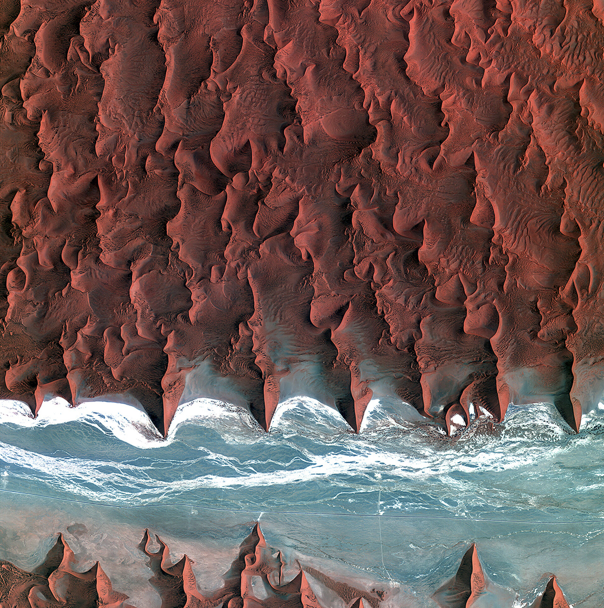
The Namib is the oldest desert in the world, stretching over 2000 km along Africa’s southwestern coast from Angola, through Namibia to South Africa. Sand dunes dominate the desert – some reaching over 300 m in height.
The blue and white area is the dry river bed of the Tsauchab – which only sees water following rare rainfall in the Naukluft Mountains to the east. Black dots of vegetation are concentrated close to the river’s main route, while salt deposits appear bright white.
This flattened area ends about 15 km to the east at the Sossusvlei salt and clay pan (not shown).
Running through the river valley, a road connects Sossusvlei to the Sesriem settlement. At the road’s 45th kilometre, seen at the lower-central part of the image, a white path shoots off and ends at a circular parking area at the base of a dune. This is Dune 45, a popular tourist stop on the way to and from Sossusvlei.
The 170 m-high dune is often photographed early in the morning or late in the day when one side is completely in shadow. In this image, there appears to be some shadow on the western side. From this we can deduce that the image was acquired during the late morning.
ESA supports Kompsat as a Third Party Mission, meaning it uses its ground infrastructure and expertise to acquire, process and distribute data to users.
This image is featured on the Earth from Space video programme.


