
Earth from Space: Guinea-Bissau
This Envisat image features the Republic of Guinea-Bissau located in Western Africa. With an area of 36 125 sq km, it is one of the smallest nations in continental Africa.
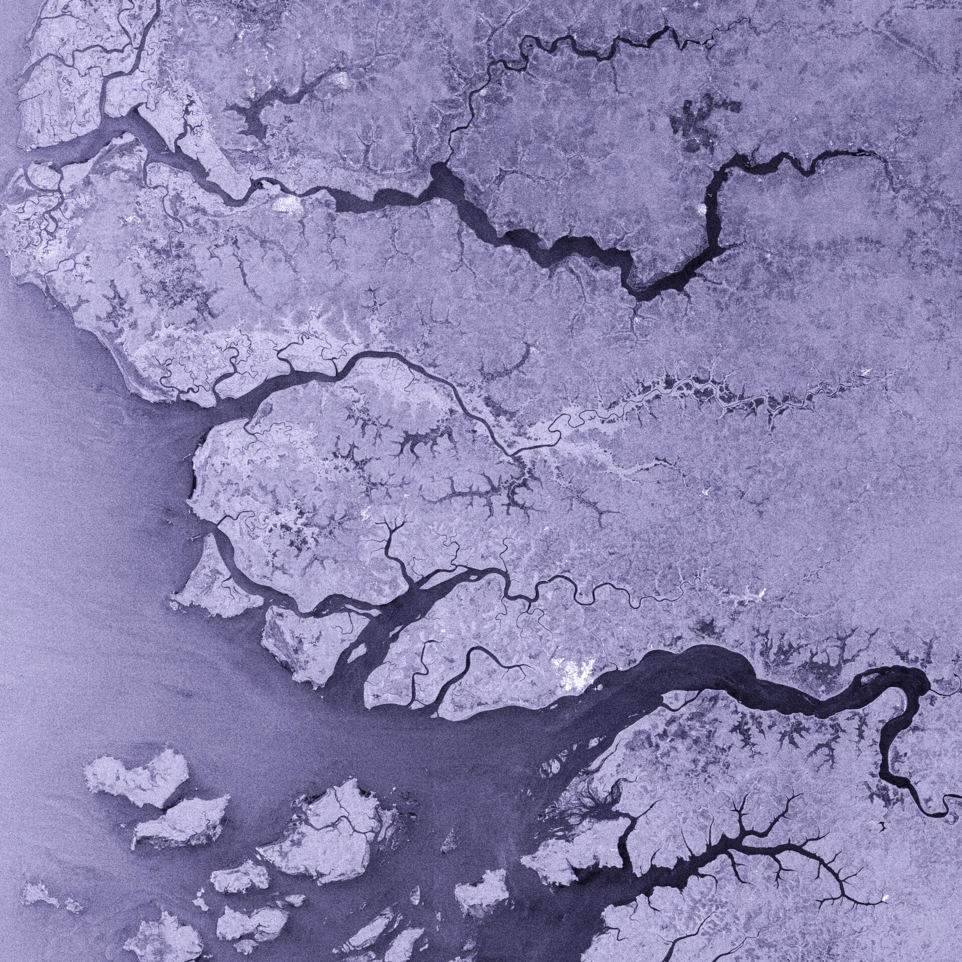
Guinea-Bissau is bordered by Guinea to the south and east, the North Atlantic Ocean to the west and Senegal (visible) to the north. The River Geba runs through the three countries, rising in Guinea, passing through Senegal and Guinea-Bissau before emptying into the Atlantic in the Canal do Geba (the second estuary up from the bottom).
The tropical island is comprised of highlands in its northeastern region and lowlands along the coast, where rain is more frequent. Bissau (seen as a large whitish area on the bank of the Canal do Geba) became the country’s capital city in 1941, replacing Bolama.
The Bissagos Archipelago (visible in the lower left hand of the image) is composed of some 88 islands, including 15 large ones, and islets as well as a large area of mudflats and mangroves and forms part of Guinea-Bissau. The archipelago, separated from the mainland and the capital Bissau by a 16 km channel, has been protected as a UNESCO Biosphere Reserve since 1993.
Guinea-Bissau has two National Parks (Ilhas de Orango - not visible but located at the bottom of the archipelago - and João Vieira e Poilão Marine National Park) and two Natural Parks (Rio Cacheu - located on the second estuary on the left from top to bottom - and Lagoa de Cufada. Lagoa de Cufada (not visible but located just off the end of the Canal do Geba) is also a Ramsar Wetland of International Importance.
The Advanced Synthetic Aperture Radar (ASAR) sensor aboard Envisat acquired this image. Because radar images measure surface texture rather than reflected light, there is no colour in a standard radar image.

