
Earth from Space: ‘The Last Frontier’
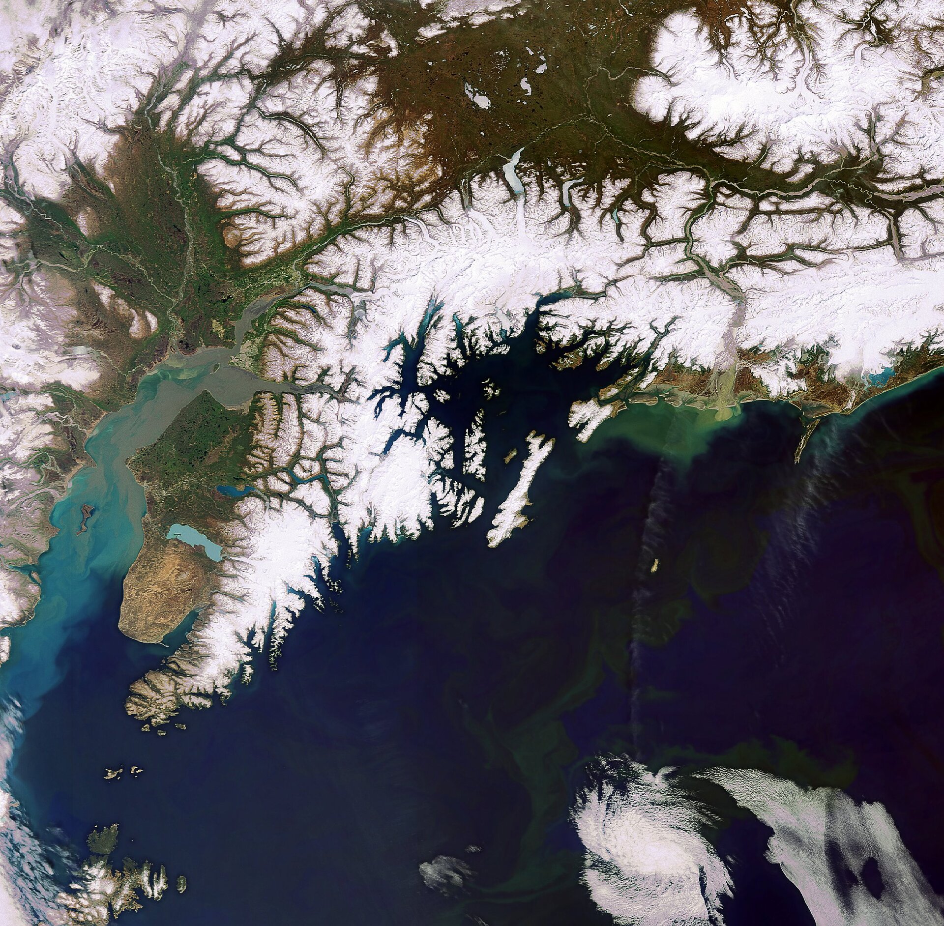
This Envisat image features the southern part of Alaska, which is located in the extreme northwest of the North American continent.
Covering more than 1 500 000 sq km, Alaska is the largest US state by area. Its rugged landscape and climate coupled with the fact that it is the least densely populated state has earned it the nickname ‘The last Frontier’.
Snow-covered mountain ranges dominate the image. The crescent-shaped Alaska Range (visible in the upper left corner) is home to Denali (also known as Mount McKinley), the highest peak in North America (over 6000 m above sea level).
The Chugach Mountains, which contain the state’s greatest concentration of glacial ice, are visible extending eastward along the southern coast for some 500 km. When warm, wet air flows off the Pacific Ocean (visible bottom right) and meets the cool temperatures of this mountain range, some of the highest snowfall in Alaska is created.
The Kenai Mountains cover the southern and eastern portions of the Kenai Peninsula (left of image centre), which is separated from the mainland by the Cook Inlet (a bay of the Pacific Ocean that is visible west of the peninsula in shades of blue, green and tan).
Several rivers and lakes dot the peninsula. Lakes Tustumena (large light blue lake to the south), Skilak (above Tustumena) and Kenai (L-shaped lake northeast of Skilak) are clearly visible.
Kodiak Island (visible in bottom left) is Alaska’s largest island and the US’s second largest, behind the Big Island of Hawaii. Kodiak bears, the world’s largest living carnivores, are found only on Kodiak and neighbouring islands. They can grow more than 3 m long and weigh more than 780 kg.
Anchorage (visible in light green), the state’s largest city, is situated at the head of Cook Inlet. The annual dogsled race known as the Iditarod Trail Sled Dog Race begins in Anchorage.
Sediments being transported in the water along the southern coast and Cook Inlet have coloured the waters shades of green, blue, tan and gray.
This image was acquired by Envisat's Medium Resolution Imaging Spectrometer (MERIS) instrument on 18 May 2009.

