
Earth from Space: Venice’s countryside
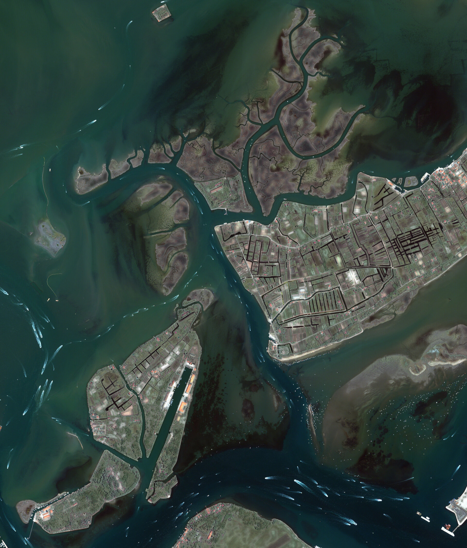
This Ikonos-2 image captures the busy waterways of the Venetian Lagoon and the islands located northeast of the city of Venice (not visible).
The Venetian Lagoon, a crescent-shaped body of water between the Italian mainland and the Adriatic Sea, covers 550 sq km and has an average depth of approximately one metre. The lagoon and Venice were declared a UNESCO World Heritage Site in 1987.
The lagoon’s largest island is Saint Erasmus (centre right). Saint Erasmus and its neighbouring island Le Vignole (bottom left) have long been referred to as Venice’s countryside because they are covered in fields, groves and vineyards.
Le Vignole once functioned as a market garden for Venice, which is located west of Le Vignole.
The lagoon’s labyrinth of waterways is made visible by boats and their contrails. The shallowness of the lagoon makes it essential to travel in navigation channels to avoid sandbanks and mudflats.
Given the strong connection of those that live in the lagoon with water, Venice was chosen as the setting for the upcoming OceanObs'09 Conference held from 21-25 September.
More than 500 participants from 30 countries will attend the conference to discuss the societal and economic needs that ocean-observing systems should address over the next 10 years. ESA, EUMETSAT and the UNESCO Intergovernmental Oceanographic Commission are sponsoring the conference along with other partners.
This image was acquired on 22 June 2008 by Ikonos-2, a commercial satellite that provides panchromatic and multispectral high-resolution imagery. ESA is supporting Ikonos-2 as a 'Third Party Mission', which means ESA utilises its multi-mission European ground infrastructure and expertise to acquire, process and distribute data from the satellite to its wide user community.


