ESA project reveals new insight into complexities of snow
An ESA project has recently demonstrated that new ways of processing satellite data can show how different properties of snow can be observed from space. This new method is expected to lead to a much deeper understanding of the role snow plays in the Earth system.
Snow is a fundamental component of Earth's energy and water cycles. It plays an important role reflecting solar radiation back out to space, emits heat and holds a significant percentage of the global freshwater budget.
However, over the last 30 years global snow cover has been shrinking owing to climate change. The consequences could be far reaching.
To improve our knowledge of the effect that declining snow cover is having on the Earth system and to understand how water resources from snowmelt are changing, the properties of snow must be studied in more detail.
Since snow affects the exchange of water and energy between the land and atmosphere, having exact values of snow and ice coverage is important for numerical weather forecasting. Also, snowmelt contributes to river discharge and potentially to floods.
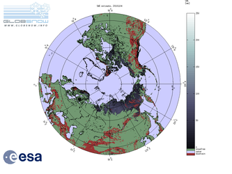
Satellite data from radar and optical instruments are routinely used to monitor the extent of ice and snow, but a recent project has taken archive data and applied new algorithms to yield detailed information on the grain size and temperature of snow.
Carried out by Brockmann Consult through ESA's Earth Observation Support to Science Element (STSE), the Snow Radiance project worked with data collected in 2004 over Greenland.
The project explored the potential of the future Sentinel-3 mission to retrieve snow parameters, resulting in a number of innovative methods and algorithms.
These methods were also tested on existing data from the Medium Resolution Imaging Spectrometer and the Advanced Along Track Scanning Radiometer on ESA's Envisat satellite.
Olaf Krüger from Brockmann Consult said, "The STSE programme is an excellent initiative to give scientists the opportunity to test fresh and new ideas.
"For the Snow Radiance project, the new algorithms could be partly integrated into ESA's data processing facility. This demonstrates the usefulness of the project and direct transition from a scientific idea to an operational product."
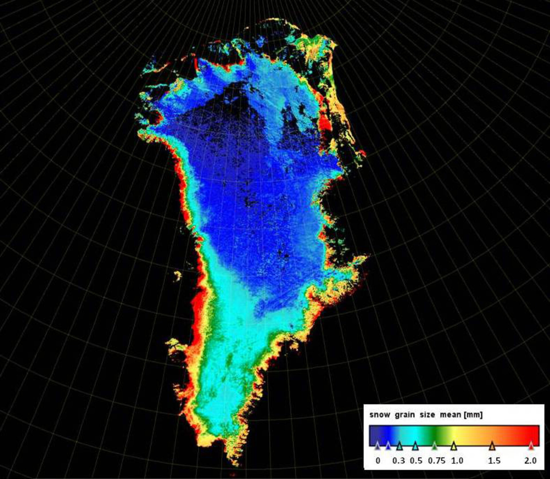
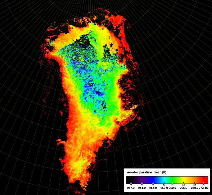
The first results obtained for snow and ice mapping on Greenland show that the size of snow grains during summer range from about 0.01 mm to around 2 mm. Larger grain sizes and higher temperatures are found nearer the coast.
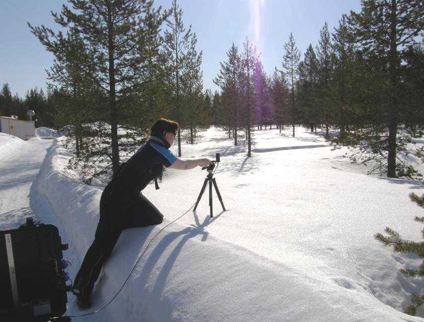
These satellite-derived values for grain size compare well with ground-based data collected during field experiments and campaigns. The satellite data also include information on snow and ice coverage, snow temperature and cloud.
The results are encouraging and demonstrate that the new algorithms, based on radiative transfer modelling, could pave the way for routinely acquiring accurate data on snow properties and how they vary over time.
Moreover, it is expected that this new method will lead to more detailed monitoring of mountain glaciers and the Greenland and Antarctic ice sheets.
This new data processing method will be applied to the Ocean Land Colour Instrument that will be carried on ESA's Sentinel-3 satellite for Europe's Global Monitoring for Environment and Security programme.