Slight surface movements on the radar
Scientists are making advances in the use of satellite radar data – such as those from the Sentinel-1 mission – to monitor Earth’s changing surface.
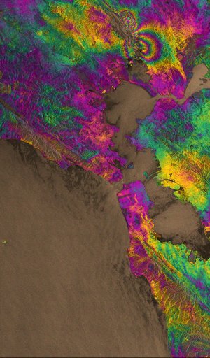
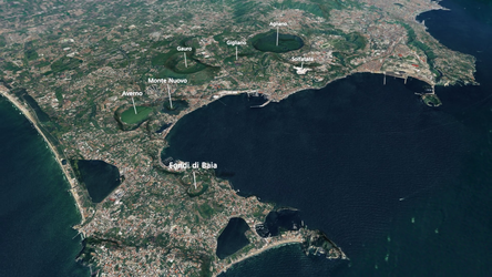
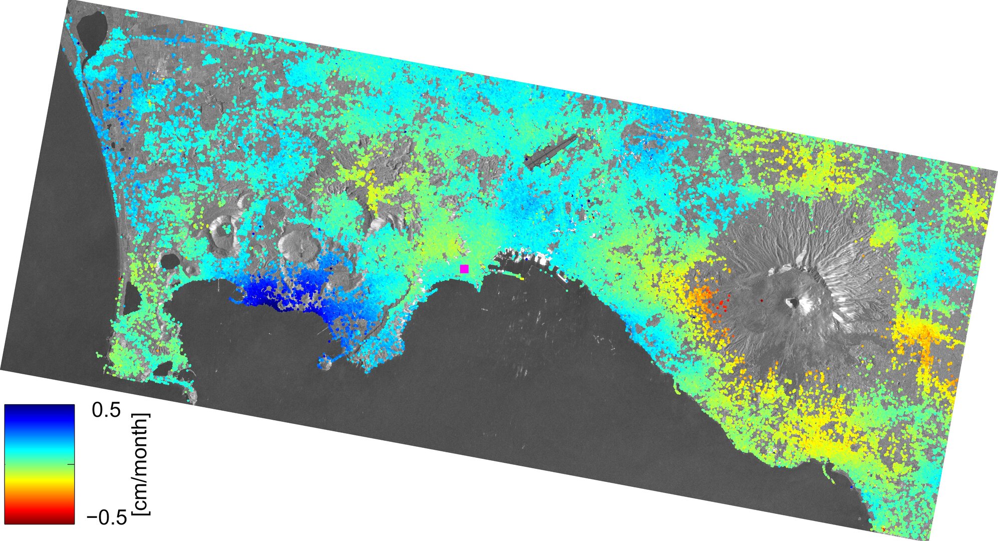
Italy’s Phlegraean Fields – or Campi Flegrei – is a large, active volcanic area near the city of Naples and Mount Vesuvius, characterised by continuous ground deformations owing to its volcanic nature.
“In 2012, deformation rates up to 3 cm a month prompted the Italian Civil Protection Department to move from the base (green) alert level of the Campi Flegrei Emergency Plan to the attention (yellow) level,” said Sven Borgstrom from Italy’s National Institute for Geophysics and Volcanology.
“The uplift continues today: radar imagery from the Sentinel-1A satellite captured over the area between October 2014 and March 2015 show that the ground is rising by about 0.5 cm per month.”

This is just one of the many findings being presented this week at the Fringe Workshop on advances in the science and applications of ‘SAR interferometry’ held at ESRIN, ESA’s centre for Earth observation, in Frascati, Italy.
Interferometric Synthetic Aperture Radar, or InSAR, is a remote sensing technique where two or more images of the same area are combined to detect slight changes occurring between acquisitions.
Tiny changes on the ground cause changes in the radar signal and lead to rainbow-coloured interference patterns in the combined image, known as an ‘interferogram’.
The Fringe Workshop takes its name from these coloured fringes seen in the interferograms.
Small movements – down to a scale of a few millimetres – can be detected across wide areas. Tectonic plates grinding past one another, the slow ‘breathing’ of active volcanoes, the slight sagging of a city street through groundwater extraction, and even the thermal expansion of a building on a sunny day.
This year, the workshop is paying particular attention to new results from the Sentinel-1 mission. Launched in April of last year, Sentinel-1A became the first satellite in orbit for Europe’s Copernicus programme, and has been delivering important data for an array of operational and scientific applications.

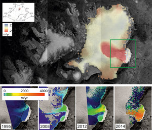
In Norway’s Svalbard archipelago, Sentinel-1 data are being used to monitor ice loss from the Austfonna ice cap. Earlier this year, the satellite captured the ice cap’s outlet glacier flowing at 3 cm per day.
With over 420 participants, this year’s Fringe workshop has seen the largest turnout since its inauguration in 1991 – when four specialists met to discuss the early InSAR results from the ERS-1 mission. Radar interferometry has come a long way since, with contributions from satellites such as Envisat and now Sentinel-1A.