Space helps forests regenerate
Many of us probably think of trees during the festive season more than any other time of the year. With Christmas trees now discarded and decorations packed away, we will be turning our attention back to daily life. The task of cultivating and regenerating forests, however, is a year-long concern – but one that can be made easier and cheaper thanks to satellites and cloud-computing.
In Finland, conifers are not only the most common native species of tree, but economically the most important. Once the trees have been felled, seedlings are planted as part of the regeneration process.
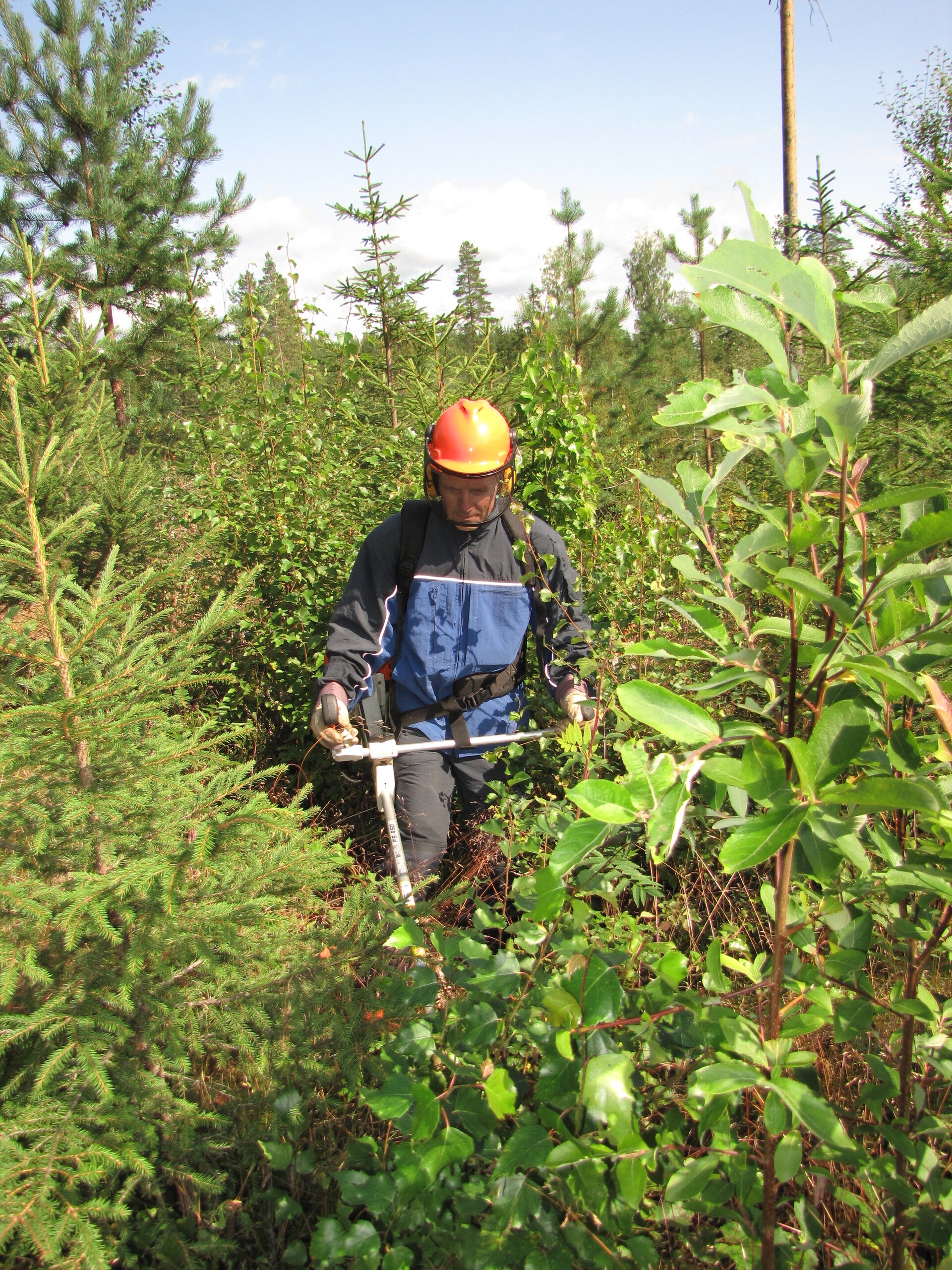
However, broad-leaved trees and shrubs can also self-seed in open regeneration areas and restrict, or even supress, the development of the conifer seedlings. This means that shrubs have to be removed to allow space for the conifers to grow.
Shrub removal is so important that the government offers financial incentives to encourage forest owners to carry it out.
With hundreds of thousands of square kilometres of land being cultivated and trees taking a relatively long time to grow, checking regeneration areas is laborious and expensive.
As ‘eyes in the sky’, satellites offer a unique source of information to ease such tasks, but it is sometimes difficult for users to make sense of complex data streams.
ESA is addressing this challenge with Thematic Exploitation Platforms. The idea is to unlock satellite data and make the information available to the non-expert along with the tools and resources they need – and critically make all this accessible from one place.
There are seven Thematic Exploitation Platforms – or TEPs for short. They cover geohazards, coastal environments, forestry, hydrology, polar regions, urban environments and food security.
The Forestry TEP is still a pilot service, but has already shown how it can make forestry more efficient and profitable, and also help ensure that government funding is not wasted.

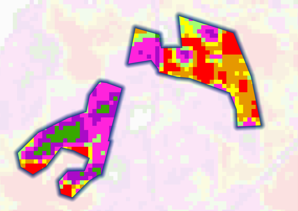
Aki Hostikka from the Finnish Forest Centre said, “The Forestry TEP allows us to map shrub coverage so that we can advise forest owners on the best time to manage regeneration areas. It can also be used to estimate how much work it will take to remove shrubs and the cost involved.
“The shrub maps are also useful to ensure that appropriate forest regeneration has actually been carried out when government funding has been issued.”
The service uses data from the Copernicus Sentinel-2 mission, which comprises two identical satellites. Each satellite carries a high-resolution camera that images Earth’s surface in five days with 13 spectral bands.
In this case, the mission’s red and near-infrared bands are used to map the abundance of unwanted broad-leaved trees and shrubs in regeneration sites. A particular index is applied to this 10 m-resolution data and then further refined and computed through the Forestry TEP to yield maps that are useful for growers.
As the service is still in development, crews on the ground use their phones to take photos of the seedling sites to serve as additional reference. The photos are transmitted to a server with the site coordinates.
With the Finnish Forest Centre testing the service over more than 100 000 sq km during the autumn of 2017, the preliminary results look promising. Moreover, these results will be used to fine-tune the service so that it is suitable for commercial service providers.


Access the video