
Wetland management on the radar
An ESA project focuses on exploiting satellite radar data to monitor wetlands for sustainable water management.
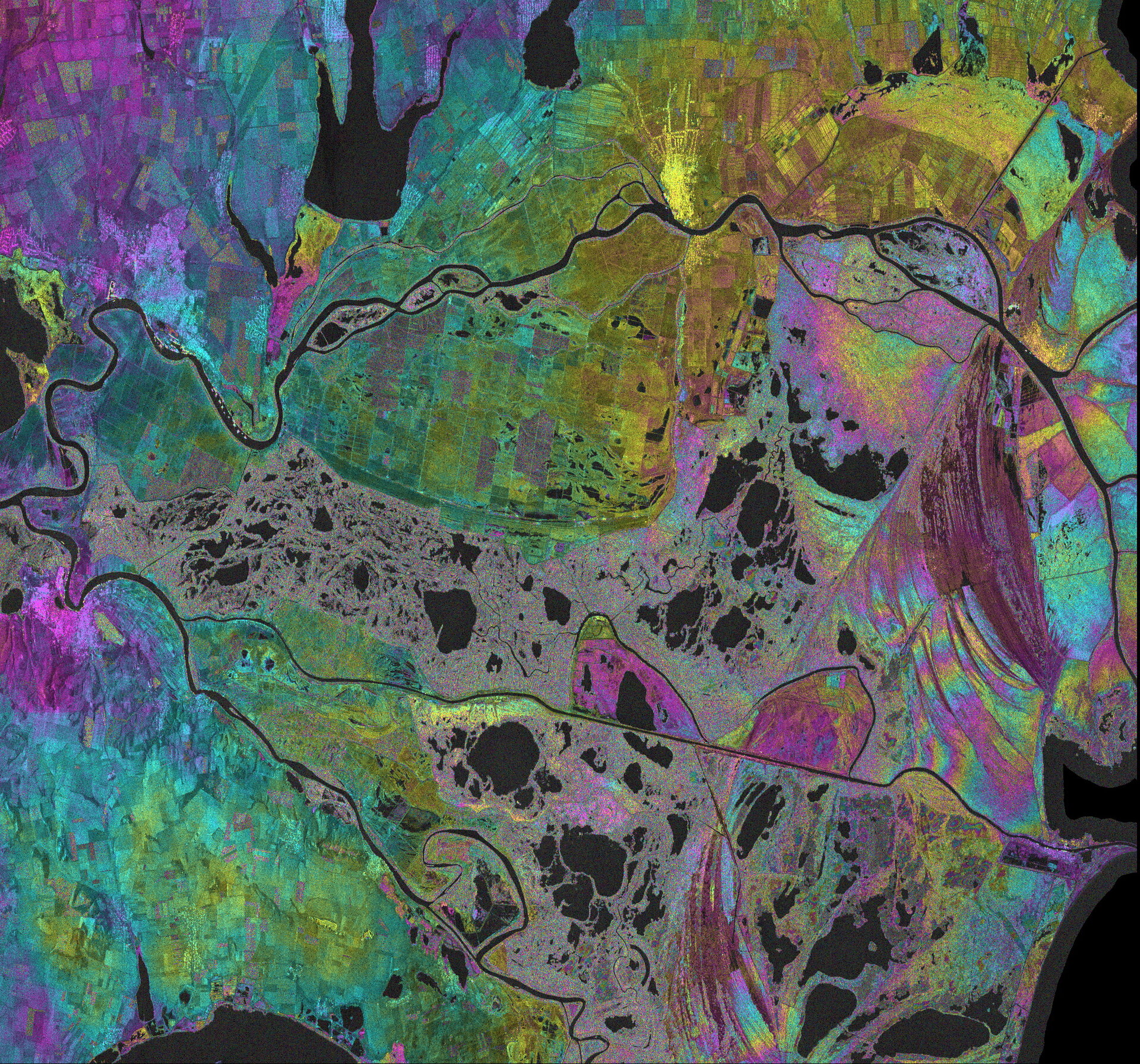
The Danube River Delta in Romania covers more than 4180 sq km. It plays an important role in local water supply and is a local haven of biodiversity.
As one of the Ramsar Convention’s wetlands of international importance, as well as a UNESCO World Heritage Site, the delta has some 30 different types of ecosystems that function as a valuable natural buffer zone for pollutants from the Danube River. Economically, it offers agriculture and fishing, and as a unique recreational area it is attracting a growing numbers of tourists.
Understanding the area’s dynamic processes allows changes in the Danube Delta to be monitored. The difference in water flow through or within the wetland, for example, can provide important insight into water quality or how human activities affect the delta’s ecosystem.

With many areas within the delta virtually inaccessible, satellites provide the means to map and monitor this biologically diverse wetland. In particular, radars – such as the one on the Sentinel-1 mission – can provide information on the present state of a wetland, hydrological interactions between the different types of reservoirs, and can help to refine current hydrological models dedicated to wetland management.
To do this, multiple images from synthetic aperture radars – or SARs – are combined to create ‘interferograms’ showing changes between the radar scans. The measurements are then analysed to show various hydrological parameters such as water surface extent, water level changes and the direction and gradients of water flow.
To promote the use of satellite radar data for the monitoring of wetlands, ESA launched the Hydro-SAR project.
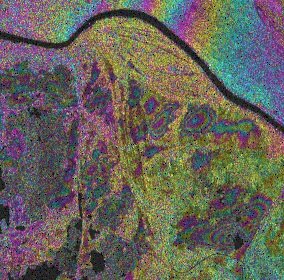
Under the project, maps related to water extent, levels and flow were produced and a monitoring prototype was tested by Terrasigna, a Romanian company that processes and interprets satellite data, together with the National Institute of Marine Geology and Geoecology, called GeoEcoMar – a Romanian research institute that focuses on aquatic, marine, deltaic and fluvial environments.
“For the first time in the Danube Delta, spatially dense interferometric radar measurements were used to study the water dynamics at the different seasonal water regimes,” said GeoEcoMar General Director Gheorghe Oaie.
“The observed local behaviours proved to be much more complex than previously believed: among others, unprecedented detail could be gained on the normally unobservable connections between water bodies, making it possible to create local water flow scenarios and improve on hydrological models.”
