Keeping transport systems on track
Operators of UK transport networks are the first who are set to benefit from Live Land, a satellite-based land monitoring system developed through ESA.
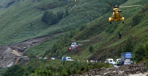
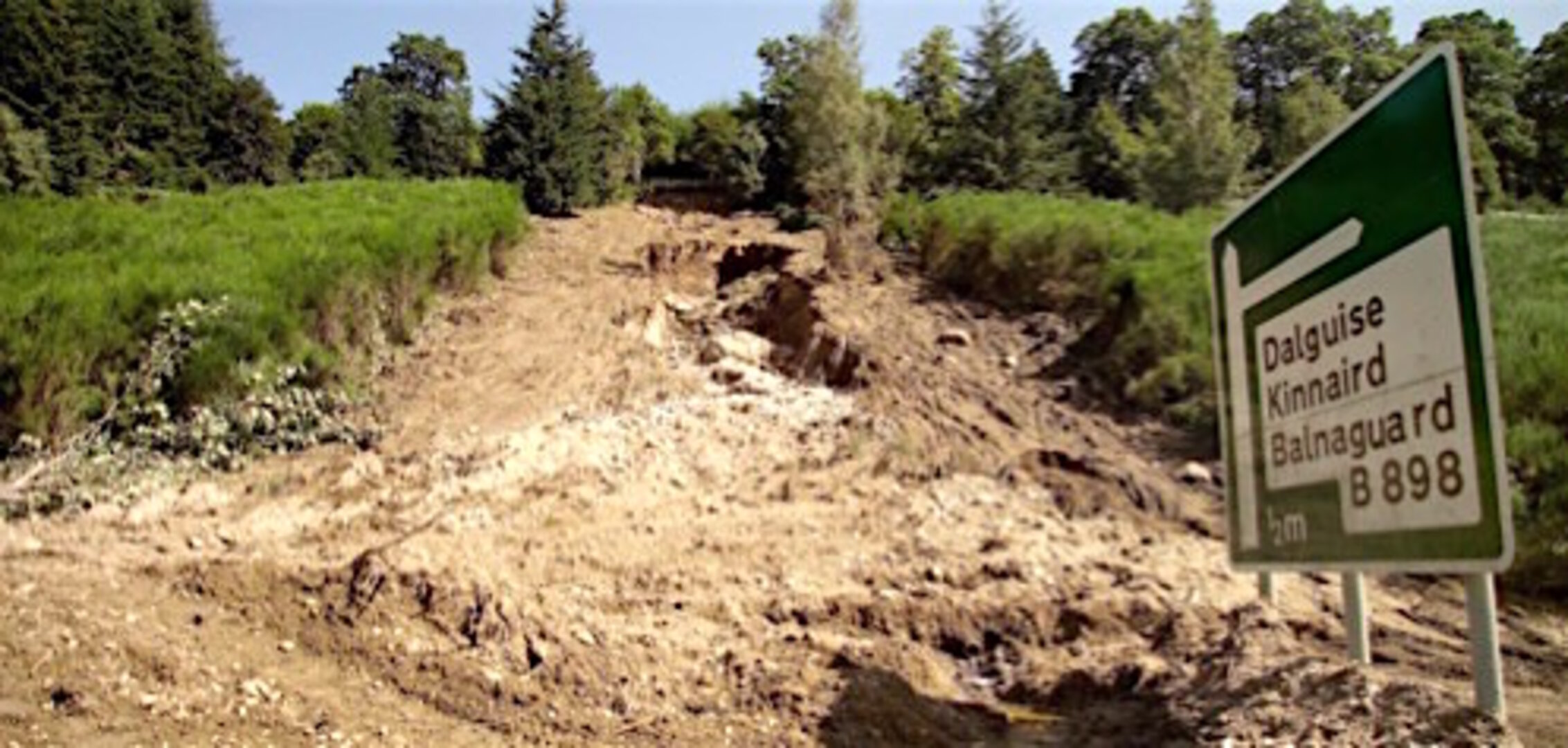
Transport operators across the UK face significant challenges in monitoring and detecting landslides and subsidence across their networks. Incidents in the vicinity of roads and railways, resulting from such geological hazards, can disrupt business and communities.
The Live Land demonstration project will help to assess and monitor high-risk areas by providing more information on geological hazards along rail and road networks using integrated data from navigation and Earth observation satellites.
Radar images from Europe’s Sentinel-1A observation satellite detect surface motion changes with millimetre precision. This is complemented with data from satnav receivers and sensors installed for in-situ monitoring in specific locations.
This space-based information is combined with knowledge about the geology of the area and weather forecasts. For example, an area of steep slopes and wet soil that is expecting heavy rainfall is at a higher risk of a landslide.
Furnished with such knowledge, transport operators can assess the risks and improve their planning and response to incidents.
Over the next two years, the Live Land consortium, led by CGG NPA Satellite Mapping in the UK, will develop a number of products for two prominent Scottish transport operators, Network Rail (Scotland) and Transport Scotland.
The project is funded under ESA’s ARTES Integrated Applications Promotions programme.
ESA’s Roberta Mugellesi commented: “Live Land integrates data collected from different sources to assess and monitor potential geological threats for transport operators. Combining space-based data increases the confidence in risk assessment and predictions.”
The Live Land consortium is working with the British Geological Survey, the UK’s Met Office and Nottingham Scientific.
After initial demonstration of the system in Scotland and regions of England, Live Land expects to interest more transport operators across the UK and continental Europe.
Claire Roberts, Live Land project manager, and remote sensing consultant at CGG NPA Satellite Mapping, said: “The developments targeted in the project are ambitious but necessary given the scale of the issues we want to address.”
Businesses and communities in remote locations will benefit particularly from the timely handling of potential geological hazards to rail and road networks. For operators, early alerts are key to maintaining a safe transport network.