Agency
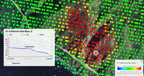
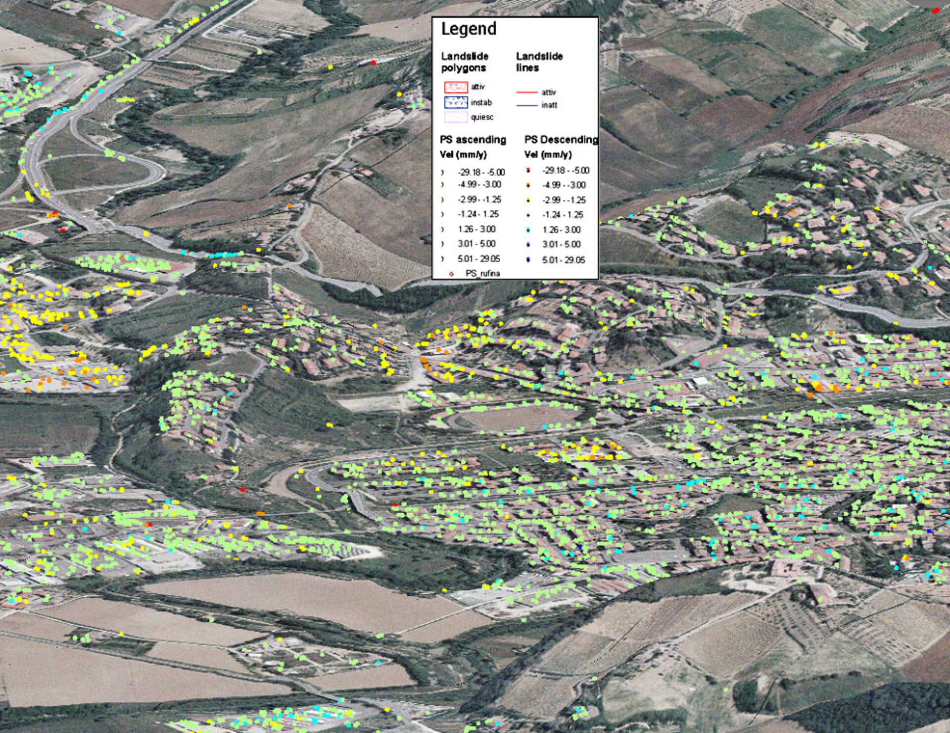
Overview of displacement measurement points over a landslide area
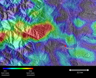
SLAM Landslide Displacement Monitoring Product Example. The image is an aerial photo draped on a 20m-resolution Digital Elevation Model and overlaid by Permanent Scatterers derived from processing of ERS SAR satellite data. Permanent Scatterers are stable sites within the landscape such as walls or large boulders whose coherence makes SAR interferometry possible. These Permanent Scatterers have been identified on ascending and descending satellite tracks by Tele-Rilevamento Europa exploiting ten years of ESA data archives, interpreted by the Universitá di Firenze in order to analyse the behaviour of specific known landslides.
ERS data copyright ESA 1992-2006