Science & Exploration
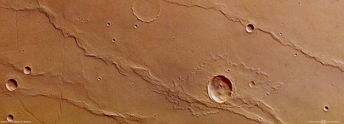
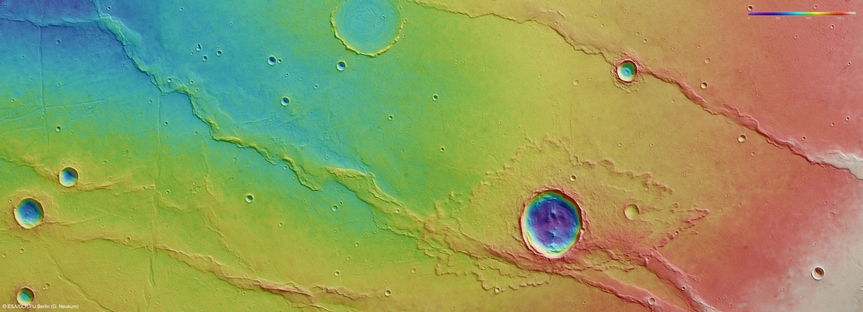
Melas Dorsa topography
This colour-coded plan view is based on a digital terrain model of the region, from which the topography of the landscape can be derived. Notable here is the almost complete lack of relief change in the crater at the top of the image, which has been filled in by volcanic activity. Centred at around 18°S and 288°E, the image has a ground resolution of about 18 m per pixel.