Topography of Deuteronilus Cavus on Mars
This colour-coded topography image shows Deuteronilus Cavus and surroundings in the northern hemisphere of Mars.
The image was created from data gathered by Mars Express’s High Resolution Stereo Camera (HRSC) on 25 October 2024. It is based on a digital terrain model of the region, from which the topography of the landscape can be derived. The elevation – indicated in the key at top right – shows the overall low elevation of the northern hemisphere.
The colour-coding helps us understand the flow of the landscape from higher to lower ground, and clearly shows the blocky knobs and mesas rising above their surroundings within the crater.
The ground resolution is approximately 18 m/pixel and the image is centred at about 36°N/14°E. North is to the right.
[Image description: A topography map of the Deuteronilus Cavus depression in the northern mid-latitudes of Mars. The scale goes from red (highest terrain) through yellow and green to the lowest terrains in deep blue. The 120 km-wide Deuteronilus Cavus, and a smaller crater to the top left are the deepest features in this scene.]

A broader view of Deuteronilus Cavus

Deuteronilus Cavus in 3D

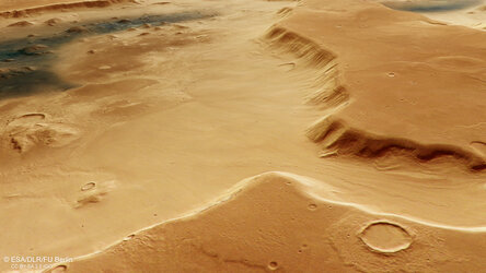
Branched channel at Deuteronilus Cavus on Mars
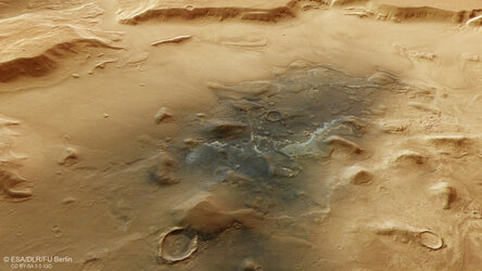
Jumbled blocks and dust on the floor of Deuteronilus Cavus