
Halting deforestation from space
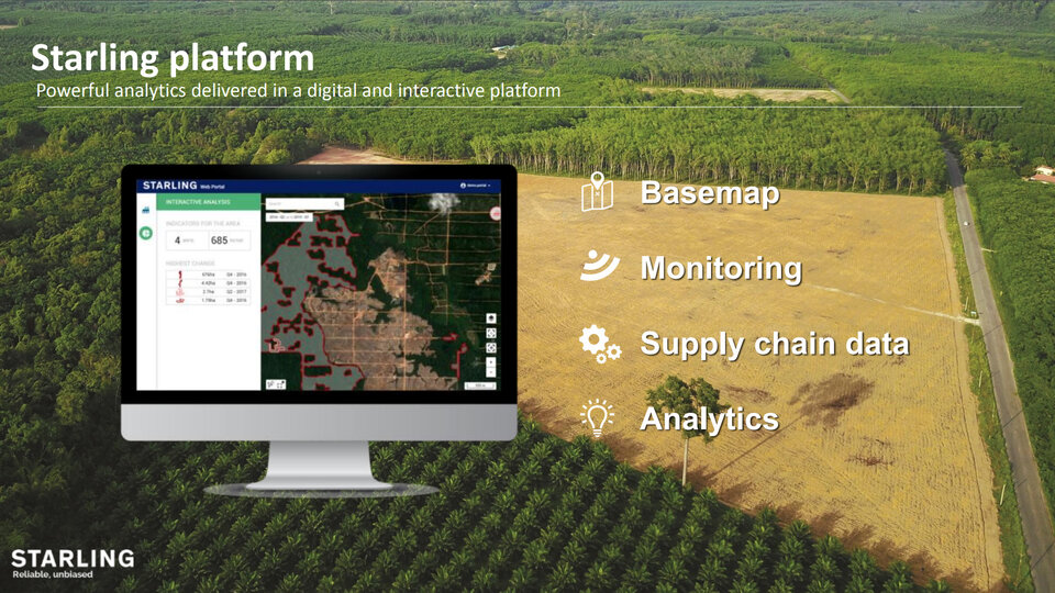
With the United Nations estimating that globally we are now losing an area of forest roughly the size of a football pitch every two seconds, private companies, public institutions and NGOs are upping their forestry conservation pledges. But Earth is huge, and many places are difficult to access, so how can they possibly monitor the progress of these commitments? Presenting Starling, the interactive digital platform using satellite images and in-situ field knowledge to monitor land cover change and forest cover disturbance in near real-time.
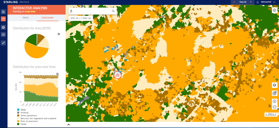
Starling kicked off in June 2017 in Indonesia and Malaysia, where the development of palm oil plantations was driving deforestation. The platform now covers 22 countries around the world, representing seven million square kilometres. Its easy-to-use interface is designed to help users identify changes in forest cover and make informed decisions about where and how to act.
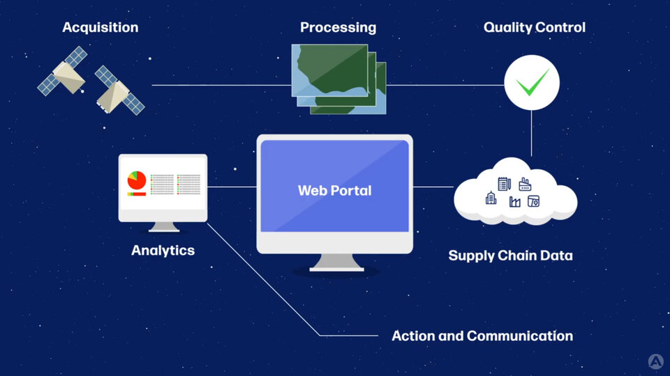
The platform is the result of a collaboration between aerospace company Airbus and the non-profit Earthworm Foundation. Whilst Airbus uses its technology and industrial know-how to process satellite images and distribute Starling worldwide, Earthworm provides on-the-ground expertise and demonstrates to different actors how they can make use of the platform to drive action.
"In addition to an imagery layer from Airbus' SPOT satellites, Starling provides a 20-year time series of land cover basemaps and land cover change analytics, using images from the Sentinel-2 and Landsat satellites," explains Pauline Sol-Wagner, who works on agricultural business development at Airbus. "These allow monitoring of the evolution of land cover, and include commodity-specific production data."
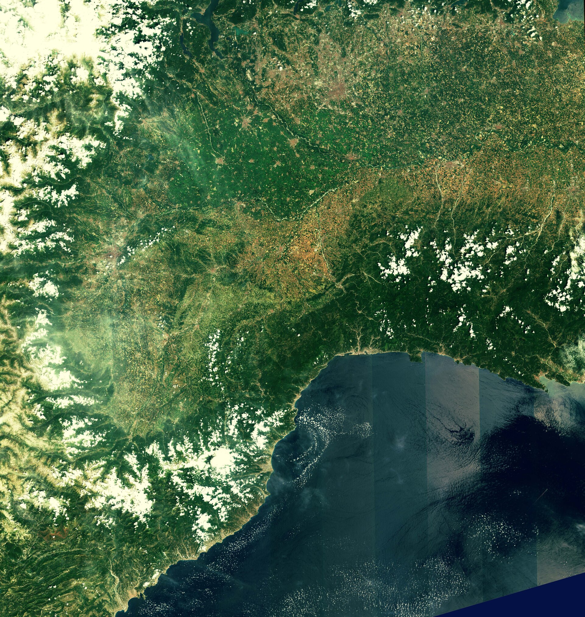
Orbiting high above, Copernicus Sentinel-2 and Landsat see a lot of the ground at once, with Sentinel-2 re-imaging the same location every five days. So far, hundreds of thousands of satellite images have been processed for Starling.
"For each location, we get around six Sentinel-2 images per month. Using these images, we regularly update Starling's monitoring layer, for which we deliver a monitoring report every quarter or at a higher frequency if required," continues Pauline. "This enables Starling users to find out about any changes in forest cover quickly."
"By comparing satellite images taken at regular intervals, Starling can detect when forest is lost, and alerts users if and when this is the case for a location they are interested in. This makes it possible to follow land cover change, address deforestation and check progress on policies throughout the supply chain."
By transforming independent data into critical insights that support the curbing of deforestation and the verification of sustainable sourcing, Starling is supporting several of the UN Sustainable Development Goals (SDGs), including goals 15, 12 and 17. SDG15 focuses on protecting, restoring and promoting the sustainable use of terrestrial ecosystems, including forests. SDG12, meanwhile, aims to ensure sustainable consumption and production patterns, and SDG17 is about using global partnerships for sustainable development – of which the partnership between Airbus and Earthworm is a great example.
Who uses Starling?
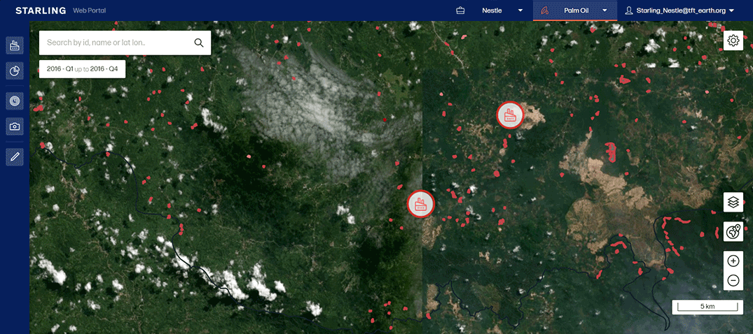
As well as supporting many public institutions and NGOs to monitor and reduce deforestation, Starling also meets the needs of several private companies such as Nestlé and Ferrero. Nestlé was actually the first company to use satellite monitoring across its supply chain, and has used Starling to verify that as of April 2019, the majority of its agricultural commodities were deforestation-free.
Nestlé also uses the information it gains through Starling to engage suppliers and prioritise transformative actions. For instance, the food and drink corporation has worked with Peru’s largest palm oil producer, Grupo Palmas, to achieve responsible growth in the country's palm oil industry.
In another example, the government of Ivory Coast used Starling to reduce the rate of deforestation, identify priority areas and follow action strategies in the country's Cavally Forest. Farmers were clearing land underneath the tree canopy to plant young cocoa plants that need shade. This is difficult to spot with traditional methods, but Starling has demonstrated the capacity to observe below-canopy vegetation using satellite radar data, making the tool ideal for monitoring cocoa-induced degradation and deforestation.
Scale, speed, simplicity and support
Pauline and her colleague Wendy Carrara, who works on digital platforms at Airbus, focus on the four 'Ss' of Starling: scale, speed, simplicity and support.
Wendy explains: "In terms of scale, we provide local insight at a high enough resolution, as well as global insight by including multiple regions and forest types. Then looking at speed, we help Starling users prioritise their actions, providing insight that gives them enough time to step in and address deforestation by offering quarterly monitoring features. Next is simplicity – we have developed the platform to be easy to use by anybody, even those with no knowledge of Earth observation. And finally support – we collaborate with Earthworm, but also with customers to help them get the best out of Starling."
Why Copernicus Sentinel-2 is key
Copernicus Sentinel-2 delivered its first set of images just four days after launch in June 2015. The mission consists of a pair of twin satellites that orbit Earth once every 100 minutes, together imaging a path on Earth’s surface 580 kilometres wide, compared to 185 kilometres for Landsat. The result is that 98% of the ground can be observed cloud-free in high resolution at least four times a year.
The satellites observe in 13 spectral bands – from visible to infrared light – giving various perspectives on land and vegetation. This means that the mission can be used to retrieve a wealth of different information about Earth’s surface.


Access the video