
How satellites save mangroves from space
After the 2004 Indian Ocean tsunami, Wetlands International saw that many lives had been spared by something surprising – mangroves. In response the non-profit organisation scaled up its work on protecting and restoring these complex ecosystems. One important tool in their arsenal is images from the Copernicus Sentinel-1 and -2 satellites.
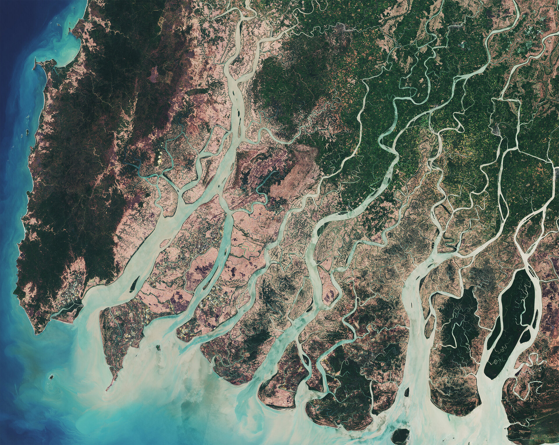
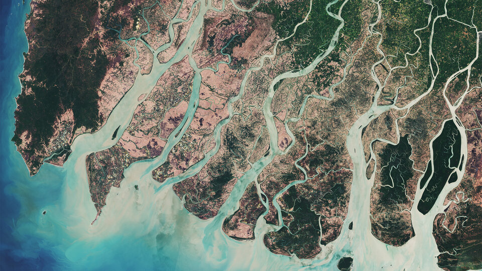
Mangroves make up only a small proportion of the world's forest but are vital for humans and nature. They are home to fish, shellfish, birds and mammals. They store more carbon per hectare than rainforests. And they protect coastal communities from extreme weather. As Wetlands International discovered, they can reduce the destructive force of a tsunami by up to 90%.
Lammert is an information manager at Wetlands International. He explains: "After the 2004 tsunami we saw that areas with intact mangroves suffered far fewer deaths and less damage than those with lost or damaged mangroves."
Between 1996 and 2016, around 6.6% of mangroves were lost worldwide. This was down from 1% per year in the 1980s.
"Historically, the biggest risk that mangroves face is from conversion to agriculture on the land side, and to aquaculture on the sea side," says Lammert. "But there is also growing pressure from climate change, with rising sea levels starting to overwhelm mangroves and changing rainfall patterns causing some to die off because of a lack of fresh water."
The good news is that most can be restored. An online platform called Global Mangrove Watch is providing remote sensing data and tools for coastal and park managers, conservationists, policymakers and practitioners to respond by pinpointing the causes of local mangrove loss and tracking restoration progress.
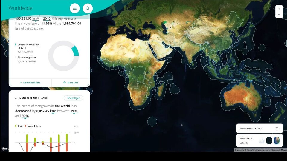
Together with Aberystwyth University, soloEO and The Nature Conservancy, Wetlands International is a key partner in Global Mangrove Watch, so Lammert explains how the platform works: "We use satellite data to produce a map of all the mangroves around the world once a year. It currently goes to 2016 but later this year we will release maps up to 2020."
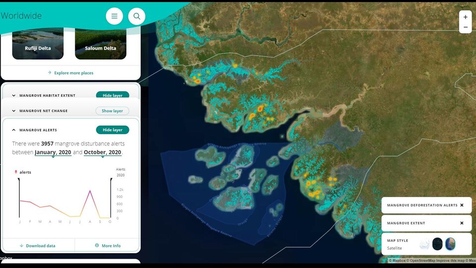
But to detect destruction and stop it in time, park managers, conservationists and policymakers need information more immediately.
"We also use data from the Sentinel-1 and -2 and Landsat 8 satellites to provide what we call 'change alerts' for Africa. The Sentinels reimage the same location every few days, so once a month we compare their new images with a baseline map. We send out alerts if we see a difference in mangrove cover."
The current baseline map was built using 2010 data from the US Landsat and Japanese ALOS satellites, but the team is currently updating it using 2021 data from the Copernicus Sentinels. This higher resolution data will give the new map a resolution of just 10 metres, compared to the current 25 metres resolution.
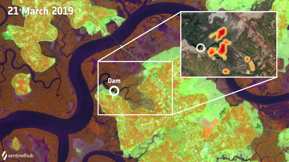
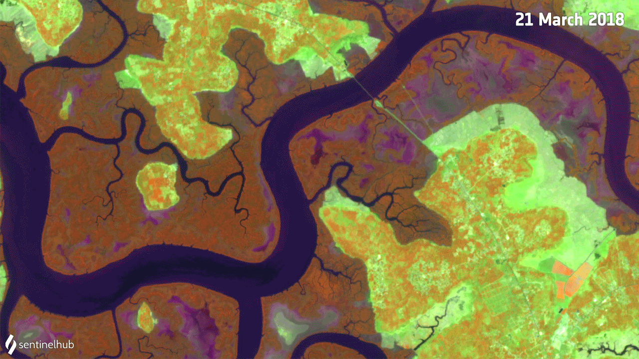
Change alerts have already been used to catalyse action, including in Guinea-Bissau. In March 2019 a Sentinel-2 image showed that an area of mangrove in the country had been significantly destroyed. A closer look revealed that a new dam had been built and was blocking the tide from coming in and out.
"We sent people on the ground to the site. They saw that the government had built the dam to turn the mangrove into rice fields. There was nothing that could be done to prevent the transformation, but often in these cases the rice fields are tended for a few years, then the mangroves grow back."
"Our change alerts currently cover Africa, but we will soon be providing them for five of the most mangrove-rich countries, including Mexico and Indonesia. We hope that the alerts will be available for the whole world in the next couple of years."
"I want to emphasise how happy we are with the Sentinel images," concludes Lammert. "They are free, high resolution, and available almost immediately after they are taken. This means that we can act quickly to protect and recover mangroves worldwide."
Explore mangroves from space yourself using the Global Mangrove Watch.
