Baltic overflight tests ESA’s PARIS receiver
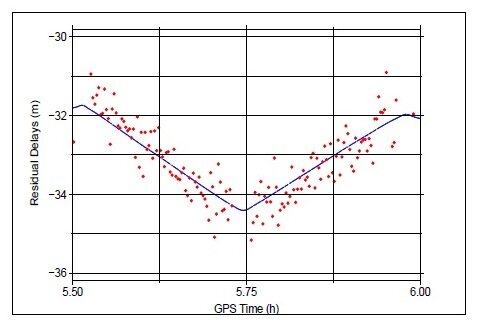
Airborne researchers tested an innovative ESA-developed remote sensing concept. By comparing GPS signals arriving directly from space and the same signals bounced back from the Baltic Sea they measured a tiny 2 cm per kilometre sloping sea surface due to local gravity variations.
The airborne trial 3 km above the Baltic marked the latest milestone in ESA’s Passive Reflectometry and Interferometry System (PARIS) project, intended to perform Earth monitoring using reflected navigation satellite signals.
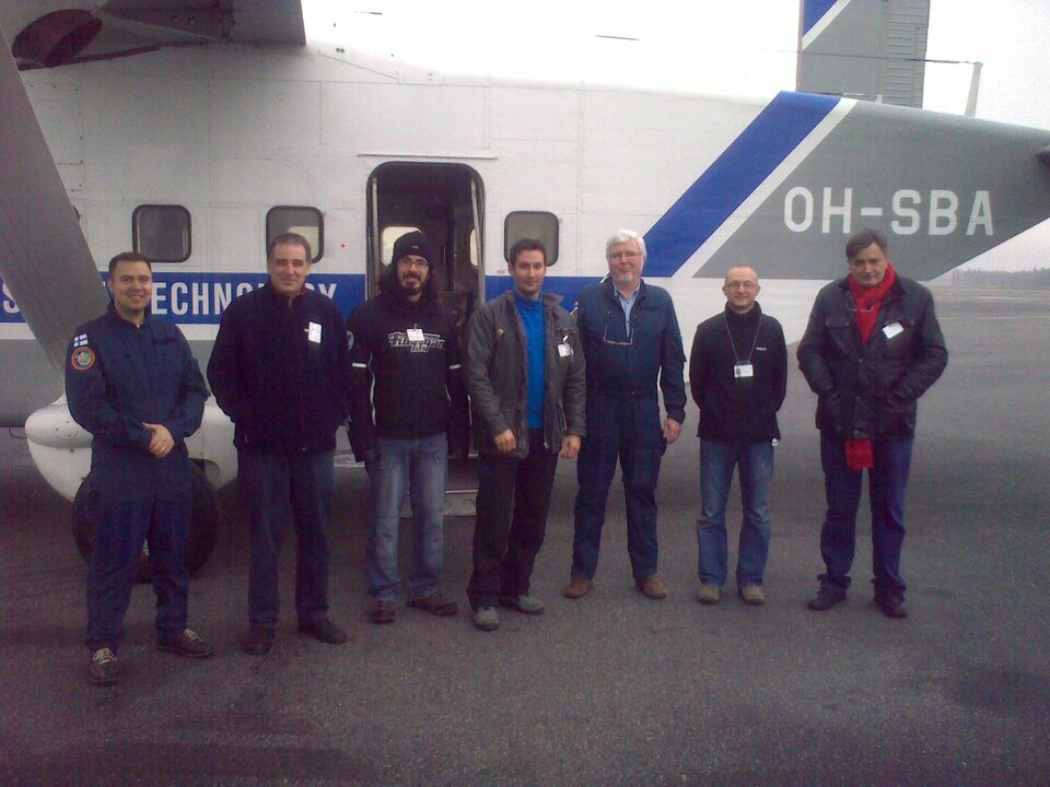
A prototype PARIS receiver, fitted by Spain’s Institute of Space Sciences (IEEC-CSIC), was flown on the Aalto University research aircraft from Helsinki Airport across the Gulf of Finland for two hours last 11 November 2011.
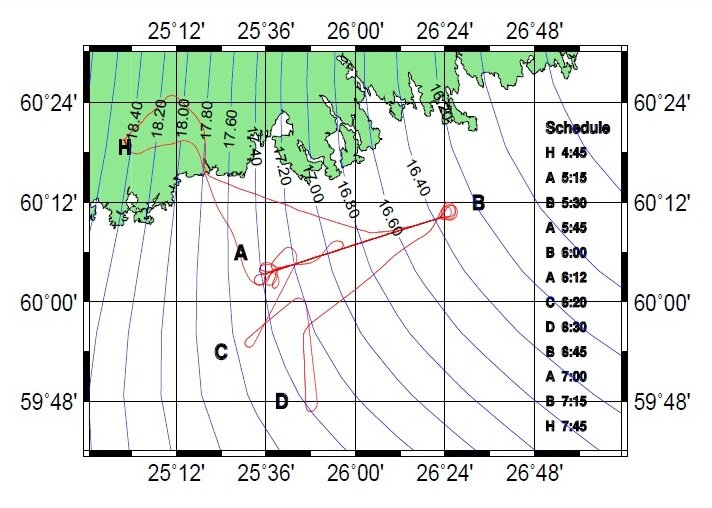
The flight path was pre-planned to synchronise with the visibility of a pair of GPS satellites supposedly transmitting all signal codes.
“While the receiver measured the coherence of the direct and the reflected GPS signals, the aircraft’s motion was precisely tracked from GPS stations on shore as well as an onboard inertial measurement system,” explains ESA engineer Manuel Martín-Neira, inventor of the PARIS concept.
“We needed to be able to compensate for any aircraft turbulence to get an idea of PARIS’s performance as if it was in orbit.
“From subsequent analysis our experiment – supported by ESA’s Basic Technology Research Programme – achieved an overall accuracy of 18 cm. “We’d target 5 cm for the operational PARIS satellite.”
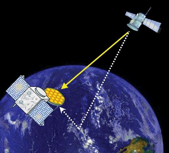
Navigation signals rain down on Earth constantly, bouncing off the surface and back out to space. The idea behind PARIS is to turn them into a scientific resource by intercepting them.
The system would complement current radar altimeter instruments flown on missions such as Envisat and CryoSat-2to provide wider multi-point views over a very wide swath at a somewhat lower accuracy.
So PARIS should be able to picture eddies, storms and other ‘mesoscale’ phenomena – and a constellation of PARIS satellites would represent a rapid early warning system for ocean tsunamis.
“The PARIS receiver has two sides – it collects the original signal on the upward side, then the reflected signal on the downward side,” explained Manuel.
“Then we use a sophisticated technique called interferometry to combine the two signals together and determine the extra travel time of the reflected beam to calculate the distance to the surface.”
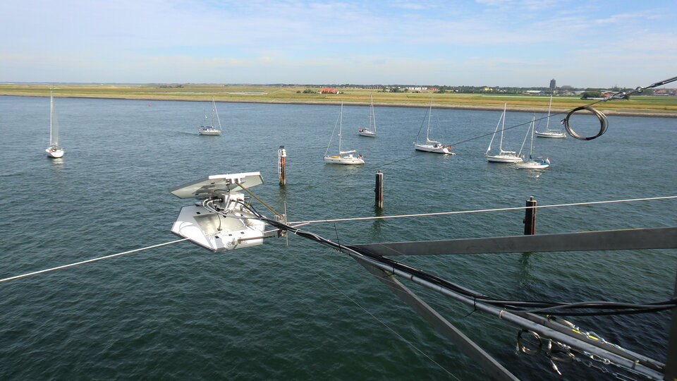
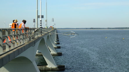
In 2010 the PARIS prototype receiver was tested much closer to the sea – it was extended off the Zeeland Bridge in the Netherlands. The team then adapted the system for airborne testing.
“The flight test results have proved promising,” Manuel added.
“The challenge is now to demonstrate that we would achieve the expected accuracy from space by receiving multi-frequency signals to compensate for the effects from the electrically-active upper layer of the atmosphere, the ionosphere.
“These include classified military codes – PARIS uses any signal from any satellite, because we don’t rely on the data encoded within each signal, just the signal itself. In fact, during our test we were able to tell one GPS satellite wasn’t transmitting its M-code that day.
“We cross-checked our results with the ‘geoid’ – which is a mathematical model of the shape of the sea surface if influenced only by gravity – revealing PARIS had detected the slight slope of the Baltic Sea basin due to a local gravitational variation.
A new, more advanced PARIS receiver and processor suited for space is being developed through ESA’s General Support Technology Programme, aimed at developing flight-ready versions of promising hardware.
Further airborne testing should then be followed by a small satellite prototype through the Agency’s In-Orbit Demonstration programme.