
Bardarbunga belches
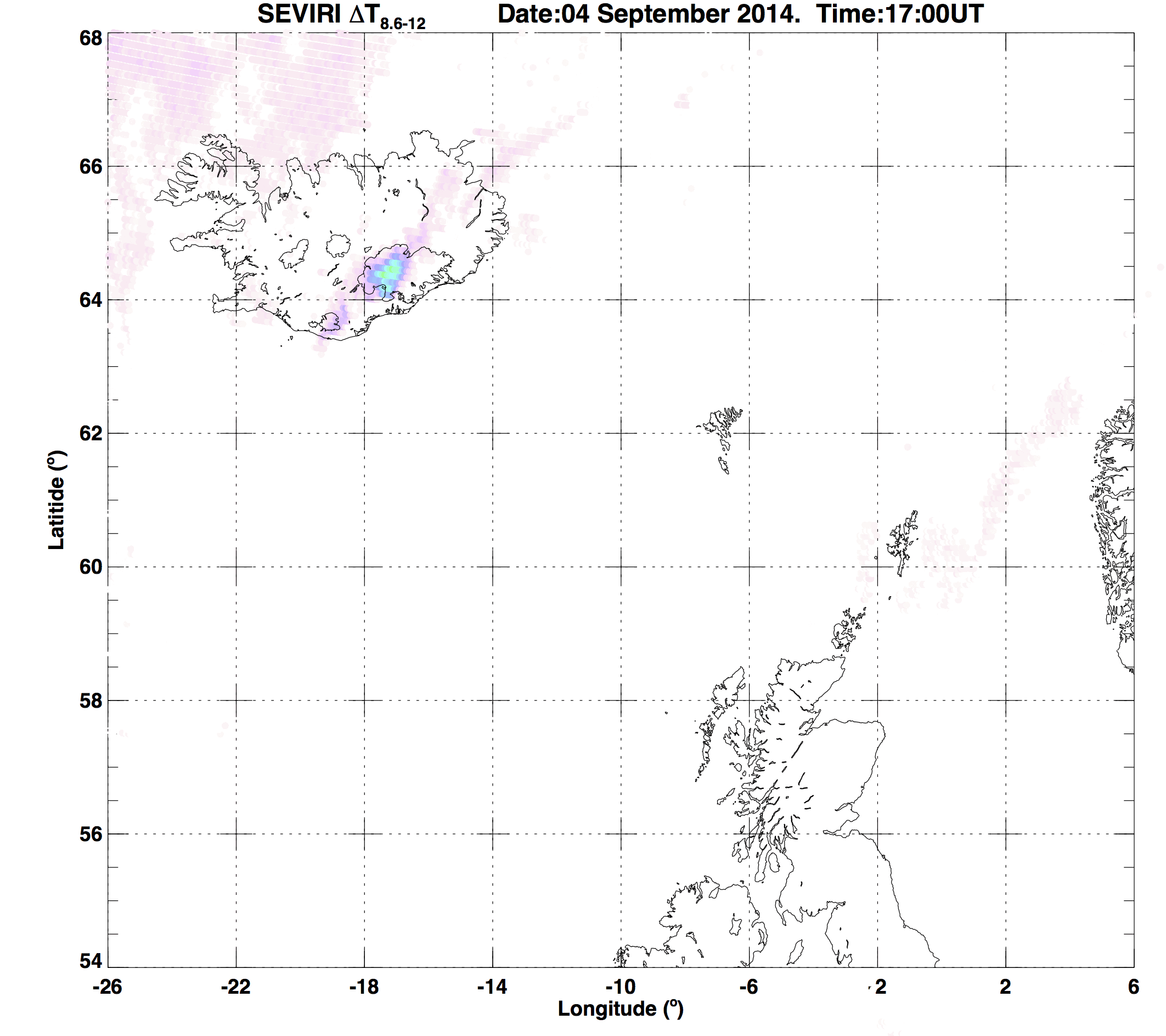
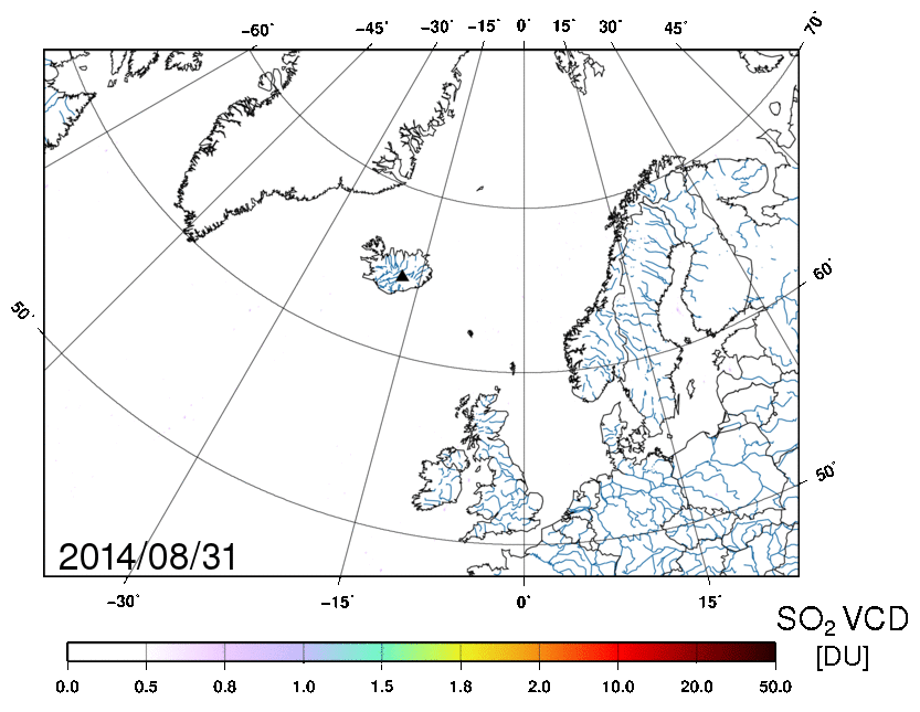
Satellites are showing clouds of sulphur dioxide from Iceland’s restive Bardarbunga volcano.
ESA’s Volcanic Ash Strategic Initiative Team (VAST) and Support to Aviation Control Service (SACS) are monitoring the situation closely, and have detected sulphur dioxide emissions since early September. A small cloud of sulphur dioxide has been drifting toward Europe since late last night.
The Bardarbunga volcano has shown heightening activity since mid-August, causing thousands of local earthquakes, spewing lava and threatening air travel. The aviation alert level is high, fluctuating between orange and red as the potential of eruption is increased.
“The current volcanic activity is typically effusive and no ash has been detected so far with satellite measurements,” said Nicolas Theys from the Belgian Institute for Space Aeronomy.
“SACS, VAST and ESA partners will continue monitoring volcanic emissions over Bardarbunga and provide added-value services, in case the eruption becomes explosive, causing ash-producing activity with possible consequences for European air space.”
The presence of ash in the atmosphere can endanger jet engines, so timely information about ash, sulphur dioxide clouds and their dispersion are crucial to alert civil aviation authorities.
Earth-observing satellites can provide this information, especially for toxic gases like sulphur dioxide, which cannot be seen with the naked eye. With frequent and worldwide measurements of ash plumes and sulphur dioxide emissions, satellites help to improve aviation safety.
SACS and VAST uses multiple satellites – including Europe’s MetOp and Meteosat missions – to provide early warning information about volcanic eruptions.
When an eruption occurs, an alert is sent to interested users, most notably to Volcanic Ash Advisory Centres and airlines, and public maps are generated showing the extent and intensity of the volcanic plumes.

