Remote sensing data
Until recently, Earth observation data from satellites was available only to a few nations, and distribution of data was limited and strictly regulated. However, with more states seeking to develop such capability, the policies of the major spacefaring nations have changed. Thanks to a combination of changing military and strategic environments and the increasing interest in satellite images and data, there is a growing international market for geo-spatial information and high-resolution commercial remote sensing.
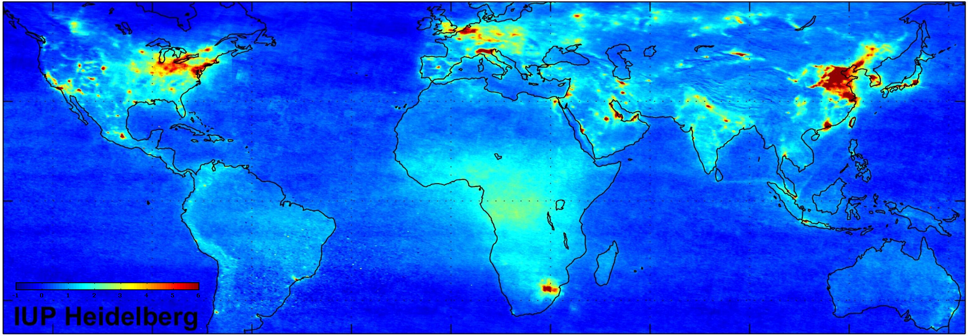
Remote sensing uses the properties of electromagnetic waves emitted, reflected or diffracted from Earth to space to create data that can be used to improve natural resources management and land use and to protect the environment. Earth-observation satellites carry instruments that make remote measurements from space to show what is happening on Earth. This data is collected and stored before being processed, interpreted and disseminated.
ESA’s Earth-observation satellites
In the early 1980s European governments entrusted ESA to develop and operate the first European Remote Sensing Satellite ERS-1 followed by ERS-2. European engineers, under the direction of ESA, developed a special instrument called a Synthetic Aperture Radar (SAR).
The first SAR was launched into space in July 1991 as one of three main instruments on ESA’s ERS-1 spacecraft. It was followed by a second on ERS-2 in 1995. At the time, the two ERS satellites were the most sophisticated Earth observation spacecraft ever developed and launched in Europe. These highly successful ESA satellites have collected a wealth of valuable data on the Earth’s land surfaces, oceans and polar caps.
In 2002 ESA launched Envisat, the most powerful European Earth observation satellite yet built. Envisat is a key element in ESA’s plans to monitor the Earth’s environment in the next decade.
Further information on current and future Earth-observation satellites and missions is available from the link “Observing the Earth” provided on the upper right hand side of this webpage.
Protecting remote sensing data
Remote sensing activities by European operators raises the question of how to protect data from Earth observation satellites. These are very costly programmes and a legal tool is needed to enable satellite operators to recover their investment and to commercialise Earth observation data. No private investor will engage in the creation of computer products derived from data unless they are certain that the legal tools exist to recover their investment if necessary.
A study carried out on behalf of the European Commission confirmed the confusion about which type of law should be applied: copyright, trade secrets or ownership rights, and that existing European legislation did not cover remote sensing data.
In effect most operators in Europe used copyright protection for their data. However, copyright law is not ideally suited for these activities as the protection is insufficient for several reasons, notably because it is inapplicable to raw data. Furthermore, there was a risk that protection could differ between ESA Member States due to the interpretation of national copyright laws.
The ideal solution for remote sensing was a sui generis protection to be adopted at a European Community level. A sui generis right means that the legislator can ‘borrow’ principles from comparable regulations to protect satellite remote sensing data.
In 1996, with ESA’s full involvement, the EU Directive on databases was enacted and subsequently transposed into domestic legislation by the EU Member States. This Directive protects creative databases under copyright law and creates a unique protection – the sui generis right - for databases that do not meet the requirement of originality but which require a substantial investment. In other words, the sui generis right extends protection to databases containing material not protected by copyright.
As a result, remote sensing data assembled in an original database is protected under the European Directive. A sui generis right is granted if the database is individually accessible and requires substantial investment. Basically it consists of two sets of rights defined in Article 7 (2) as the extraction right and the re-utilisation right.


