
Craters and cracks on Mars
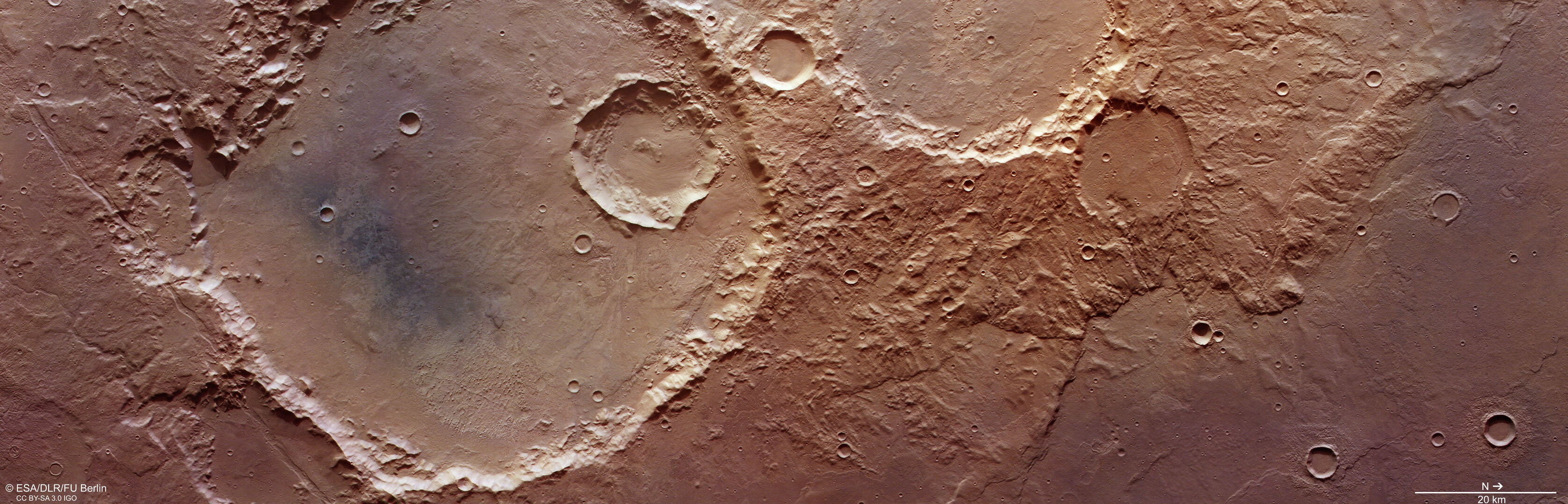
This complex region of craters and fractures in the Terra Sirenum region highlights the varied history of Mars. The image was taken by ESA’s Mars Express on 5 April 2022.
Making an impact
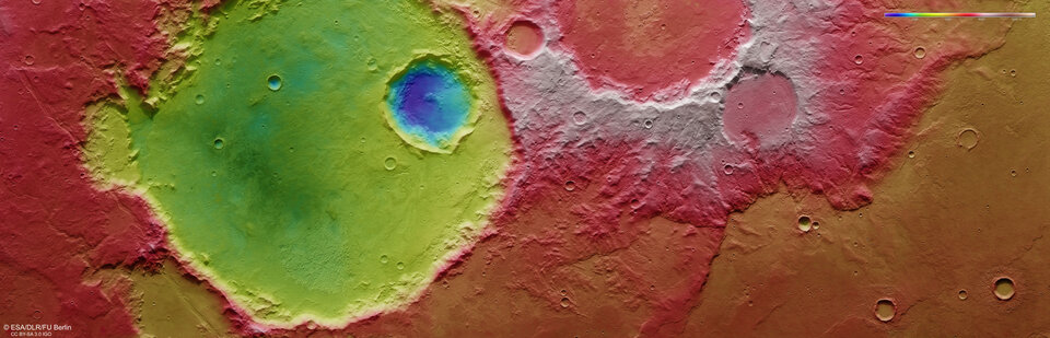
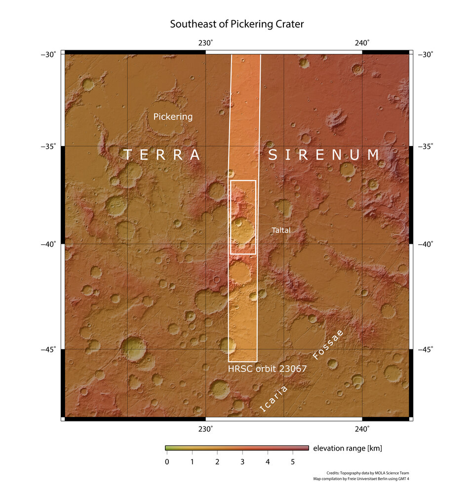
The image, taken by the High Resolution Stereo Camera (HRSC), is dominated by a large impact crater on the left (south) of the image, which measures about 70 km wide. This crater is in the Terra Sirenum region of Mars, which lies in the southern hemisphere. Another area of the same region was imaged by Mars Express in 2017.
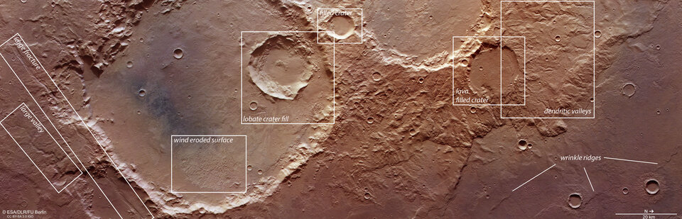
The imprint of martian wind is detectable within the crater – in the lower, eastern part of the crater, rough features known as yardangs are visible signatures of wind erosion. The contrasting dark-toned sand within the crater may have been transported into the flat base by wind.
Clues left by water
Nestled within the large crater is a smaller crater measuring about 20 km wide. The smaller crater and its neighbour can be seen in staggering detail in the perspective view. The structure and outline of the crater, and its smaller neighbour in the background of the perspective image, suggest that water or ice may have covered this surface when the impact occurred.
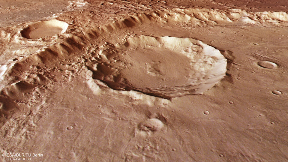
Signatures of past glaciers are visible in the smooth surface of the two neighbouring craters in the perspective image. The glaciers are thought to be made from a mixture of debris and ice, which flow downhill. The sedimented debris leaves clues about the direction and movement of the ice through the small sweeping channels in the base of the craters.
Water also leaves its mark in other parts of the scene. The winding valley on the far left of the main colour image measures up to 1.8 km in width. It is thought to have been a pathway for water which melted in the basin to the east.
The right (north) side of the image showcases a complex region of twisting valleys, known as dendritic valleys, whose origins are believed to be due to rain or snow early in martian history.
Tectonic stress
The surface of the Red Planet is marked by the results of tectonic stress on the martian crust. Parallel to the large valley at lower left in the main colour image, and about 10 km away, lies a fracture which cuts through the basin.
When the crust is pulled apart by tectonic stress, parts of the surface drop downward creating the faults. These 'graben' can also be found in a region called Icaria Fossae, marked on the context map.
Lava also makes its mark on the surface in two sections of the image of the region. While the larger crater has glacial signatures, the impact crater in the north (right) shows signs of a layer of lava on the crater floor (labelled as the 'lava filled crater' in the annotated image).
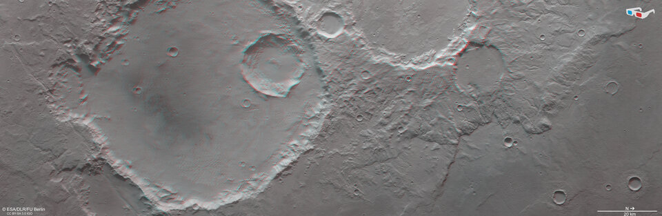
Small slivers, called wrinkle ridges, are marked in the lower right corner of the image. These are formed when a soft lava sheet is compressed by tectonic forces, causing a ridge where the material buckles over the lava sheet.
The array of features visible in one image shines a light on the varied physical processes and history of the Red Planet.
Exploring Mars
Mars Express has been orbiting the Red Planet since 2003, imaging Mars’ surface, mapping its minerals, identifying the composition and circulation of its tenuous atmosphere, probing beneath its crust, and exploring how various phenomena interact in the martian environment.
The mission’s High Resolution Stereo Camera (HRSC), responsible for these new images, has revealed much about Mars’ diverse surface features, with recent images showing everything from water-shaped basins through impact craters and channels that once carried liquid water to craters and crust-rupturing canyons.
For more information, please contact:
ESA Media Relations
media@esa.int