
Landslides at the foot of Olympus Mons
ESA’s Mars Express has turned its trusty High Resolution Stereo Camera (HRSC) towards Mars’s most imposing volcano, revealing its dramatic surroundings and turbulent past.
Mars is home to the largest volcanoes in the Solar System. The tallest of these is Olympus Mons, a giant shield volcano spotted in 1971 by NASA’s Mariner 9 spacecraft. Olympus Mons is 21.9 km tall at its peak, about 2.5 times higher than Earth’s Mount Everest rises above sea level.
Mariner scientists spied not just Olympus Mons’s peak but also its surroundings, noticing an ‘aureole’ spreading out from the volcano’s base for hundreds of kilometres. This aureole in turn surrounds the volcano’s ‘basal scarp’, an immediate perimeter around Olympus Mons that is remarkably steep, hitting seven km tall in some places.
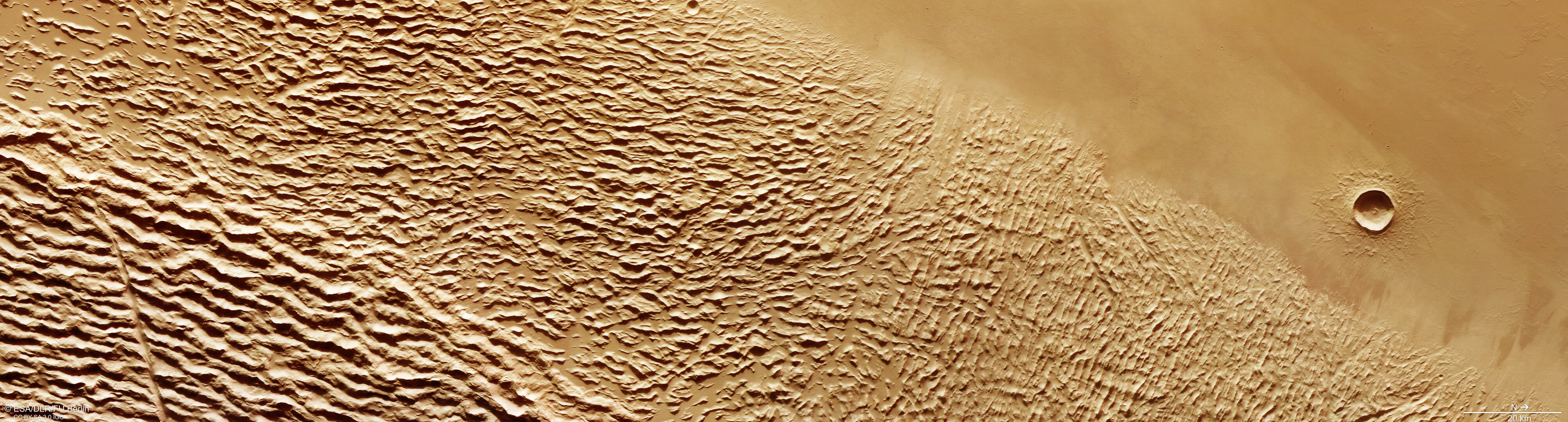
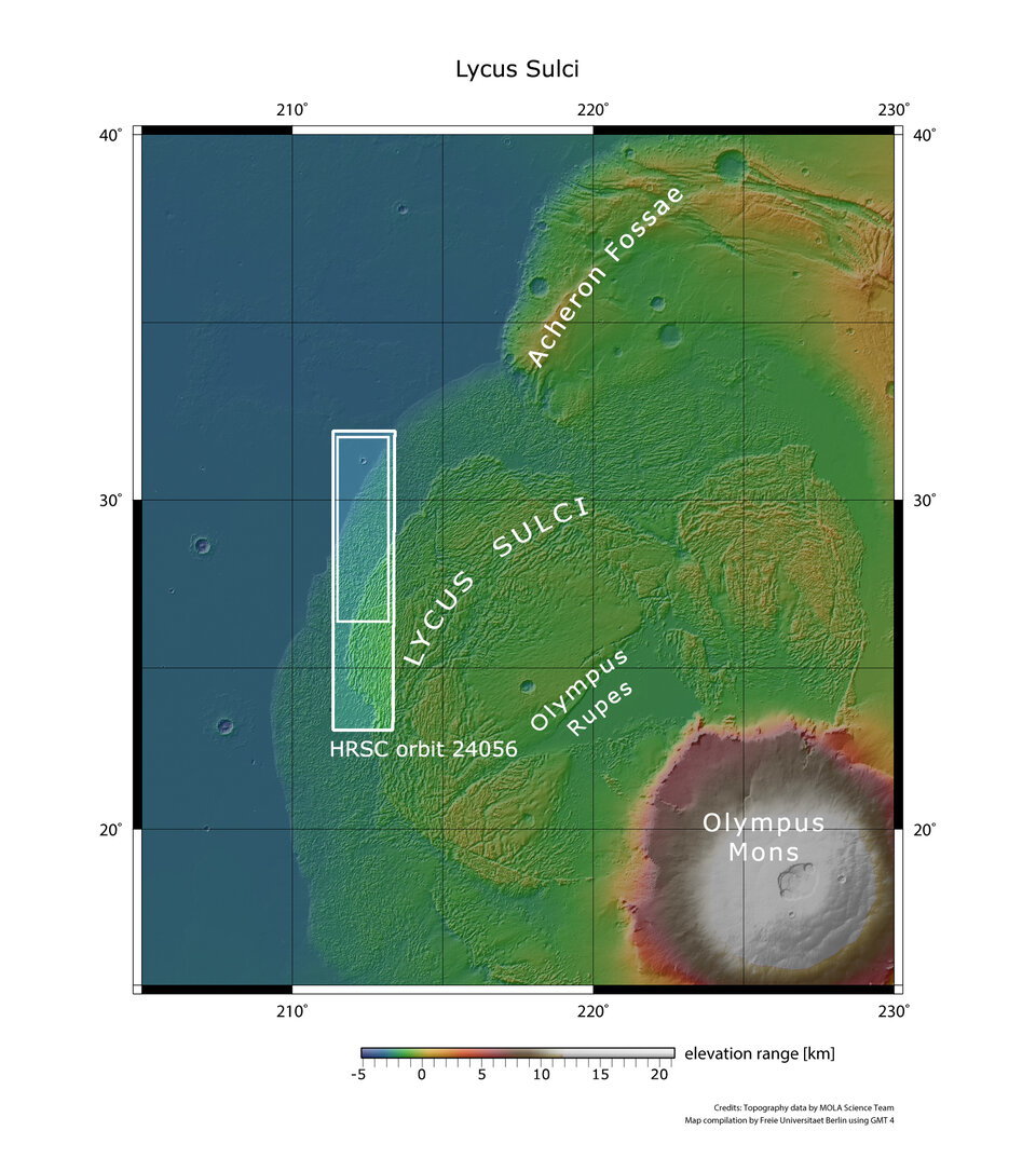
These new images show a crumpled feature named Lycus Sulci, on the edges of the aureole; the volcano itself is located out of frame to the bottom left (south-east), many hundreds of km away.
Catastrophic collapse
The aureole – seen especially well in this 2004 image from NASA’s Mars Orbiter Laser Altimeter, and in the contextual map associated with this new Mars Express release – tells the story of how Olympus Mons’s lower flanks catastrophically collapsed several 100 million years ago.
Large amounts of lava once flowed down the volcano, triggering landslides that tumbled down its flanks to meet bedrock – in this case, bedrock containing ice and water.
The swelteringly hot lava caused this ice to melt and become unstable; as a result, the rocky rim of Olympus Mons broke off and partially slid away. This collapse came in the form of huge rockfalls and landslides, which slipped downwards and spread widely across the surrounding plains.
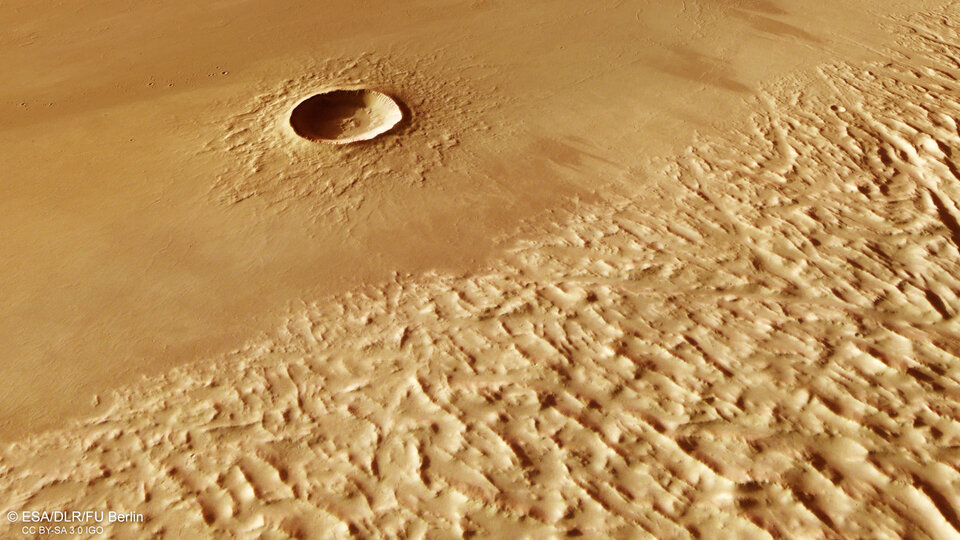
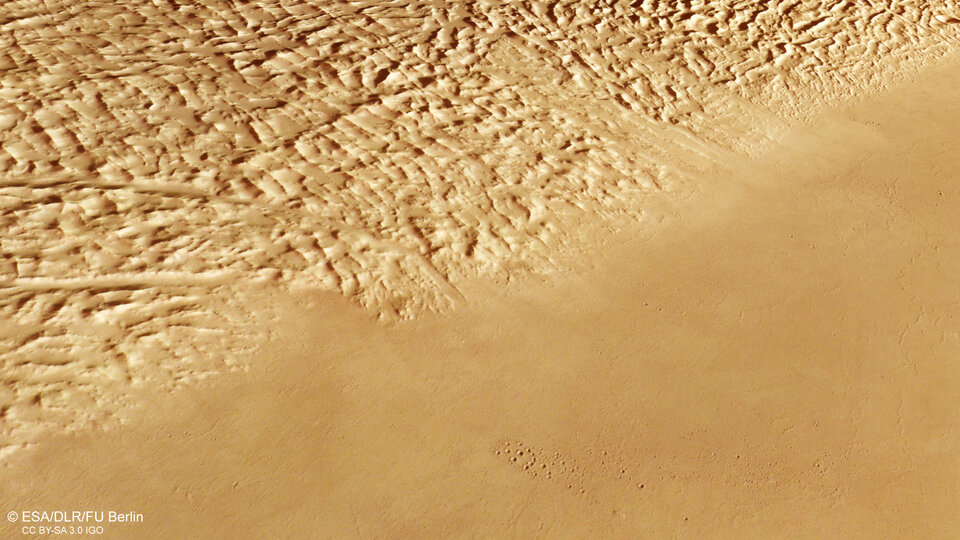
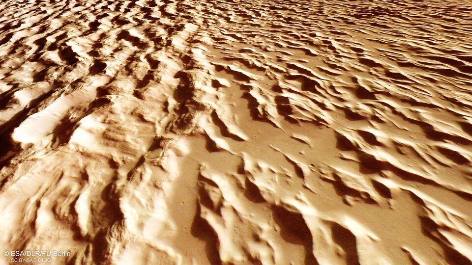
As the landslides moved away from Olympus Mons and travelled across the martian surface they became alternately compressed and stretched – crumpled and pulled apart. This created the characteristic wrinkles seen in these new images of Lycus Sulci.
Weakened by wind
Following its formation, Lycus Sulci became even more prominent over time as wind whipped across the martian surface, eroding its material. This wind also picked up dust and carried it far and wide across Mars, later scattering this fine sand over nearby hills and ridges.
Single landslides of the kind experienced by Olympus Mons can be hundreds of metres thick. However, for this behemoth, which saw multiple colossal and overlapping collapses, they can be up to two kilometres thick.
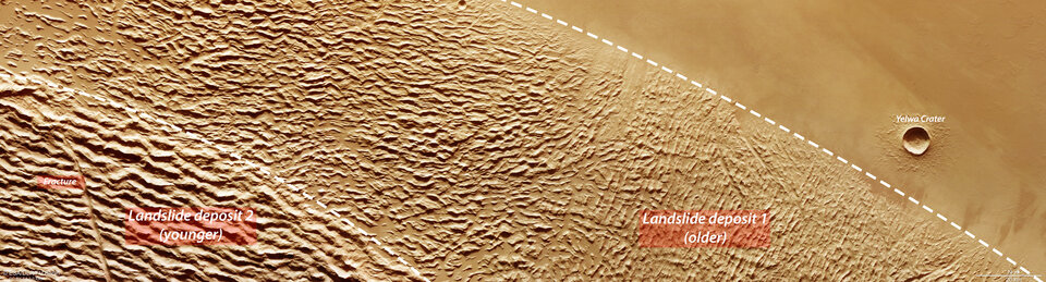
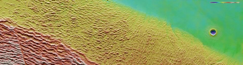
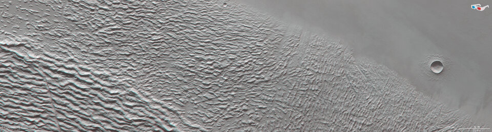
This superposition of landslides can be seen clearly in the annotated image; the wrinkled terrain to the right of the frame is older than the overlying crumples to the left, which flowed down the volcano’s slopes later in Mars’s history.
Similar but alien
Despite their otherworldly dimensions, Mars’s volcanoes show similarities to those we see on Earth. Comparable landslides – in type, if not in scale – can be seen around the volcanic islands of Hawaii and the Canary Islands, which have seen large rockfalls in the past.
Another feature highlighting the truly immense proportions of Olympus Mons can be seen to the right of the frame in Yelwa Crater. Although dwarfed by the extensive Lycus Sulci, this crater is over 8 km in diameter – just shy of Mount Everest’s elevation above sea level.
Yelwa Crater is situated over 1000 km from the peak of Olympus Mons, demonstrating just how far the destructive landslides travelled from the volcano’s flanks before settling.
Exploring Mars
Mars Express has been orbiting the Red Planet since 2003. It is imaging Mars’s surface, mapping its minerals, identifying the composition and circulation of its tenuous atmosphere, probing beneath its crust, and exploring how various phenomena interact in the martian environment.
The spacecraft’s HRSC, responsible for these images, has revealed much about Mars’s diverse surface in the past 20 years. Its images show everything from wind-sculpted ridges and grooves to sinkholes on the flanks of colossal volcanoes to impact craters, tectonic faults, river channels and ancient lava pools. The mission has been immensely productive over its lifetime, creating a far fuller and more accurate understanding of our planetary neighbour than ever before.
The Mars Express High Resolution Stereo Camera (HRSC) was developed and is operated by the German Aerospace Center (Deutsches Zentrum für Luft- und Raumfahrt; DLR).