
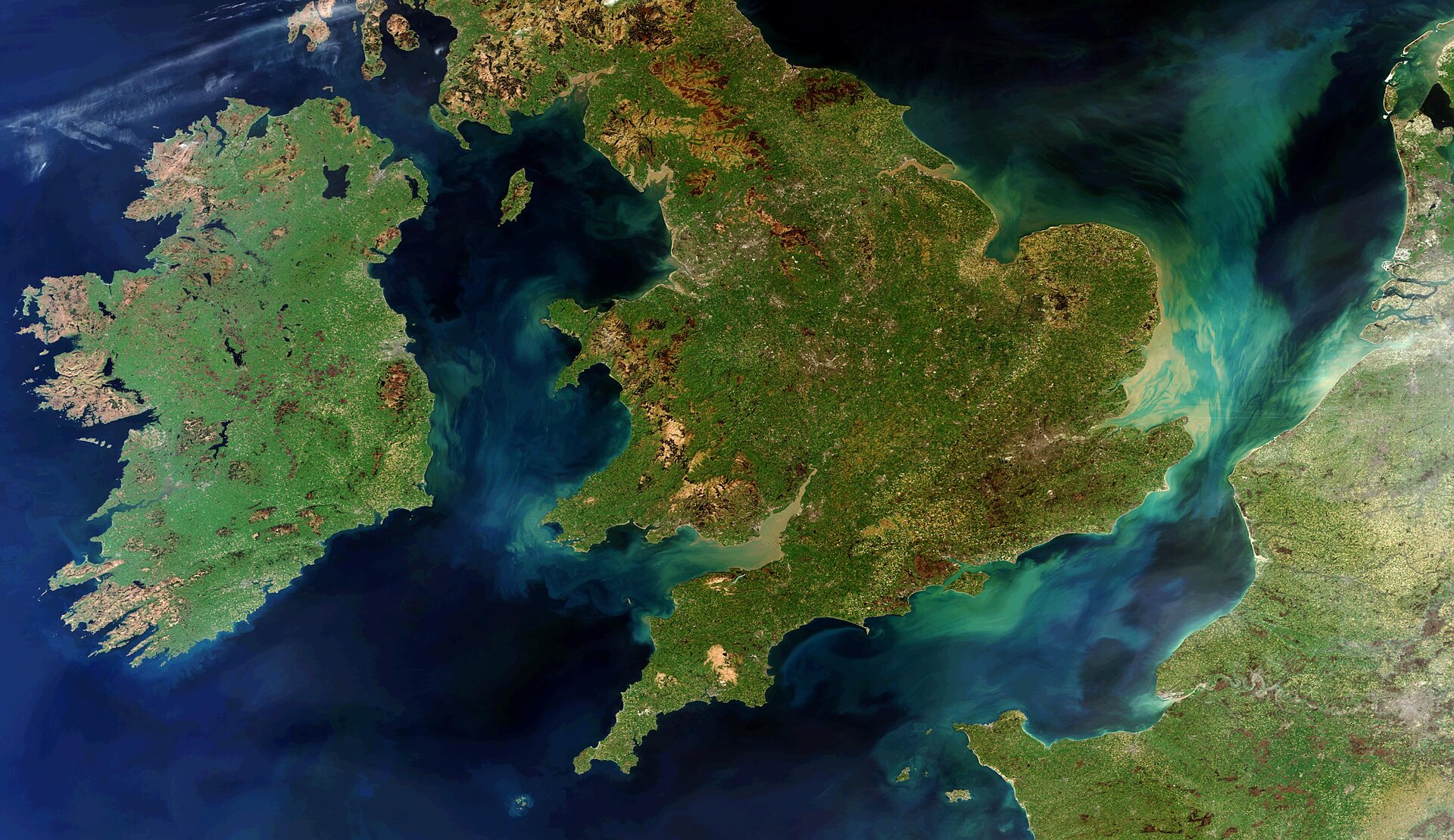
Cloud-free view of Ireland, UK and France
The lush landscapes of Ireland, Great Britain and northern France are pictured in this rare cloud-free view taken by the Envisat satellite.
To the west, thousands of lakes speckle the island of Ireland, made up of the Republic of Ireland (covering the majority of the island to the south) and Northern Ireland (top eastern corner). The largest lake in the region is Lough Neagh in Northern Ireland.
A ring of coastal mountains surround low plains at the centre of the island. The highest of these is Carrauntoohil in County Kerry, which rises to 1,038 m above sea level, with several navigable rivers extending inland. The island has lush vegetation, a product of its mild but changeable oceanic climate, which avoids extremes in temperature. Thick woodlands covered the island until the 17th century.
To the east of Ireland, the Irish sea and the North Channel, separate the island from Great Britain. The North Channel spans a width of 23 kilometres] at its narrowest point. To the west is the northern Atlantic Ocean and to the south is the Celtic Sea, which lies between Ireland and Brittany in France.
In the lower-right corner of the image, the river Seine flows through Paris (seen here as a grey area) and snakes toward the English Channel. Following mainland Europe’s coastline north, we can see the Rhine–Meuse–Scheldt delta followed by part of the intertidal Wadden Sea in the extreme top-right corner. The green and tan-tinted swirls in the seas and channels are due to sediments being transported in the water. Sediment is particularly concentrated around Britain’s southeastern coast, carried by the River Thames through London and into the North Sea.
This image was acquired by Envisat’s Medium Resolution Imaging Spectrometer on 28 March 2012.
In the lower-right corner, the river Seine flows through Paris (seen here as a grey area) and snakes toward the English Channel. Following mainland Europe’s coastline north, we can see the Rhine–Meuse–Scheldt delta followed by part of the intertidal Wadden Sea in the extreme top-right corner. The green and tan-tinted swirls in the seas and channels are due to sediments being transported in the water. Sediment is particularly concentrated around Britian’s southeastern coast, carried by the River Thames through London and into the North Sea.
This image was acquired by Envisat’s Medium Resolution Imaging Spectrometer on 28 March 2012.