Extended cyclone relief efforts aided from space
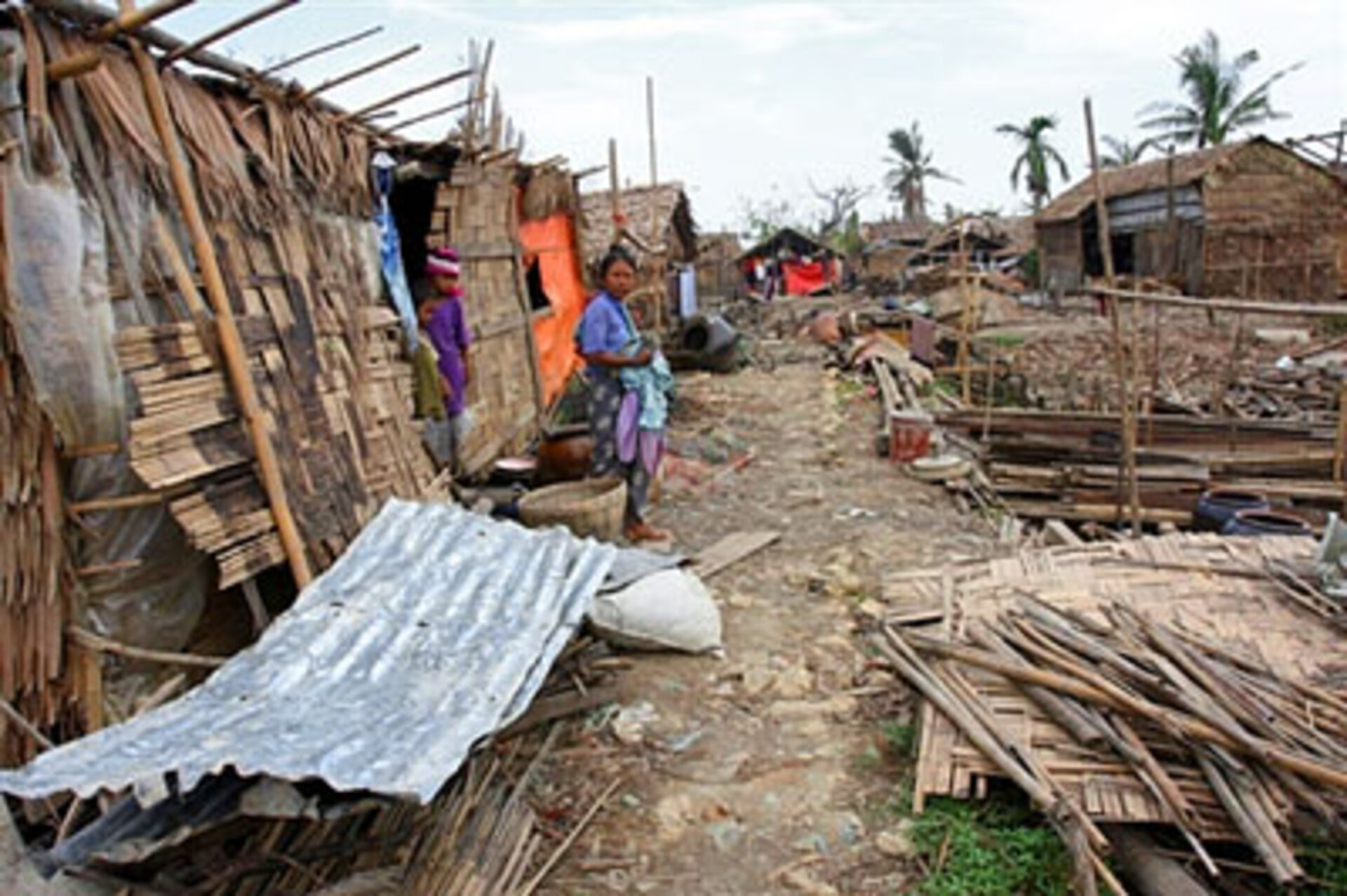
Earth observation satellites have provided vital information to relief workers in Myanmar throughout a particularly long crisis response window following the devastating Cyclone Nargis that hit the country on 2 and 3 May 2008.
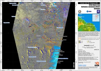
Immediately after the disaster, the UN Office for the Coordination of Humanitarian Affairs (OCHA) asked the International Charter on 'Space and Major Disasters', referred to as ‘the Charter’, for support by providing immediate crisis mapping of the affected areas.
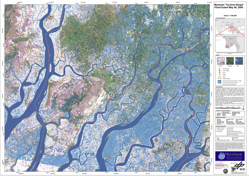
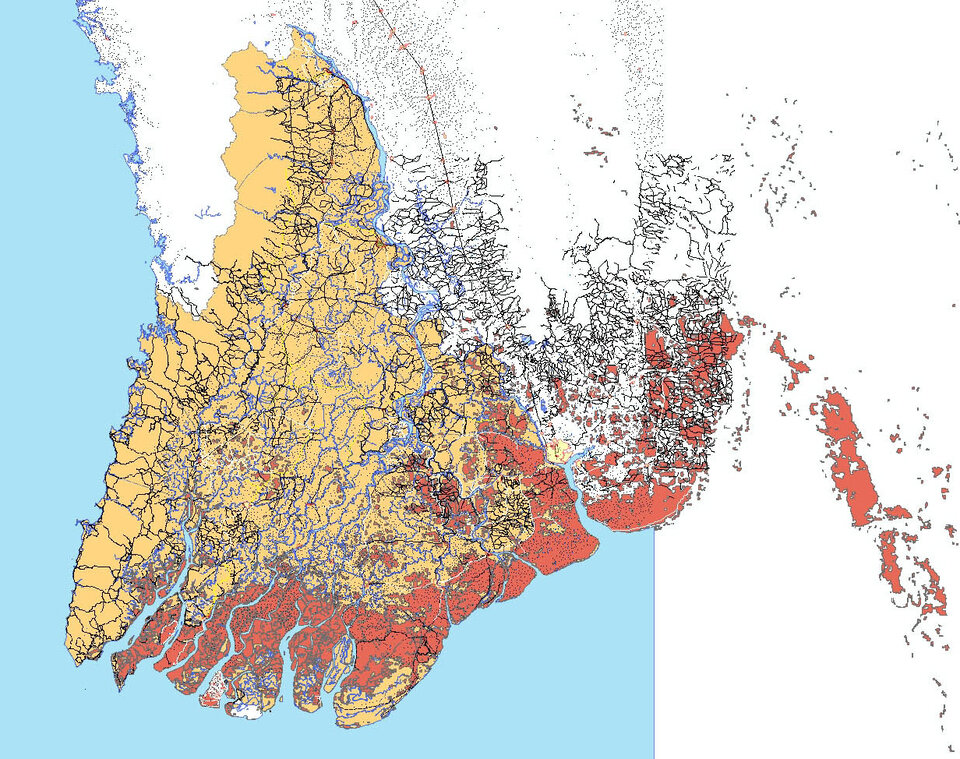
Following the request, rapid mapping products were created with Earth observation (EO) satellite acquisitions taken in the wake of the event to derive an estimation of the flood surge impact and other damage information to help plan emergency response operations.
Damage maps were able to be created quickly because the RESPOND project, which delivers satellite mapping for disaster reduction and humanitarian aid, had delivered EO-derived topographic maps of Myanmar a month before the disaster.
This activity was part of a project to help local communities reduce exposure to disaster risks. This enabled the RESPOND team to compare up-to-date basic maps before the disaster with satellite images acquired during or after the cyclone impact.
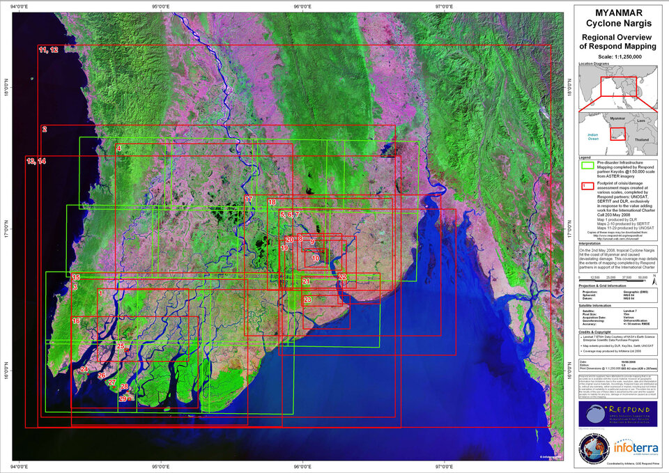
Thanks to the Charter more than 10 different sensors – radar and optical – from several EO missions provided more than 60 satellite images, which were used to derive 29 damage maps.

These maps were provided to the UN community in Myanmar and Bangkok for the emergency response phase, which lasted more than 40 days because of the scale of devastation caused by Nargis and the difficulties encountered by the international humanitarian community to access the country.
To provide aid workers with timely and synoptic damage information, space agencies and service providers worked around the clock. RESPOND’s partner UNOSAT – UN provider of EO mapping services to the humanitarian aid community – called on RESPOND providers SERTIT of France and the German Centre for satellite-based crisis information (ZKI) of DLR to join their mapping efforts under the coordination of Infoterra UK.
"It is important to differentiate map products according to the needs and, in a case like this, to firstly get an overview and then move into more detailed assessments as the relief operation progresses," explained Dr Einar Bjorgo, head of UNOSAT, who was designated as the Project Manager for this activation, a rotating role assigned by Charter members.
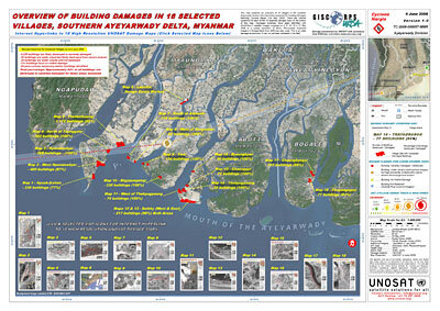
After the acute phase of the disaster had passed, the range of mapping products was extended to provide further details on the condition of roads, bridges and buildings. For instance, UNOSAT teamed with GISCorps, a US-based non-profit association, to digitise every building pre-disaster from the available data. These maps were highly accurate, showing features of less than one metre in size.
In addition to Charter members, other EO missions’ data were made available by space agencies, such as the Italian Space Agency (ASI) and the German Space Agency (DLR), and imagery providers, such as the Canadian MDA and the American Digital Globe.

To date, the map products have been used by over 40 organisations, including non-governmental aid organisations based in Myanmar, such as the Red Cross, and governmental organisations, such as the German Federal Agency for Technical Relief (THW) and the Myanmar Department of Forestry.
The Red Cross printed several sets of maps and sent them with their team to Myanmar, hoping to have better access to the field.
"We download your maps and use [them] in rescue works," Myanmar national rescue worker Prof. Charlie Than said.
Thant Lwin Htoo from Myanmar emergency response actions said he downloaded maps of Hpontawbye village for emergency relief activities.
Products have been used to plan field assessments, provide synoptic views for resource mobilisation and decision-making, and are currently being exploited to gather hazard damage-related information that can be used for reconstruction purposes.
"It was important to continually produce damage assessment maps for aid workers because very severe rain events occurred in the days following Nargis," said SERTIT Director Paul de Fraipont. "Based on feedback from specialists in the field, this made the products even more useful."
Particular attention was paid to the coordinated dissemination of products to ensure aid workers were able to quickly gain access to these maps; all maps using Charter data were made freely available on the RESPOND and UNOSAT websites as soon as they were produced.
In addition, the maps were accessible via UN OCHA’s Reliefweb and Reuters Alertnet with direct RSS feeds constantly accessible to over 400 non-governmental organisations.
The International Charter on 'Space and Major Disasters', an initiative of ESA and the French Space Agency (CNES), currently has 10 members, including the Canadian Space Agency (CSA), the Indian Space Research Organisation (ISRO), the US National Oceanic and Atmospheric Administration (NOAA), the Argentine Space Agency (CONAE), the Japan Aerospace Exploration Agency (JAXA), the British National Space Centre/Disaster Monitoring Constellation (BNSC/DMC), the U.S. Geological Survey (USGS) and the China National Space Administration (CNSA).