Envisat focuses on carbon-rich peat swamp forest fires
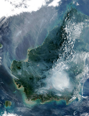
Multiple sensors on ESA’s Envisat environmental satellite have been used to peer beneath a vast pall of smoke above tropical Borneo and detect fire hotspots – known to add millions of tons of harmful greenhouse gases to the atmosphere.
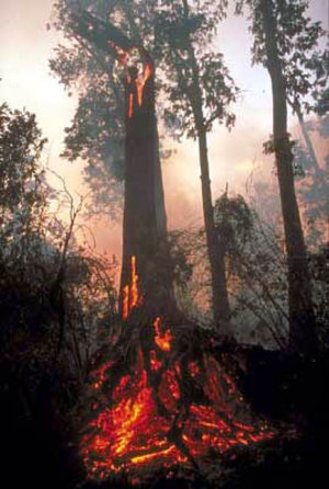
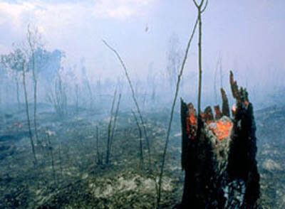
Fires occur often during the dry season on the South East Asian island of Borneo, but it isn’t only the forests that burn. Lowland tropical peat swamps are formed from layers of woody debris too waterlogged to fully decompose. Slowly deposited over thousands of years, the carbon-rich peat strata have been known to reach a thickness of up to 20 metres.
By rights these humid peat swamps shouldn’t be vulnerable to flame but during the last couple of decades the Indonesian government started draining them for conversion into agricultural land. In an unfortunate side effect the dried-up peat swamps are turned into tinderboxes – and once a peat fire begins smouldering it is almost impossible to put out.
The El Nino event back in 1997-8 caused an unusually long dry season across South East Asia – and encouraged the spread of many thousands of man-made fires across Borneo. A choking haze hung across the region, and ESA-led research later established that – due mainly to burning peat – up to 2.5 billion tonnes of climate-changing carbon was released into the atmosphere, an amount estimated to equal Europe’s entire carbon production for a year.
In 2002 a weak El Nino meant another drier than usual year: thousands of fires were again observed, and haze conditions spread all the way to Singapore. But this time ESA’s newest and most advanced environmental satellite was watching from orbit.
“We’ve made use of Envisat to monitor and analyse this disaster,” said Florian Siegert of the University of Munich and the German-based Remote Sensing Solutions GmbH, which carried out a case study on behalf of ESA. “The idea was to investigate the satellite’s performance while also obtaining valuable data on an incident with global impact - the second major fire incident in the peat swamps within five years.”
Three Envisat instruments were used – the Advanced Synthetic Aperture Radar (ASAR) could pierce the smoke clouds to provide high-resolution fire impact assessment, while the Medium Resolution Imaging Spectrometer (MERIS) could provide large scale fire scar mapping as well as identify smoke plumes whose sources could then be spotted by the Advanced Along Track Scanning Radiometer (AATSR), the most useful instrument of all when it comes to fire.
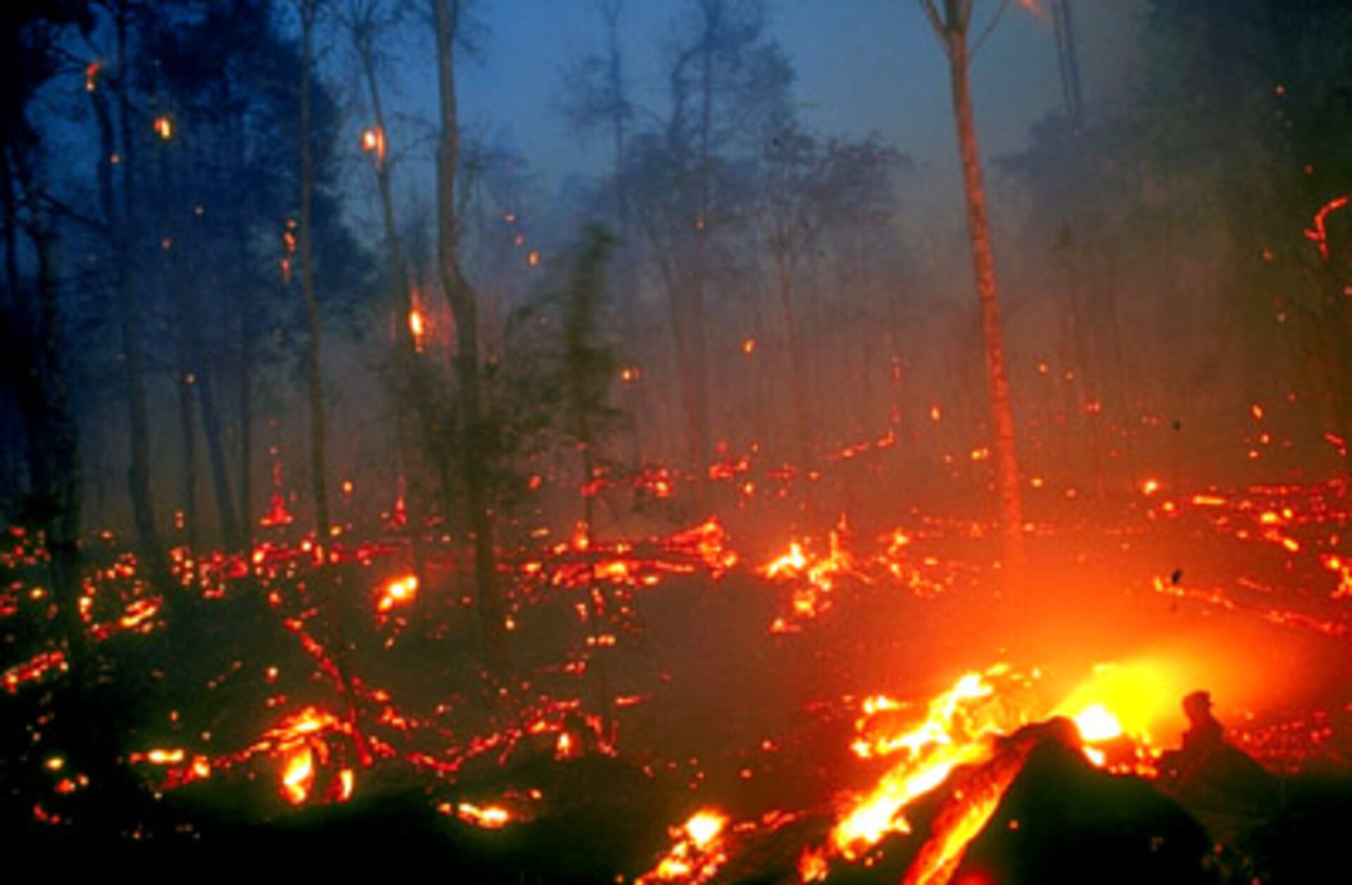
Measuring infrared wavelengths, AATSR measures surface temperature and so – used during local night for maximum effectiveness - can identify fire hotspots, Siegert explained: “The smouldering peat fires burn on the surface, but their energy release is weaker than other fires, so detecting them represented a particular challenge.
“Not all but most fires were detected by AATSR, and it is a useful instrument to assist fire fighting in future once the product becomes available in time,” Siegert added. “Aerial surveillance is too expensive to be used in this way but AATSR is cheaper, can screen a much larger area and is available for use daily.”
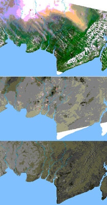
Envisat’s ASAR was found to work well at detecting burnt areas, which have a lower radar backscatter than forest zones in dry weather conditions. In high-resolution wide swath mode, towns and villages and even individual houses were also visible – corrugated roofs can send a strong backscatter signal if orientated towards the sensor.
This ability to map settlements might be useful in assessing future fire risk – some blazes are started illegally by settlers to clear land for cultivation, then spread out of control. Also visible to ASAR were the network of irrigation canals that have been dug to drain the peat swamps.
The Envisat data were assessed against other comparable satellite products – NOAA’s Advanced Very High Resolution Radiometer (AVHRR) and NASA’s Moderate Resolution Imaging Spectrometer (MODIS) for hotspot detection and Landsat for burn scars and damage mapping.
It was found that rainy weather lessened the effectiveness of ASAR to detect burn scars, but overall the results were very satisfactory. And by comparison to AVHRR – currently the sensor most often used operationally for fire hotspot mapping – testing has established that, used at night, Envisat’s AATSR actually detects a higher rate of hotspots.
Ground assessments of the affected area were also made, working with Indonesia’s University of Palangkaraya. It was found that on the average 20 to 30 centimetres of peat had been burnt off in Central Kalimantan, and in some cases individual craters up to 1.5 metres deep were seen.
Important but invisible damage was also done to global climate. Jack Rieley of the University of Nottingham in the UK estimates “the amount of extra carbon released into the atmosphere by the fires in 2002 could have been in the range of 200 million to a billion tonnes”.
That’s less than 1997-8, but even the low-end estimate is much more than the UK’s entire annual carbon emissions, underscoring the need for further study of this neglected phenomenon. Latest reports indicate there are once more fires kindling across the island.

“Our research has shown that tropical peatlands are an important carbon store on global scale,” said Siegert. “Repeated fires will release significantly more carbon than current climate models take into account - thus accelerating global warming.”
The European Commission is already working with Indonesia on a five-year €8.5 million scheme called the South Sumatra Forest Fire Management Project. Based west of Borneo on the Indonesian island of Sumatra, the aim of the project is to develop a model for sustainable management of land and forest resources to help limit future fire outbreaks across the whole region.
Siegert believes that space resources can help achieve this goal: “Immediate action to control fire occurrence has to be taken. ESA’s Envisat has shown it could play an important role in this task and support European activities in this field.”