

New navigation missions for enhanced satnav and Earth mapping
ESA’s Navigation Directorate – already the design architect of the Galileo satellite navigation system, Europe’s largest satellite constellation – is reaching out to European industry as it plans the development and in-orbit validation of future ‘positioning, navigation and timing’ (PNT) missions into novel orbits.
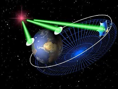
One mission will prove the concept of LEO PNT and accordingly bring satellite navigation signals closer to Earth, in the shape of a low-Earth in-orbit demonstration, while the GENESIS satellite up in medium-Earth orbit will combine satellite navigation signals with other space-based geodetic techniques to hone the precision of the International Terrestrial Reference Frame, the foundation for all space- and ground-based observations in navigation and the Earth sciences.
The Navigation Directorate has issued ‘requests for information’ for both missions – asking European companies if and how they are interested in participating in these projects – ahead of them being presented to ESA’s Ministerial Council towards the end of this year as part of a new optional programme called FutureNAV, designed to respond to future trends in satnav.
Bringing satnav closer with low-Earth orbit constellations
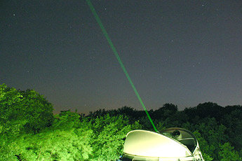
Until now, all navigation satellites have flown high up in medium-Earth orbit – up at 23 222 km in the case of Galileo, which delivers accuracy at metre level and below. At such altitudes the satellites move slowly across the sky, helping ensure global availability of satellite navigation signals, albeit at relatively low power thus depending on the level of processing by the receivers on ground.
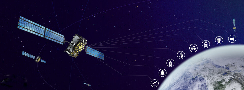
At the same time demand is growing for ubiquitous ‘always on’ positioning, navigation and timing (PNT) services, increasingly seen as essential for realising future smart cities and mobility, such as assisted and autonomous driving and urban drones.

Satnav services from medium-Earth orbit (MEO) alone cannot fulfil these needs, so the aim is to move to a ‘multilayer system of systems’ approach, with MEO signals supplemented by those from low-Earth orbit (LEO) satellites at altitudes of less than 2000 km – along with additional inputs from terrestrial PNT systems and user-based sensors.
ESA’s low-Earth orbit PNT in-orbit demonstration would test out this approach, helping European companies move forward at a time when worldwide commercial interest is high in LEO constellations of all kinds, especially for telecommunications and PNT.

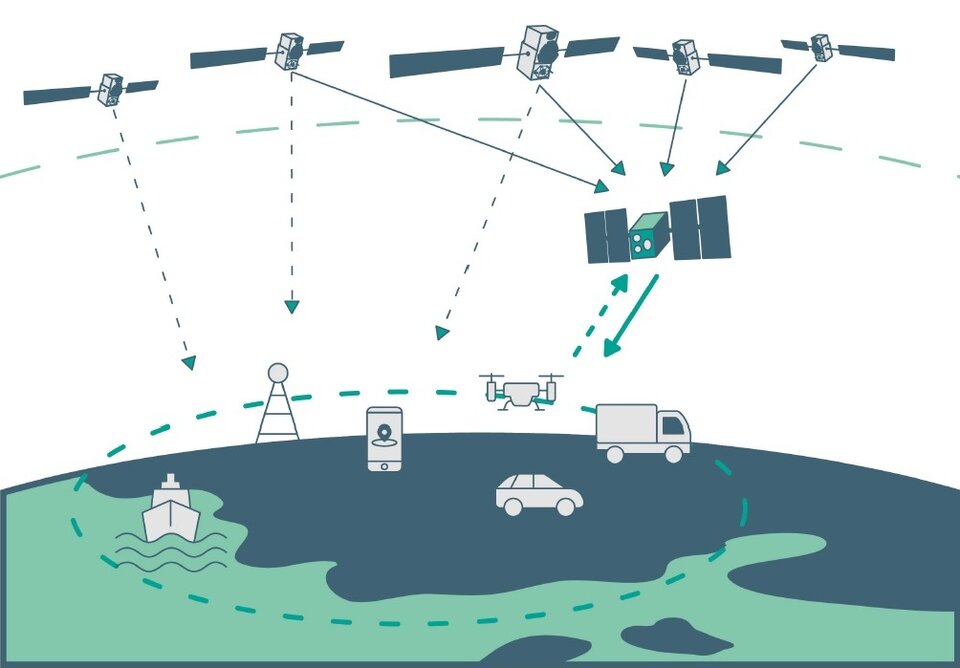
The satellites themselves can be stripped down compared to current satellite navigation satellites in MEO, because they would essentially be building on the signals from MEO so that their signal broadcasting payload can be simplified in size, weight and power consumption.
This is a key point because there will need to be many more satellites to ensure global coverage – as the lower the orbit the faster each individual satellite will pass across the sky. This fact also opens the way to a more agile ‘New Space’ approach to satellite construction for European firms, with smaller payloads and simplified operations from the ground.
Because of the closer distance and the transmission on novel frequencies, their signals can better reach difficult or denied environments, such as deep urban areas or even indoors, which – along with the new geometries made possible by LEO satellites – should enhance overall service availability and resilience. Such constellations will also deliver faster position fixes, possibly enable new services with two-way links and boost overall signal availability.
The aim of this LEO in-orbit demonstration mission, made up of approximately a dozen satellites, is to put European industry in a leading position to take advantage of follow-on private-sector and institutional PNT initiatives.
GENESIS: mapping a new Earth
As Earth rotates it is continuously in motion in many other ways as well. One of the less known benefits of the age of Global Navigation Satellite Systems (GNSS) has been the ability to support the tracking of ongoing small-scale movements of the overall Earth system through networks of ground based GNSS stations.
By continuously fixing their position through the use of satnav – supplemented by other space-based methods – these networks reveal slow motion of tectonic plates, glacial rebound, the melting of glaciers and sea level rise, right down to centimetre or millimetre level, and all essential measurements in the monitoring of climate change dynamics.
In order to plot these tiny shifts in a consistent way, researchers need a frame of reference. The International Terrestrial Reference System is a commonly agreed reference system, which in turn produces the ‘International Terrestrial Reference Frame’, a precise, regularly-updated charting of our planet for the authoritative fixing of coordinates, with axes extending from the ever-shifting centre of mass of the entire planet, including its oceans and atmosphere.
This International Terrestrial Reference Frame is of more than solely scientific interest, being essential to numerous activities, including civil engineering, agriculture and disaster management – even maintaining stable satellite orbits. Indeed, the United Nations has recognised improvements in the precision of ‘global geodetic reference frames’ as a sustainable development goal.
ESA’s proposed GENESIS satellite targets a global reference system accuracy of around 1 mm with a long-term stability of 0.1 mm/y, so as to be able to detect the smallest variations in the Earth system components.
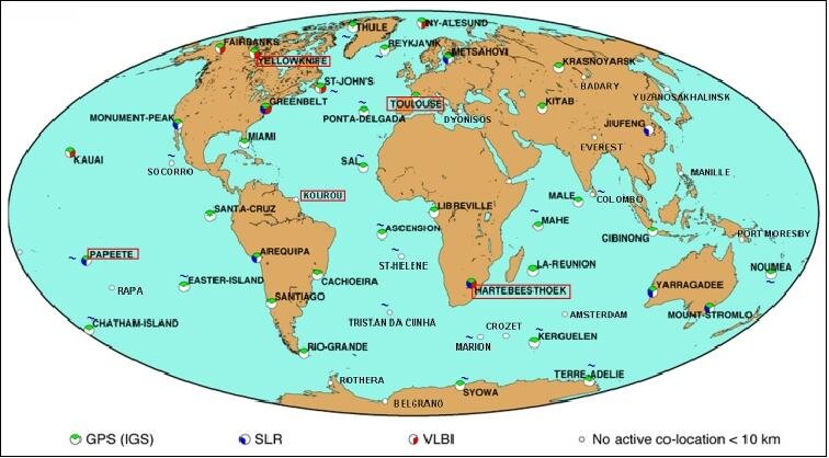
To do this, GENESIS will combine, for the very first time, all four space-geodetic techniques (satellite laser ranging, Doppler-based ‘DORIS’ radio positioning, Very Long Baseline Interferometry VLBI, as well as satnav) that are used to fix the position of GNSS stations around the globe onto a single space-based platform. This will result in a unique, dynamic space geodetic observatory, which – combined with the measurements of geodetic collocation techniques stations on Earth – shall enable resolution of the inherent errors and biases of each method.
GENESIS will also allow the assessment of several new navigation related technologies and precise orbit determination strategies of potential interest in future GNSS and Earth observation satellites.
Intended as a small, low-cost mission, GENESIS will orbit in lower-level MEO, approximately 6000 km up, which allows to provide an excellent simultaneous operation of all onboard geodetic techniques and ensure the possibility of simultaneous observation at intercontinental distance of VLBI ground stations, an essential point which will also allow the provision of closer links between the Earth and the Celestial reference frames, which provides multiple scientific and application benefits.
Beyond its very high scientific and navigation techniques interest, the results obtained thanks to the GENESIS mission will result, in turn, into a major increase on the overall accuracy, stability and availability of geodetic datasets, which will no doubt stimulate the creation of a plethora of novel or enhanced applications.

Putting the missions together
This current ‘Request For Information’ for these two proposed missions aims to gather inputs from industrial partners which could undertake them. Responses can address the entire missions or parts of them – covering as a minimum the platform or payloads.
The process will include a dialogue phase to better understand respondent capabilities, and responses will be subsequently used to prepare an Invitation To Tender (ITT) targeting implementation of the missions, following their agreement by Europe’s space ministers at the ESA Ministerial Council in November.
The two missions are the main components of ESA’s FutureNAV optional programme that ESA will propose to enable Europe to respond quickly and effectively to GNSS and PNT market opportunities.