Air pollution
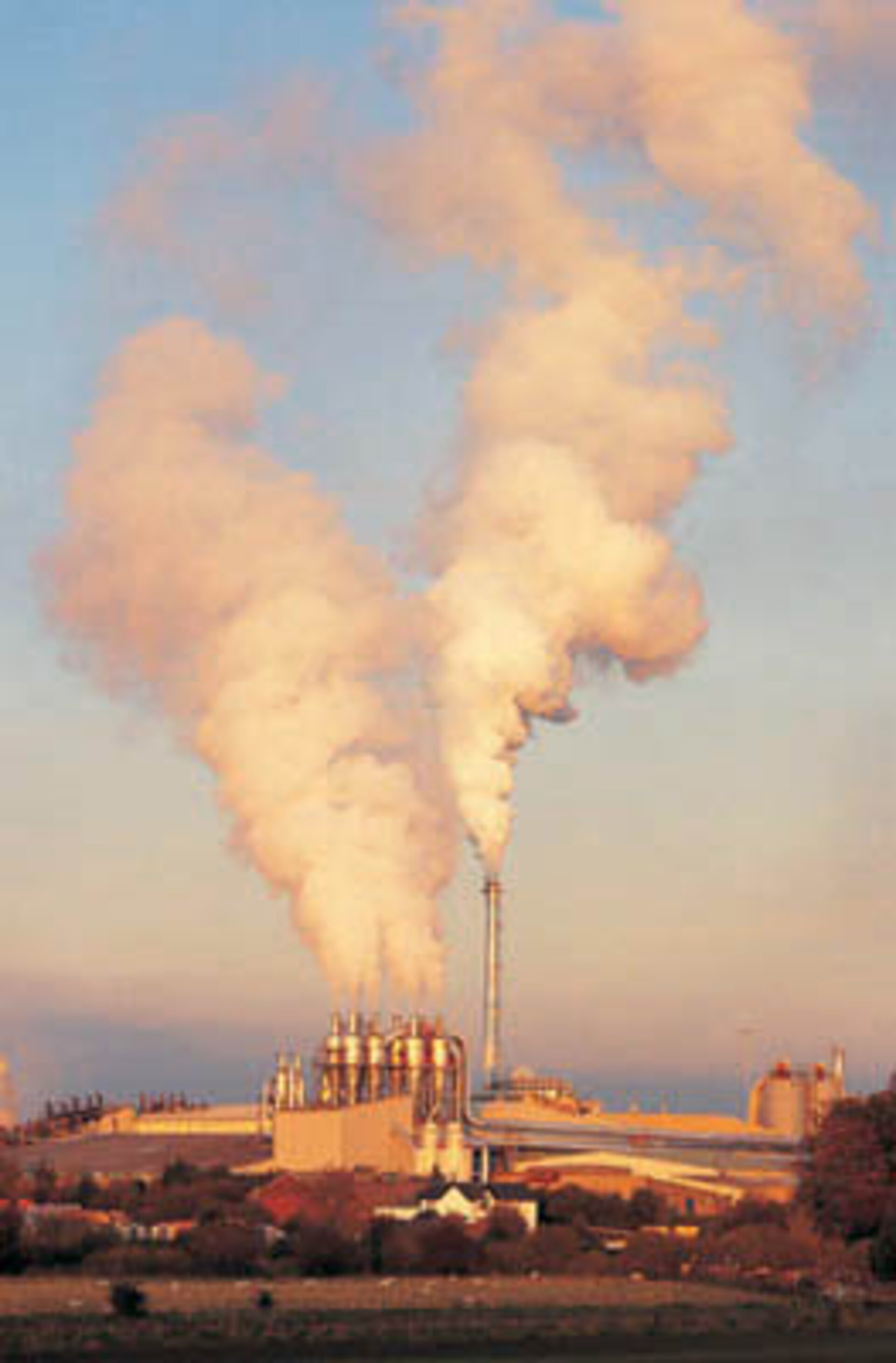
When tainted air around industrial centres first became an issue, back in the last century, authorities simply ordered taller smoke stacks to disperse factory pollution higher and wider.
Today we know our world is too small for such practices: sulphur dioxide emitted from factories and power stations has been shown to acidify lakes half a continent away, and acid rain from the same sources has damaged two thirds of all the trees in Europe. The hinterlands around many cities are often shrouded in traffic-produced smog and respiratory illnesses are on the rise across the developed world.
Seen from space, our urban centres are overhung by invisible plumes of pollution. Envisat’s atmospheric instruments can trace the emission of waste chemicals by industry, power generation and traffic, and follow their subsequent movements through the atmosphere.
MIPAS examines the infrared part of the spectrum to detect the signatures of more than 20 trace gases, including such harmful pollutants as hydrocarbons, nitrogen oxides, tropospheric ozone and some CFCs. MIPAS looks either sideways or rearwards into the atmosphere, gathering vertical profiles of pollutants between about five and 150 km. This information is important, because many of these chemicals have the potential to react harmfully with other atmospheric gases, depending on their altitude.
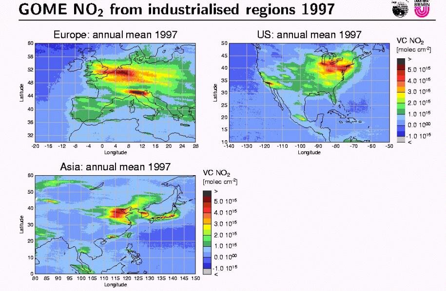
Working on a wider range of wavelengths, SCIAMACHY peers either forewards to detect trace gases and aerosols through the vertical - all the way to ground level where most pollution stays concentrated - or straight down to map areas of pollution. Observing across a 1000 km swath SCIAMACHY can pinpoint the sources of pollution from the surface, watch their movements through the air and track where they end up being deposited.
The third atmospheric spectrometer, GOMOS, is pointed high up into the stratosphere and above, to look for the presence of ozone-destroying human-made chemicals as well as nitrogen oxide emissions from aircraft engines, which are concentrated along air traffic corridors.
Together these Envisat sensors compile detailed pollutant maps to help enforce international environmental standards, identify regional ‘exporters’ and ‘importers’ of pollution across the world, and enable real-time air quality warnings when plumes advance.