La Palma volcano: How satellites help us monitor eruptions
Since the Cumbre Vieja volcano began erupting on 19 September 2021, lava has burned through homes, roads and farmlands causing mass destruction on the west part of the Canary Island of La Palma. Satellite imagery has helped authorities monitor and manage the ongoing crisis. From capturing images of the rivers of lava, to measuring gas emissions and assessing damage, the fleet of Copernicus Sentinel satellites have been providing crucial data for local teams.
It has been over three weeks of continuous activity at Cumbre Vieja, which means ‘The Old Summit’ in Spanish. On Saturday 9 October, it was reported that parts of the northern face of the volcano’s cone collapsed, leading the lava to overflow in different directions. On Sunday 11 October, 21 seismic movements were detected, with the largest measuring 3.8 on the Richter scale, according to the National Geographic Institute of Spain (IGN).
A build-up of ash and dust on the runway forced authorities in La Palma to close the island’s airport, according to Spain’s airport authority AENA. It has been the second time the airport has been closed due to ash build-up since the eruption began on 19 September.
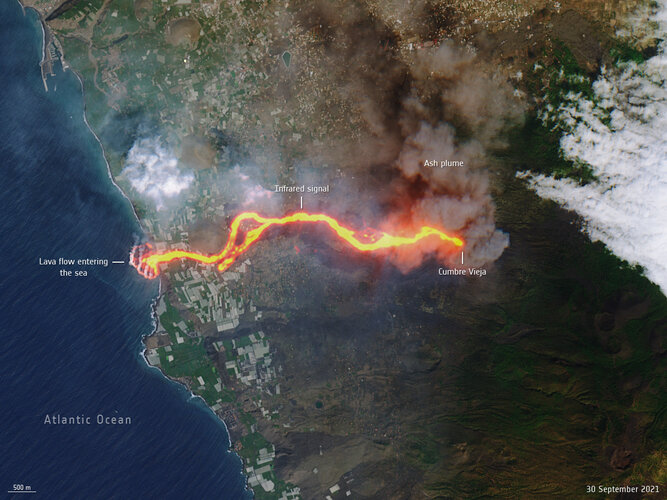
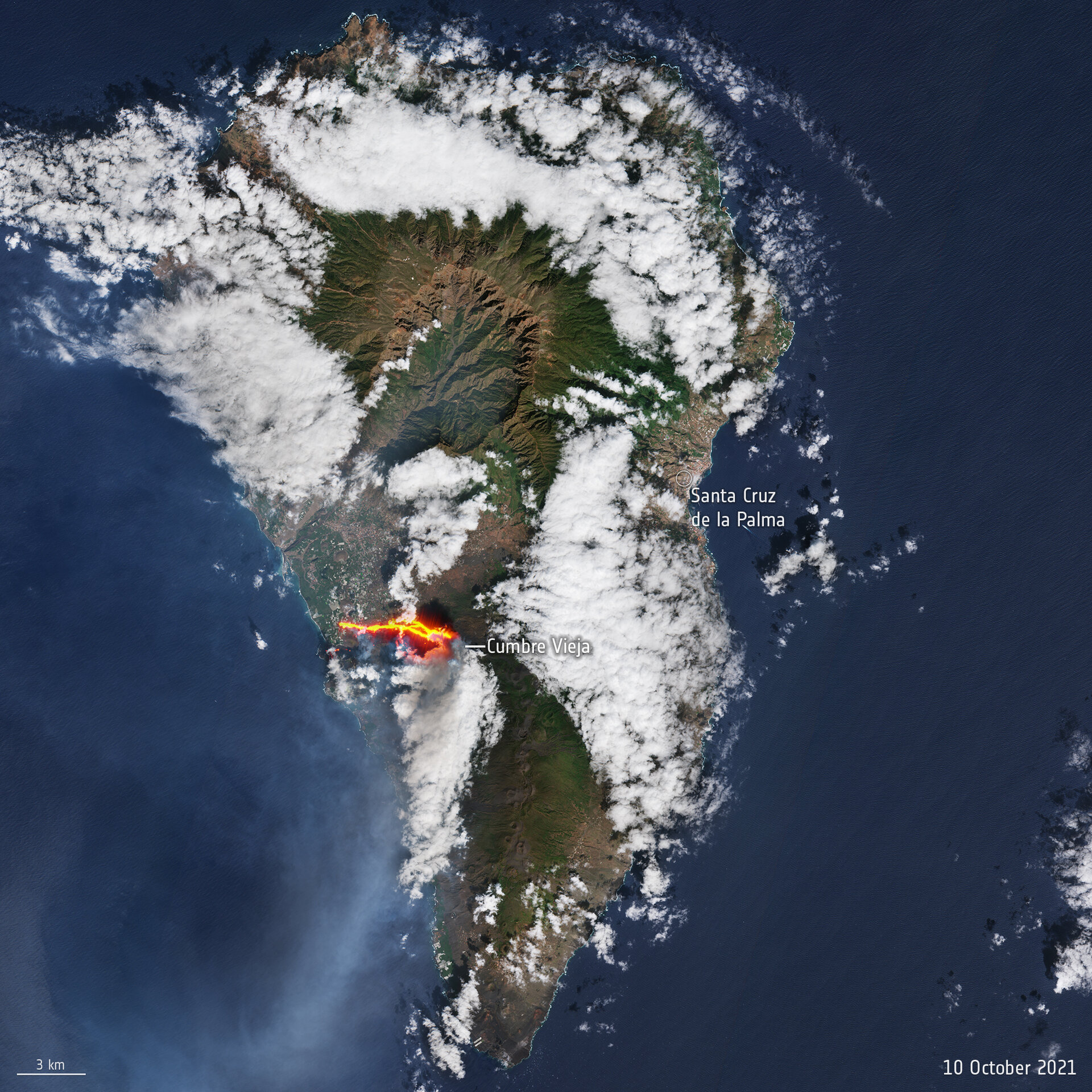
In stunning new images taken on 10 October, the new river of lava belched from the Cumbre Vieja volcano has been captured by the Copernicus Sentinel-2 mission. This Sentinel-2 images have been processed in true colour, using the shortwave infrared channel to highlight the new flow of lava.

The Volcanology Institute of the Canary Islands (Involcan) stated that the lava flow, with temperatures up to 1240°C, destroyed the few remaining buildings still standing north of the Todoque neighbourhood.
In response to the ongoing eruption, the Copernicus Emergency Mapping Service was activated. Since its activation, the service has released 17 monitoring mapping products to monitor the lava flow which has affected 497 hectares of land and destroyed over 1100 buildings (as of 8 October).
Satellites in orbit carry different instruments that provide a wealth of complementary information to better understand volcanic eruptions. Atmospheric sensors can identify the gases and aerosols released by the eruption, as well as quantify their wider environmental impact.
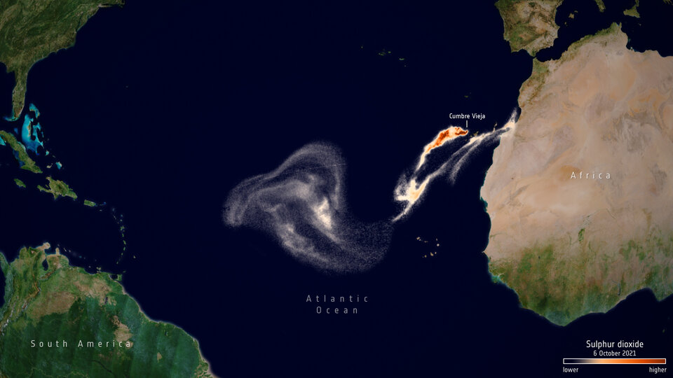
This image shows the sulphur dioxide emissions from the eruption on 6 October captured by the Copernicus Sentinel-5P satellite, moving over the Atlantic Ocean towards Central America. Sentinel-5P can monitor sulphur dioxide, aerosol and ash emitted by volcanic eruptions and follow its movement through the atmosphere.
ESA’s Copernicus Sentinel-5P mission manager, Claus Zehner, comments, “This volcanic eruption demonstrates how Sentinel data can support different operational Copernicus services. Sentinel-5P sulphur dioxide measurements can be used by the Copernicus Atmospheric Monitoring Service to help aviation companies to avoid volcanic ash and sulphur dioxide plume encounters.
“Sentinel-2 lava flow measurements can support the Copernicus Emergency Management Service in case of natural disasters like a volcanic eruption.”
Sulphur dioxide concentrations can be monitored using the Copernicus Sentinel-5P Volcanic Sulphur Dioxide online platform. Using data from the Copernicus Sentinel-5P satellite, the platform shows the daily sulphur dioxide concentrations coming primarily from volcanic sources. The platform can be accessed by clicking here.