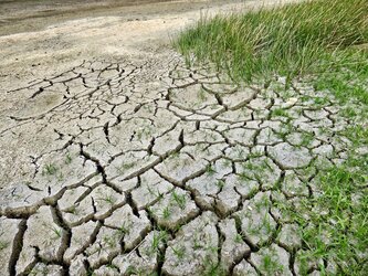
Zooming in on drought from space
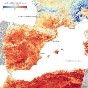
We are all aware that the summer of 2022 has been one of the hottest on record, causing drought and raging wildfires in many parts of Europe. Satellite data have been used to report the baking temperatures of the land surface and map fires, but the Copernicus Sentinel-1 radar mission has also been used to zoom in and provide very high-resolution measurements of the actual moisture content of the surface soils. Maps of northern Italy, for example, show how dry this summer has been compared to two years ago.
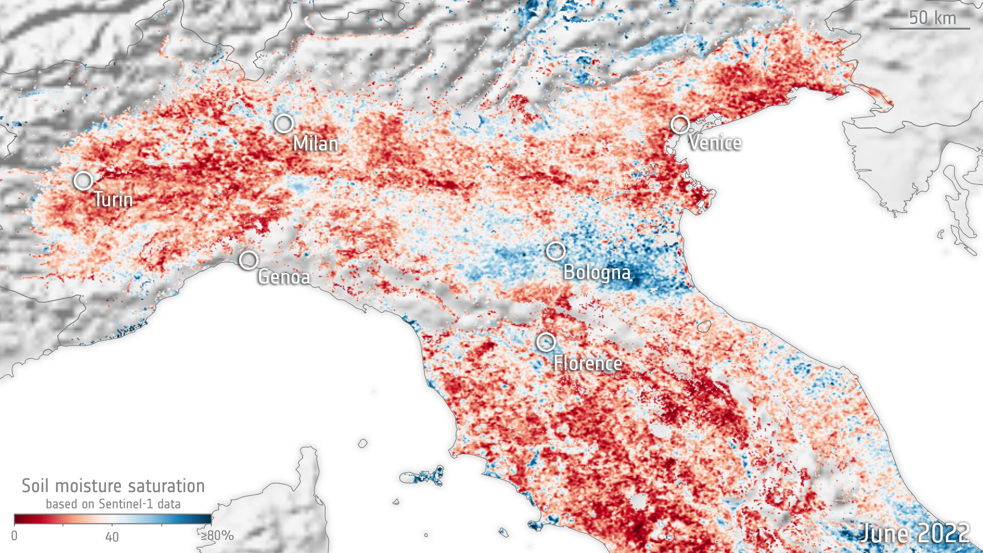
The two maps of northern Italy show soil moisture in June 2020 and in June 2022.
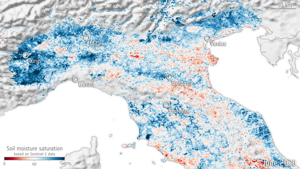
While just comparing one year with another year of any variable such as soil moisture doesn’t necessarily give you the full picture, the 2020 map can be considered ‘normal’.
Luca Brocca, from the National Research Council of Italy, said, “Indeed, the Sentinel-1 measurements of soil moisture during June 2020 were close to average conditions, meaning they are very similar to every June over the last 15 years, according to the soil water dataset available from the Copernicus Global Land Service.
“The difference between the June 2020 and the June 2022 maps, where red essentially shows drier soil and blue shows wetter soil than usual, is very clear to see.
“It probably comes as no surprise that the soil has been drier this year given the fact that summer seemed to arrive earlier and the hot dry weather persisted. But one of the things to note is that the plains south of the Alps have been excessively dry, and this is partly due to the fact that less water is flowing down to the Po Valley from the mountains.”

“Moreover, the key point to make is that scientists at the Vienna University of Technology, TU Wien, used Sentinel-1 radar to generate these maps with a resolution of 1 km. This degree of resolution will make it possible to assess the availability of water and better predict drought over much narrower swathes of land than has been previously possible.”
Mariette Vreugdenhil, from TU Wien, said, “Sentinel-1 provides data at an unprecedented spatial resolution, which allows us to obtain soil moisture estimates at spatial scales that are 10 to 25 times higher than current operational soil moisture datasets. The main challenge in the development of this new Sentinel-1 soil moisture product was to find a retrieval approach capable of dealing with the significant spatial heterogeneity of the land surface at this spatial scale.”
The new high-resolution data from Sentinel-1 will be an asset in advancing towards high-resolution hydrological modelling in areas lacking in-situ data, for example in parts of Africa where networks are rare.
The lack of water is clearly a major problem but so too is the issue of too much, flooding for example. Again, these events are expected to be more common as a result of climate change.
This new research was funded by ESA’s Earth Observation Science for Society programme. To better help with the management of water, be it the lack of or too much of, ESA is working on the Digital Twin Earth Hydrology project. Here the aim is to develop a 4D reconstruction of dynamic hydrology at unprecedented resolution through the integration of Earth observation and an advanced modelling system.