

Earth from Space: Chongqing, China
Chongqing, the largest municipality in China, is featured in this Copernicus Sentinel-2 image.
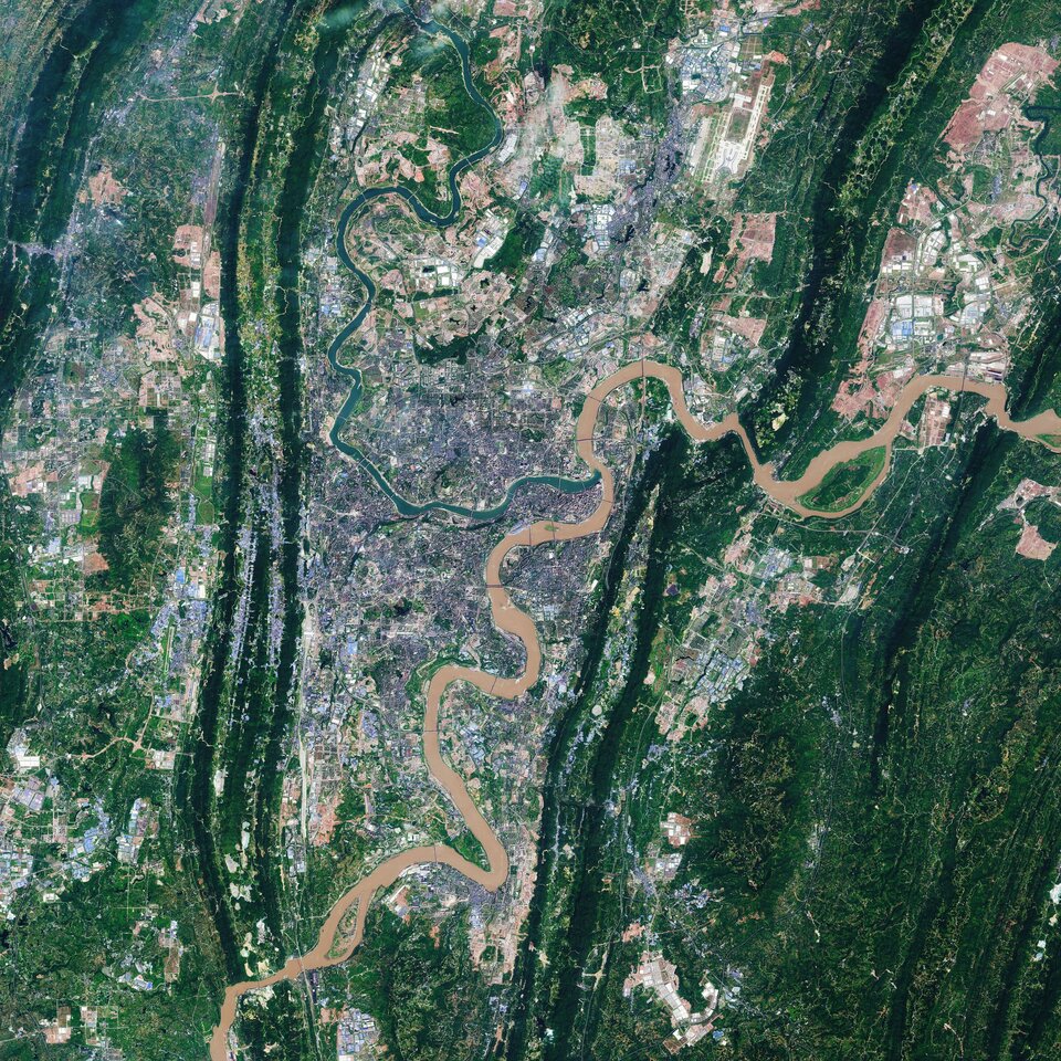
Covering an area of over 80 000 sq km, around the size of Austria, Chongqing is located in southwest-central China. Chongqing covers a large area crisscrossed by rivers and mountains. These are the Daba Mountains in the north, the Wu Mountains in the east, the Wuling Mountains in the southeast and the Dalou Mountains in the south.
The city of Chongqing, one of the most important economic centres in China, is known as a ‘mountain city’ owing to its rugged terrain and steep gorges. Chongqing is a major manufacturing and transportation centre, and has become the biggest automobile manufacturing base in China.
The city lies at the confluence of the Yangtze and Jialing rivers, where the clashing colours of the rivers meet. The Yangtze river is visible in brown in the right of the image, while the green waters of the Jialing can be seen in the left. The rivers make Chongqing China's biggest port city in the southwest region.
With a length of 6300 km, the Yangtze is the longest river in both China and Asia and the third longest river in the world. The Jialing River, rises in the Qin Mountains, and joins the Yangtze after a course of around 1190 km.
Copernicus Sentinel-2 is a two-satellite mission. Each satellite carries a high-resolution camera that images Earth’s surface in 13 spectral bands. The mission is mostly used to track changes in the way land is being used and to monitor the health of our vegetation.
This image is also featured on the Earth from Space video programme.

Access the video

