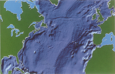
Envisat and ocean circulation
The dream is that one day mathematical models will routinely predict ocean circulation for up to a few days or weeks in advance, in much the same way that such models forecast weather today. To reach this goal, oceanographers have instigated an international initiative called the Global Ocean Data Assimilation Experiment (GODAE). Its aim is to demonstrate that operational forecasting of ocean circulation is practical.
Given that oceans cover roughly three quarters of the globe and play a major role in redistributing the Sun’s energy around the Earth, it is easy to see that they affect weather patterns and that GODAE is an important programme.
Envisat is now contributing to the programme, which began back in 1997. Its Radar Altimeter measures sea-surface height, something which ocean prediction models need to take into account when calculating the oceans’ future behaviour.
During the first three years of GODAE, scientists defined experimental aims and figured out how observations from satellites, marine buoys and shipping could be collected on a global basis, then transmitted to and incorporated continuously in the computer models.
During 2001 and 2002 the computer models were being refined and tested, but between 2003 and 2005 oceanographers are feeding observations (including from Envisat) to the models, with the intention of demonstrating that the system is feasible.
All being well, the step after GODAE will be to establish an operational forecasting system for ocean circulation, much like the numerical weather prediction models of national meteorological agencies that churn out weather forecasts every day.