Filling the GOCE data gap unearths South Pole’s geological past
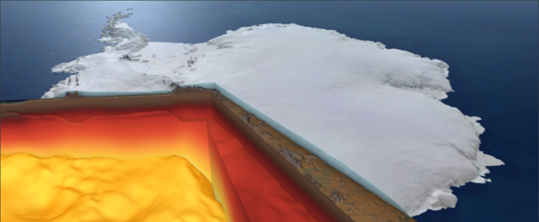
It’s very difficult to know what lies beneath a blanket of kilometres-thick ice, so it is hardly surprising that scientists have long contested the shape and geology of the ancient supercontinent from which East Antarctica formed over a billion years ago. An ESA-funded study can now lay some of this conjecture to rest. Using sensors on aircraft to measure changes in the gravity and magnetic signatures of the different rocks under the ice, scientists have discovered a huge bay the size of the UK formed part of the edge of East Antarctica.
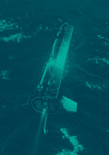
Satellites orbiting Earth from pole to pole don’t actually fly directly above the North and South Poles. This leaves two small circular gaps in the global data. To fill in these missing measurements for ESA’s GOCE gravity satellite mission over the South Pole, an international team of scientists joined forces to take a multitude of measurements from aircraft as part of an ESA campaign called PolarGAP.
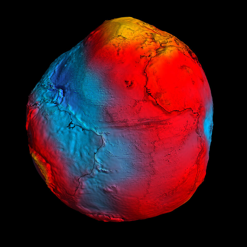
The GOCE mission mapped Earth's gravity with unrivalled precision and provided the most accurate model of the ‘geoid’ ever produced to further our understanding of how Earth works.
The geoid is the surface of equal gravitational potential defined by the gravity field – crucial for deriving accurate measurements of ocean circulation and sea-level change, both of which are affected by climate change.
It was therefore important to fill in the measurements that GOCE could not take at the poles owing to its orbit.
As well as supplying these missing data for GOCE, the PolarGAP team has yielded new insights into the hidden geology at South Pole, shedding new light on the extent and shape of the edge of East Antarctica.
A paper, published this week in Nature Communications Earth & Environment, describes how the team flew over East Antarctica and used airborne sensors to measure changes in the magnetic and gravity signatures produced by the different rocks hidden beneath the ice.
The map below on the right shows the extent of the PolarGAP flights.
The data they gathered along these flight paths enabled the team to determine key characteristics of the rocks, which provided tantalising new clues about how the edge of East Antarctica evolved.
This is important because East Antarctica is the least known region of Earth. Today, Antarctica is isolated from the rest of the world. But a billion years ago, before the ancient Pacific Ocean formed, East Antarctica may have been much closer to other huge landmasses, including North America – an idea that is hotly debated by geologists.

To the team’s surprise, the new data showed that an area of ancient rocks the size of the UK, which was thought to also make up part of East Antarctica’s coast, is entirely missing.
In its place, they found an embayment made up of younger rocks than expected. This newly discovered embayment is referred to as the Pensacola Embayment.
This means that less of East Antarctica than was previously assumed formed part of the ancient Mawson Continent, which included part of East Antarctica and Australia, and which is inferred in some reconstructions to have been close to North America.
The consequences of this finding will form the basis for a wide range of Antarctic research. It will help researchers build global reconstructions of Earth’s ancient supercontinents and lead to a better understanding of how the ancient geology of East Antarctica influences the flow and stability of the modern ice sheet.
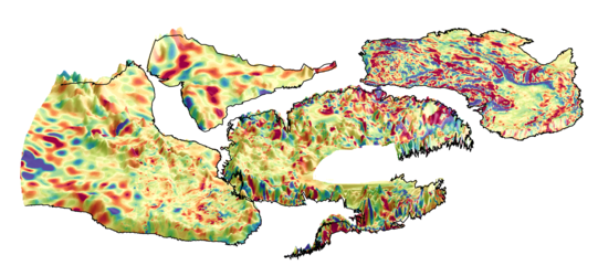
The image below shows the newly revealed patterns of highly magnetic rocks (shades of red), and areas where these rocks appear to be missing.
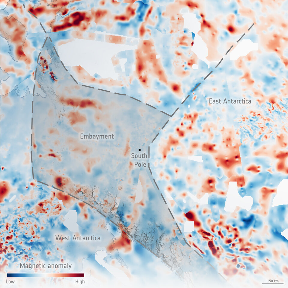
Dr Tom Jordan, lead author and geophysicist at the British Antarctic Survey, said, “It’s as if a huge bite has been taken out of East Antarctica. This probably happened during a major rifting event, likely linked to the opening of the ancient Pacific Ocean about 650 million years ago.
“The embayment in the South Pole region subsequently influenced how mountain ranges and volcanoes developed in the area, and the scars at the edge of where the embayment formed continue to guide the flow of the present-day ice sheet.”
Dr Fausto Ferraccioli, from the National Institute of Oceanography and Applied Geophysics and PolarGAP principal investigator, added, “Finding out where the edge of the East Antarctic craton lies helps constrain the extent of East Antarctica in ancient supercontinents.
“And, what interests me most for current ESA research – edges of cratons also exert a key influence on geothermal heat flux. Lower values are typically found on the craton side compared to younger embayments. The new data will help determine if this is also the case at the South Pole, with cascading implications for understanding how this affects the water that flows beneath the East Antarctic Ice Sheet.”
The international collaborative ESA PolarGAP campaign made this study possible.
The main aim of the campaign was to augment the GOCE satellite gravity field in the polar gap region around South Pole, where satellite measurements were missing. But thanks to careful survey design and planning for PolarGAP, a broad spectrum of science results has emerged in this previously largely unexplored frontier in East Antarctica.