

Living Planet Symposium Extra News: Day 5
ESA’s Living Planet Symposium came to a close today, concluding a week of networking, discussions and meeting of curious, scientific minds.
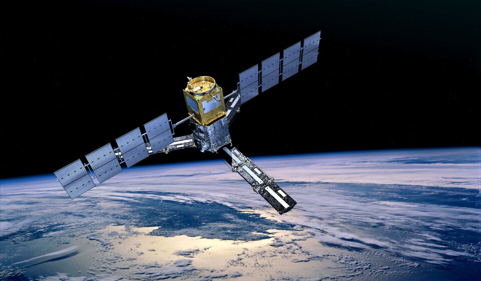
Today, one of the focal points was thermal imaging instruments, which are critical for monitoring land-surface temperature – and will be carried on upcoming missions such as the upcoming Copernicus Land Surface Temperature Mission. ESA’s Soil Moisture and Ocean Salinity (SMOS) mission celebrated passing its 15-year milestone in orbit – the mission has helped improve weather and climate models. Three new contracts were signed for ESA’s InCubed programme, which is central to the agency’s efforts to turn promising concepts into successful Earth observation services, strengthening Europe’s position in this rapidly evolving sector.
The following 'extras’ are in addition to in-depth coverage on specific results presented at the symposium.
Follow ESA's Earth observation page for more news from Living Planet Symposium 2025.
Space agencies work together to improve land-surface temperature monitoring

As the demand for interoperable data increases, space agencies are collaborating to ensure that similar types of data from comparable satellite sensors can be used together to maximise their scientific value.
Today, at the Living Planet Symposium, one of the focal points was thermal imaging, which is critical for monitoring land-surface temperature.
Missions such as the upcoming Copernicus Land Surface Temperature Mission (LSTM) and the Thermal Infrared Imaging Satellite for High-Resolution Natural Resource Assessment (TRISHNA) – a joint mission between the French Space Agency (CNES) and the Indian Space Research Organisation (ISRO) – will both carry thermal-infrared instruments.
These two missions will be key to monitoring land-surface temperature for applications related to agricultural productivity, drought prediction, water resource management, and addressing issues such as urban heat islands.
Ensuring data comparability between these missions is essential for identifying and understanding measurement biases that may affect one mission relative to the other.
Therefore, ESA and CNES have partnered through a project called TIRCALNET to jointly calibrate the two sensors before launch.
Participants at the Living Planet Symposium learned how this works in practice.
The project involves setting up various sites around the globe that feature surfaces with varying spatial and temporal stability in emissivity. Instrumentation will be installed to automatically and continuously collect surface measurements that simulate the signal a satellite sensor would detect at the top of the atmosphere. This will allow the satellite sensors to be calibrated against a reliable reference.
While similar efforts exist for satellite optical sensors, a harmonised ground calibration network for thermal-infrared sensors is still needed. Such a network – aligning site measurements and radiative transfer – will provide a crucial calibration resource for the rapidly growing domain of high-resolution land-surface temperature missions, which is gaining momentum among space agencies and commercial actors alike.
From wildfires to ancient caves: celebrating 15 years of SMOS
ESA’s remarkable Soil Moisture and Ocean Salinity (SMOS) mission celebrated passing its 15-year milestone in orbit, observing two important aspects of Earth’s water cycle: soil moisture and ocean salinity. The mission has advanced our understanding of how water is exchanged between the planet’s surface and the atmosphere, helping to improve weather and climate models.
Launched in 2009 as one of ESA’s Earth Explorer missions, SMOS has far exceeded its planned mission duration. It has also delivered more in terms of scientific goals.
Even in recent years, SMOS has made headlines. In 2023, the mission proved its worth with observations of ground moisture and dry vegetation during severe wild fires in Canada. The real-time satellite data was integrated into wildfire forecast models, helping to manage the response.
And in March 2024, it tracked a severe solar storm, together with ESA’s Swarm mission. When a particularly active part of the Sun emitted a powerful solar flare, warping Earth’s magnetic field, SMOS was there to capture the solar radio burst with its interferometer radiometer, Miras.
SMOS data has even been used in scientific papers investigating the microclimate of the Altamira caves in Spain, where ancient cave paintings provide an invaluable glimpse of prehistoric culture.
ESA’s SMOS Mission Manager, Klaus Scipal, said, “This landmark for SMOS is incredible considering the mission has far outlived its planned lifetime – and the results have really been beyond our expectations. Not only has SMOS provided valuable scientific results on Earth’s water cycle, but its versatility means it has also provided important services, such as the data for better prevention of wildfires and monitoring of space weather.”
Three new InCubed co-funded projects set for launch

As the demand for satellite data and services grow, so does the need to support companies bringing new solutions to market. The ESA InCubed programme is central to ESA’s efforts to turn promising concepts into successful Earth observation services, strengthening Europe’s position in this rapidly evolving sector. During the Living Planet Symposium, three new contracts were signed.
With SITAEL as the prime contractor, O-STEP is an advanced onboard mass memory and edge-processing unit for small satellites operating in low Earth orbit. Designed for satellites between 100 and 500 kg, the unit combines data storage with AI-powered processing and platform autonomy, aiming to improve onboard data management and reduce both operational costs and dependence on ground stations.
IVSEN is a satellite-based monitoring system designed to help energy infrastructure operators address challenges in network monitoring, maintenance and security. Led by an industrial consortium – SATLANTIS, Alén Space, DHV Technology and GeoAI – and with direct involvement from users such as Iberdrola, this initiative will deliver a very-high resolution payload with integrated subsystems to reduce mass and volume, and provide agile observation modes. The system will feature an onboard image pre-processing algorithm complemented by the ground-based processing chain, providing analytics and tailored data products for operational use.
As a Copernicus Contributing Mission, ICEYE operates a fleet of satellites providing synthetic aperture radar data for applications such as land use monitoring, border surveillance, and environmental management. Building on this capability, ICEYE is preparing to extend its observation network by developing a solar-powered, fixed-wing aircraft platform. This HAPSEYE platform will operate at altitudes above 20 km for extended periods and carry a synthetic aperture radar to complement ICEYE’s satellite constellation. The activity will begin following the completion of test flights for HAPS Prototype-1, scheduled for late 2025.
Quantum sensing: the next frontier in sensor performance

ESA’s FutureEO programme is exploring the next frontier in sensor performance: quantum sensing. Quantum technology is still an emerging field but development is already under way for its use in Earth observation, where exceptional sensitivity and accuracy are needed. In order to gather data on Earth’s atmosphere, seas, land, forests and ice, Earth observation missions require powerful and highly precise sensing instruments.
Quantum sensors rely on the unique properties of matter and light at the smallest scales. The programme is currently investigating and evaluating several sensor types to identify how they can be used in Earth observation. These include:
- cold atom accelerometery
- nitrogen-vacancy and alkali vapour magnetometers, which detect changes in magnetic fields using quantum states in diamond or atomic vapours
- Rydberg atom sensors that probe electric fields and microwave radiation
- levitated nanoparticles suspended in optical or electromagnetic traps to measure minute forces
- quantum light sources that could enable unique optical detection techniques
By involving Earth observation science needs early, ESA is already exploring how they could help answer key questions from the Earth observation Science Strategy, such as monitoring atmospheric composition or magnetic and radiative processes.
According to ESA’s Aaron Tilmann Strangfeld, JP in Quantum Sensing Technology, collaboration across communities will be vital for harnessing this technology for future Earth-sensing missions. He said, “Quantum laboratories bring frontier knowledge while Earth observation scientists bring a deep understanding of environmental processes and systems engineers ensure feasibility in the harsh realities of space. To truly accelerate progress, FutureEO wants to help these communities work together now to guide innovation toward real-world impact.”
To support this effort, ESA is launching a new Call for Proposals for small, agile study teams to explore novel quantum-sensor-enabled Earth observation concepts. The call offers:
- Funding up to €180,000 per study
- 12-month durations, starting between March and May 2026
- Emphasis on lightweight, focused studies directly tied to ESA’s Earth Observation Science Strategy
For more information, register now for the Q&A session.


