

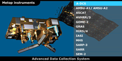
MetOp's suite of instruments
MetOp's suite of sophisticated instruments offer enhanced remote-sensing capabilities to provide high-resolution images, detailed vertical temperature and humidity profiles, and temperatures of the land and ocean surface on a global basis. Also on board are instruments for monitoring ozone levels in the atmosphere and wind over the oceans. In addition, the payload includes an instrument for data collection, an instrument to observe the weather in space as well as a tracking system to aid search and rescue operations.
Five are new European state-of-the art instruments, whilst the others, which have been provided by the National Oceanic and Atmospheric Administration (NOAA) and Centre National d'Etudes Spatiales (CNES), come with well-proven heritage being flown on American satellites already delivering valuable data.
European instruments
ASCAT – Advanced Scatterometer
Developed by ESA, ASCAT will provide data on wind speed over the oceans for use in weather forecasting, and will also find applications in a number of other areas such as the monitoring of land and sea ice, snow cover and soil moisture. ASCAT is the enhanced successor to the highly successful scatterometers flown on ESA's ERS-1 and ERS-2 satellites. Its use of six antennae allows the simultaneous coverage of two swaths on either side of the satellite ground track and hence provides twice the information of earlier instruments.
GOME-2 – Global Ozone Monitoring Experiment-2
Developed by ESA, GOME-2 is a spectrometer that collects light reflected or backscattered from the surface of the Earth and atmosphere and decomposes it into its spectral components. The recorded spectra are used to derive detailed profiles of atmospheric ozone, nitrogen dioxide, trace gases and ultraviolet radiation. GOME-2 will continue the long-term ozone monitoring started by GOME on ERS and SCIAMACHY on Envisat.
GRAS - Global Navigation Satellite System Receiver for Atmospheric Sounding
Developed by ESA, GRAS is a Global Navigation Satellite System (GNSS) receiver that operates as an atmospheric sounding instrument. GRAS will provide atmospheric soundings of temperature and humidity of the Earth's atmosphere by the process of radio occultation to improve weather forecasting and climate monitoring. GRAS is also used to determine the precise position of MetOp by continuously tracking a constellation of GPS satellites.
IASI – Infrared Atmospheric Sounding Interferometer
Developed by the Centre National d'Etudes Spatiales (CNES), IASI will provide improved infrared soundings of temperature profiles in the troposphere and lower stratosphere, and moisture profiles in the troposphere. In addition, IASI will provide data on some chemical components playing a key role in climate change and atmospheric chemistry.
MHS – Microwave Humidity Sounder
Developed by EUMETSAT, MHS is a five-channel, self-calibrating, total power, microwave scanning-radiometer that will provide data on humidity at various altitudes in the atmosphere. Temperature information at the Earth's surface can also be determined
Meteorological heritage instruments provided by the United States
These instruments are part of the complement of American instruments provided by the National Oceanic and Atmospheric Administration (NOAA) to fly on MetOp-A and MetOp-B. Some instruments are also provided for MetOp-C.
AMSU-A1 and A2 – Advanced Microwave Sounding Units
The AMSU instruments measure scene radiance in the microwave spectrum. The data from this instrument is used in conjunction with the High-resolution Infrared Sounder (HIRS) to calculate the global atmospheric temperature and humidity profiles between the Earth's surface and the upper stratosphere. The data is used to provide precipitation and surface measurements including snow cover, sea-ice concentration, and soil moisture.
AVHRR – Advanced Very High Resolution Radiometer
The AVHRR/3 scans the Earth surface in six spectral bands to provide day and night imaging of land, water and clouds. It also measures sea-surface temperature, ice, snow and vegetation cover.
HIRS/4 – High resolution Infrared Radiation Sounder
This is a 20 channel radiometric sounder that measures radiance in the infrared spectrum. Data from HIRS/4 is used in conjunction with data from the AMSU instruments to calculate the atmosphere's vertical temperature profile and pressure from the Earth's surface to an altitude of about 40 kilometres. HIRS/4 data is also to be used to determine ocean-surface temperatures, total atmospheric ozone levels, water, cloud height and coverage, and surface radiance (albedo).
Data collection instrument
A-DCS Advanced Data Collection System
The A-DCS is to provide a worldwide in-situ environmental data collection and Doppler-derived location service with the basic objective of studying and protecting the Earth's environment. The A-DCS is currently jointly operated by NOAA and CNES. However, with the instrument installed on the MetOp series, EUMETSAT will become the third agency to operate the system.
Space weather instrument
SEM-2 Space Environment Monitor
Provided by NOAA, the SEM-2 is a spectrometer that provides measurements to determine the intensity of the Earth's radiation belts and the flux of charged particles at the satellite altitude. It provides knowledge of solar terrestrial phenomena and also provides warnings of solar wind occurrences that may impair long-range communication, high-altitude operations, damage satellite circuits and solar panels, or cause changes in drag and magnetic torque on satellites.
Search and Rescue instruments
SARP-3 Search And Rescue Processor
Provided by CNES, SARP-3 receives and processes emergency signals from aircraft and ships in distress. It determines the name, frequency and time of the signal. These data are then fed into the SARR instrument for immediate transmission to SARSAT (Search and Rescue Satellite) distress terminals on the ground.
SARR Search And Rescue Repeater
Provided by NOAA, the SARR receives and downlinks emergency signals from aircraft and ships in distress. In addition, it provides a downlink for data received by the SARP-3. The SARR receives distress beacon signals in three separate frequencies, translates and retransmits them to Local User Terminals on the ground. These terminals process the signals, determine the location of the beacons and then forward this information to a Rescue Mission Control Centre.
