

MHS data products
MHS is one of the new European instruments to fly on MetOp, however, the same instrument is already in operation on the NOAA-18 satellite, which was launched in May 2005. This image, compiled from MHS data, was taken from the NOAA-18 satellite on 28-29 August 2005 and shows Hurricane Katrina heading towards the southern states of America.
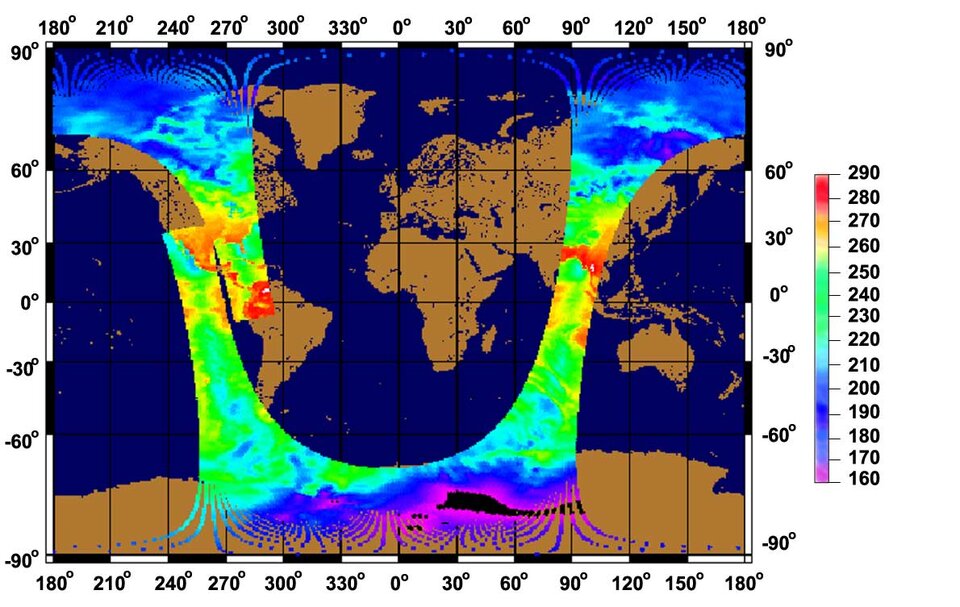
Data from this 89 GHz channel allows the instrument to 'look' further through the atmosphere than channels at the higher MHS frequencies, such that surface features (e.g. land) are visible, and surface temperature and emissivity from the Earth's surface can be determined.
Channels at the higher frequencies will show atmospheric details, like cloud coverage, type, water content, ice content, precipitation etc.
The scanning of the MHS instrument is synchronized to the scanning of the AMSU-A1 and AMSU-A2 instruments. This allows additional ground processing of data to be performed, using data from selected channels from several of these instruments at the same time. This will provide additional scientific information, which would not otherwise be available from any one instrument alone.
