United space in Europe
Surface areas mapped by VIRTIS
Science & Exploration

Surface areas mapped by VIRTIS

12/01/2007 1034 views 3 likes 237105 ID
  • HI-RES JPEG [2.33 MB]

Thank you for liking

You have already liked this page, you can only like it once!

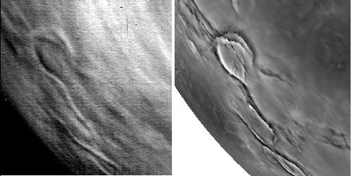
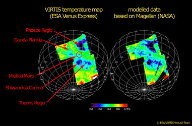
On this radar-map of Venus, built with data that NASA’s Magellan gathered in the early 1990s, the areas that were over-flown by Venus Express on 10 August 2006 are indicated by the named features. The VIRTIS instrument on board retrieved unprecedented information about the surface temperature, and so provided the first ever large-scale temperature map of the Southern hemisphere of Venus.

The non-labelled version of this image is available by clicking here .

  • NASA/Magellan
  • Space Science
  • Venus Express
Thermal and radar maps of Venus’ surface compared
Science & Exploration

Thermal and radar maps of Venus’ surface compared

Image 1559 views 4 likes
Temperature maps of Venus’ surface
Science & Exploration

Temperature maps of Venus’ surface

Image 1489 views 8 likes
Terrific south polar vortex
Science & Exploration

Terrific south polar vortex

Image 1079 views 8 likes
Cloud structures in Venus atmosphere
Science & Exploration

Cloud structures in Venus atmosphere

Image 627 views 3 likes
Close-up on cloud structures on Venus
Science & Exploration

Close-up on cloud structures on Venus

Image 808 views 5 likes