• → European Space Agency

      • Space for Europe
      • Space News
      • Space in Images
      • Space in Videos
    • About Us

      • Welcome to ESA
      • DG’s blog
      • For Member State Delegations
      • Business with ESA
      • Law at ESA
      • ESA Exhibitions
      • ESA Publications
      • Careers at ESA
      • ESAshop
    • Our Activities

      • Space News
      • Observing the Earth
      • Human and Robotic Exploration
      • Space Transportation
      • Navigation
      • Space Science
      • Space Engineering & Technology
      • Operations
      • Telecommunications & Integrated Applications
      • Preparing for the Future
    • Careers at ESA

    • For Media

      • Media
      • ESA TV
      • Videos for professionals
      • Photos
    • For Educators

    • For Kids

    • ESA

    • Preparing for the Future

    • Space for Earth

    • Sustainable Development

    • ESA and Sustainable Development and Migration

      • ESA and the Sustainable Development Goals
      • When disaster strikes
      • On the move
      • Spotting the wrong
      • Supporting local communities
    • What ESA offers

      • How to access data
      • ESA’s Medspiration project branches out to support biodiversity
      • Climate change
      • SAT-AIS for maritime
    • Programmes, Partners and Users

      • Earth Observation for sustainable development
      • ARTES programme
      • Technology Transfer Programme
      • Focus on Global Goals (HRE)
      • General Studies Programme
      • Concurrent Design Facility
    • Conferences and Workshops

      • Space and migration jam session
      • How to tackle migration issues?
      • Proceedings from the Workshop on Space and Migration
    • Publications related to Space for Migration

      • Sentinel-3: A bigger picture for Copernicus
      • Sentinel-2: Colour vision for Copernicus
      • SMOS: ESA's water mission
      • Understanding climate change from space
      • Outcome of the 2004 TIGER workshop
      • Proba-V brochure
      • Sentinel-2 brochure
    • Publications related to Sustainable Development

      • ESA activities supporting the SDGs (catalogue)
      • Space applications and sustainable development
      • Sustainable development report 2013-2014
      • Sustainable development report 2011-2012
      • Sustainable development report 2009-2010
    • Multimedia
    • Image gallery
    • Video gallery

    ESA > Our Activities > Preparing for the Future > Space for Earth > Space for Sustainable Development

    Spotting the wrong

    SAT-AIS: Tracking ships via satellite

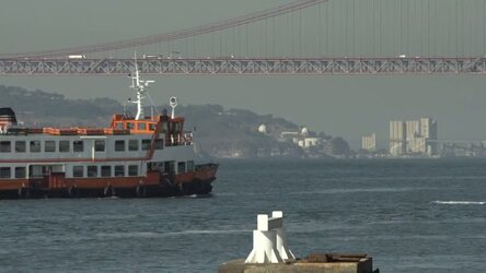
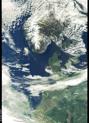
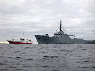
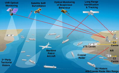
    Our planet is a big place to monitor. It seems nigh-on impossible to keep track of all earthly activities and not get overwhelmed by the shear amount of data involved. And yet, numerous projects have been set up in their own specific fields to gather information on the sustainable use of our resources, and where applicable, where things go wrong. Satellite imagery has been employed to monitor illegal fishing activities, for instance, where vessel identification technology has played an important role.

    More illegal activities on the ocean, such as oil spills and human trafficking can also be spotted with some help from above. Satellites also monitor the oceans in terms of ocean salinity, surface temperature and chlorophyll content to help predict storms, as well as give an indication of which areas are richer in fish to make sustainable fishing possible.

    Illegal logging

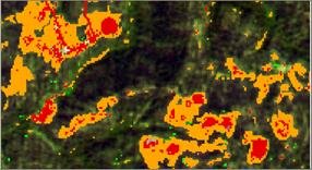
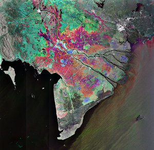
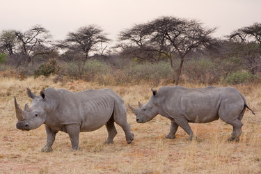
    Illegal activities unfortunately also occur on land in a variety of ways. Satellite imagery has helped to pinpoint where illegal poaching of rhinos and elephants has taken place. Illegal deforestation, which has implications for climate change, loss of biodiversity and land degradation, is a real global concern, as are the associated socio-economic issues. By monitoring certain high-risk areas over time by satellite it is possible to assess how much of our precious forests are vanishing and by relaying this information to local authorities this devastating loss can be hampered.

    wetlands
    Wetlands are found all over Earth

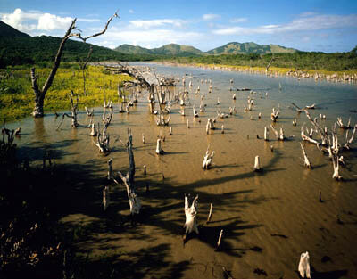
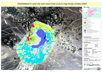
    Sustainable use of land is beneficial to local and regional communities but quite often it is hard to follow through as global economic factors play a role too. Satellite imagery can provide tools to define problems and where necessary provide data on land loss and how this affects the local economy. An example is the use of satellites to monitor wetlands, which are of important ecological, hydrological and economic value. When wetlands disappear it is paramount to find out what the reasons behind this are and as such measures can be taken to conserve and re-instate these precious water sources.

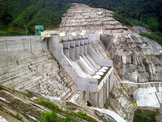
    Sometimes economic activities, such as mining, agriculture, energy generation using a hydroelectric dam can have adverse effects on a local community that were not clear at the start of the activity. Prediction models and real imagery can then help to provide tools for maintaining the economic activity without further negative effects on the community. A vast knowledge of how to deal with satellite imagery and big-data experts are required to bring this to a good end.

    Last update: 12 January 2017

    Rate this

    Views

    Share

    • Currently 5 out of 5 Stars.
    • 1
    • 2
    • 3
    • 4
    • 5
    Rating: 5/5 (1 votes cast)

    Thank you for rating!

    You have already rated this page, you can only rate it once!

    Your rating has been changed, thanks for rating!

    1278
    Tweet
    • ESA links
      • SAT-AIS for maritime
        • Sustainable fishing by satellite
        • Monitoring deforestation in Brazil
          • Pooled satellite data for maritime surveillance on the horizon
            • ESA to sign agreement with Indonesian Ministry of Forestry
              • EC unveils new EU maritime policy
                • Guiding fishing fleets
                  • Developing agriculture from the sky
                    • Space technology for wildlife conservation and humanitarian work
                      • Tapping into Earth observation data for international development
                        • Satellites protect wetland areas
                        • Maritime prevention project (MAPP) demonstrator
                        • Space assets for enhanced demining (SAFEDEM)
                        • Saving peatlands with satellites
                        • Logging the smart way
                          • Tracking marine traffic via satellite
                            • Wetland management on the radar
                            • External links
                            • Wetlands International
                            • Monitoring illegal mining activities
    • App Store
    • Subscribe
    • mobile version
    • FAQ

    • Site Map

    • Contacts

    • Terms and conditions