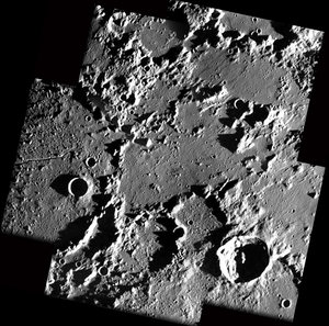
SMART-1 maps Humorum edge - where Highlands and Mare mix
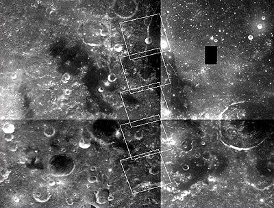
This sequence of images, taken by the advanced Moon Imaging Experiment (AMIE) on board ESA's SMART-1 spacecraft, shows on area on the near side of the Moon, on the edge of the Mare Humorum basin.
AMIE obtained these raw images on 13 January 2006 from a distance ranging between 1031 and 1107 kilometres from the surface, with a ground resolution between 93 and 100 metres per pixel.
The imaged area is located at longitude 45.7º West and latitude between 30.5º and 24.5º South. The field of view of each single image is about 50 kilometres.
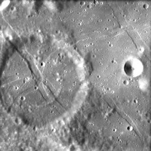
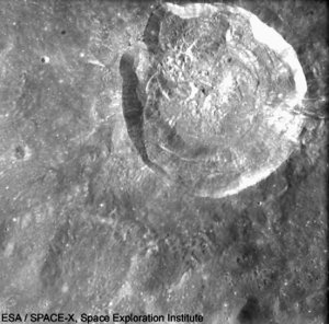
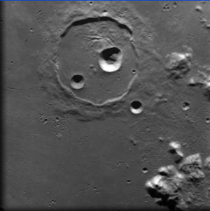
The flat lava plain in the upper right image is the floor of Mare Humorum. The bowl-shaped crater on top, cut by a fracture, is called ‘Liebig F’ and has a diameter of nine kilometres.
The Mare Humorum impact basin is 825 kilometres across. Its precise age could not be determined yet by previous lunar programmes, but geologic mapping suggest it could be around 3.9 thousand million years old – an age comprised between those of the Imbrium and Nectaris Basins. The Humorum basin is filled with a layer of basalt, likely thicker than three kilometres at its centre.
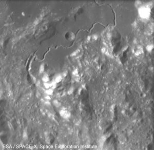
The Humorum basin, like several other lunar basins, was formed in a period which ended around 4.1 billion years ago. It was filled with mare material - basaltic flood eruptions caused by very large meteoroid impacts - only during the later Eratosthenian era, in a period comprised between 3.9 and 3.2 billion years ago. The western edge of the sea is marked by a network of cracks and clefts following the Rupes Liebig.
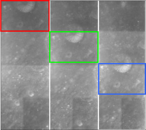
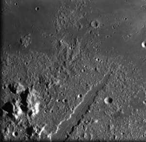
The three northern images include part of the flat darker area corresponding to the mare basalt filling the inner ring of the basin impact. A fresh small crater is surrounded by brighter deposits.
The top north image also shows giant lava tubes or rilles in the Mare. Some graben-lineated structures (a graben is an elongated and relatively depressed crustal block that between two fault systems) indicate the stress structures created during the multi-ring collapse, and refreshed by additional load deformation from the weight of later basalt fill.
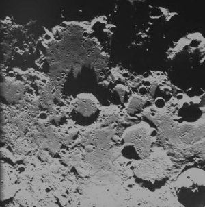
It is possible to notice the landscape transition towards the most southern image typical of an old cratered highland. In the middle image the small craters are not very clear because the terrain has been partly covered by material ejected from the impact basin.
Note to editors:
An intersting reference on Mare Humorum compositional and geological studies is given by Martin, Pinet, Chevrel and Daydou (1998, http://www.lpi.usra.edu/meetings/LPSC98/pdf/1547.pdf)
For more information:
Jean-Luc Josset, SPACE-X Space Exploration Institute
Email: jean-luc.josset @ space-x.ch
Bernard H. Foing, ESA SMART-1 Project Scientist
Email: bernard.foing @ esa.int