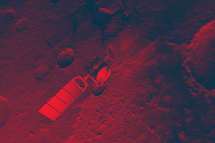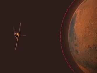
Mars Express and the story of water on Mars
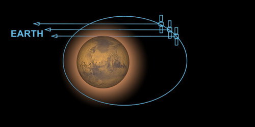
For a number of decades now, astronomers have wondered about water on Mars. Thanks to ESA's Mars Express, much of the speculation has been replaced with facts. Launched on 2 June 2003, Mars Express has changed the way we think of Mars.
Since the Viking missions of the 1970s, planetary scientists have changed their perception of water on Mars several times, passing from the picture of a dry planet to that of a warmer and wetter one. Mars Express's data are now shedding a new light on the complex issue of the evolution of water on the Red Planet.
"We are re-writing the history of Mars," says Gerhard Neukum, Freie Universitaet Berlin, Germany, and the Principal Investigator on Mars Express’s High Resolution Stereo Camera (HRSC). "The big picture of a warm wet Mars is not completely correct. Any warm wet period lasted only a few hundred million years. By four thousand million years ago, it was over," he adds.
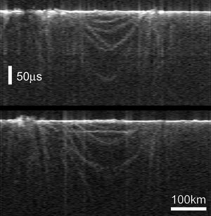
Three instruments on Mars Express have been at the centre of this revolution in thought. One is the Mars Advanced Radar for Subsurface and Ionospheric Sounding (MARSIS). Since July 2005, MARSIS has probed beneath the surface of Mars to depths of thousands of metres. This is the first time such investigations have taken place.
"MARSIS has shown that many of the upper layers of Mars contain water ice," says Jeffrey Plaut of the Jet Propulsion Laboratory, Pasadena, who is the co-Principal Investigator on the MARSIS experiment.
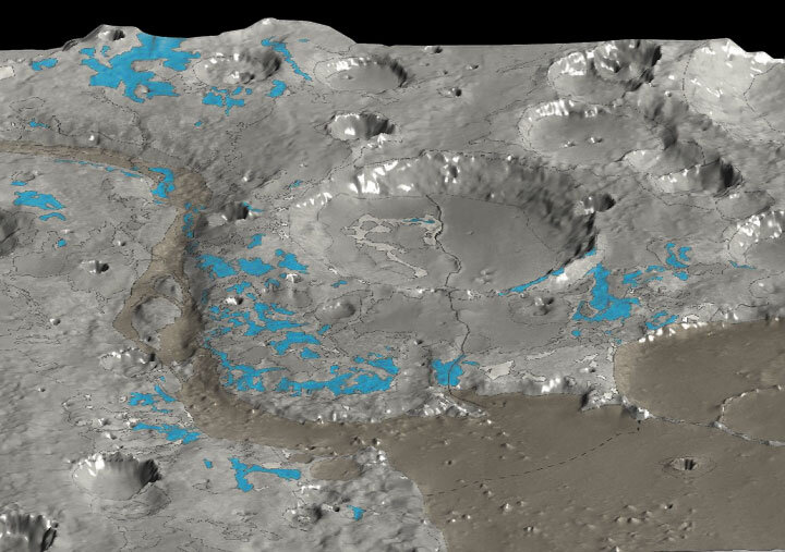
The scientists detected abundant water ice in the Martian polar regions and also received a surprise from some of the very first results that MARSIS returned. When the radar passed over the mid northern latitudes of Chryse Planitia, the signals showed a buried impact crater, below the surface. Inside this impact structure was a thick layer of possibly water-ice-rich material. "We are finding reservoirs of ice that have never been seen before," says Plaut, "But we are still puzzling out when and where the water on Mars was liquid."
“The last MARSIS observations have been done on the South Pole,” adds Giovanni Picardi, MARSIS Principal Investigator, from the University of Rome ‘La Sapienza’. “The quality of the preliminary results of the advanced analysis we are still performing are really exciting and promising, with respect to the main scientific objectives of our experiment.” The objectives include the detection of subsurface water.
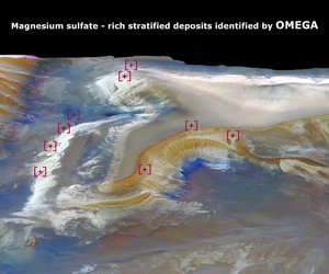
The OMEGA Visible and Infrared Mineralogical Mapping Spectrometer has taken giant steps towards answering that question. OMEGA detects minerals on the surface of Mars. Three in particular reveal the history of Martian water. "We have demonstrated that water could have been stable on Mars's surface but not for very long," says Jean-Pierre Bibring, Institut d'Astrophysique Spatiale, Orsay, France, and OMEGA's Principal Investigator.
OMEGA detected clay-like minerals that form during long-term exposure to water, but only in the oldest regions of Mars. That suggested water flowed during the first few hundred million years of the planet’s history only. When these bodies of water were lost, water then occasionally burst from inside the planet but quickly evaporated.
During the evaporation they made sulphates, the second mineral that OMEGA detected. When even this stopped and the remaining water on Mars became permanently frozen, then the atmosphere gradually turned the soil red by creating the third mineral OMEGA detected, ferric oxide.
Mars has been like this for thousands of millions of years. "It is remarkable that, for the first time, we have identified where and when liquid water might have been present on Mars. It is not where one thought of before," says Bibring.

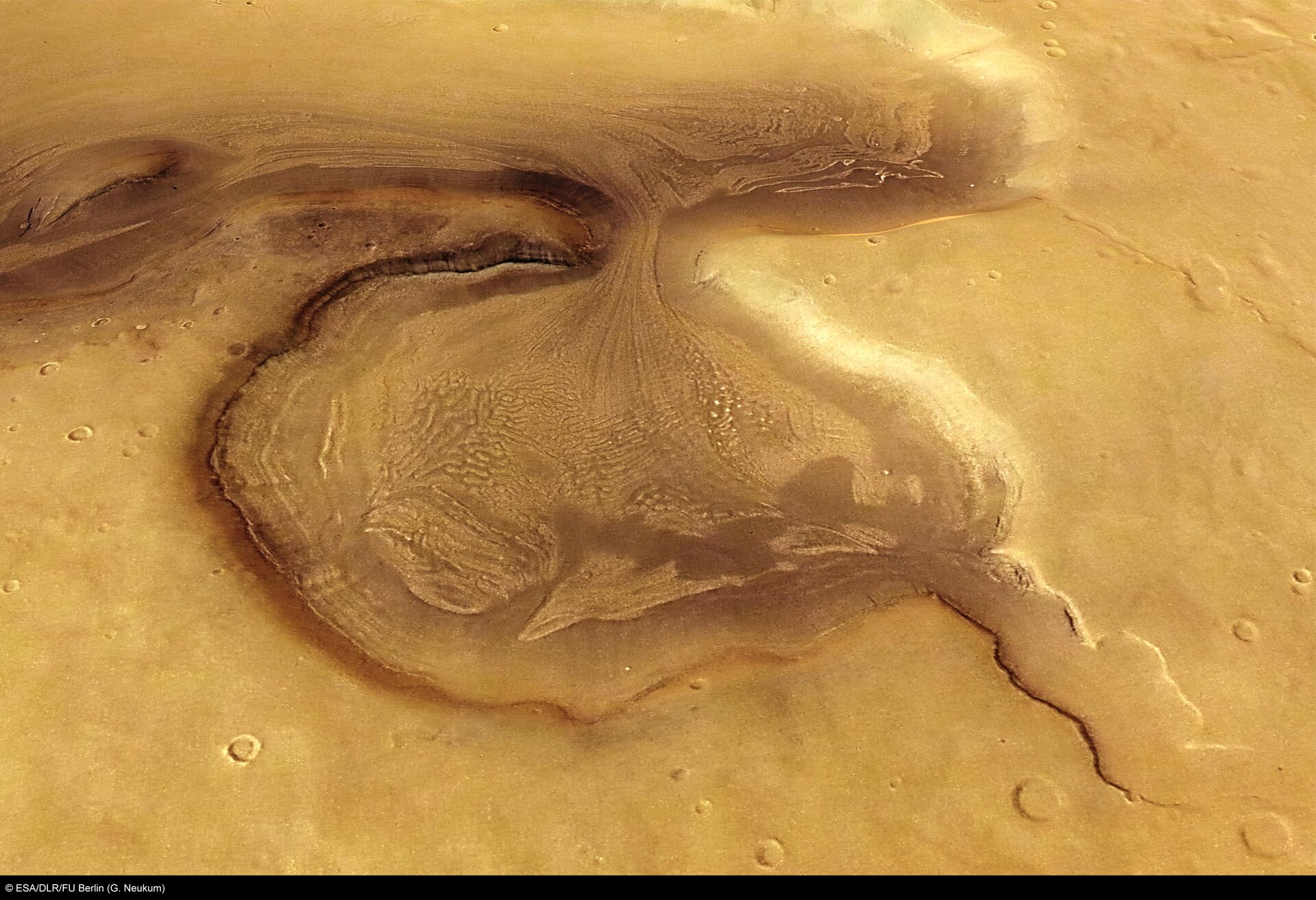
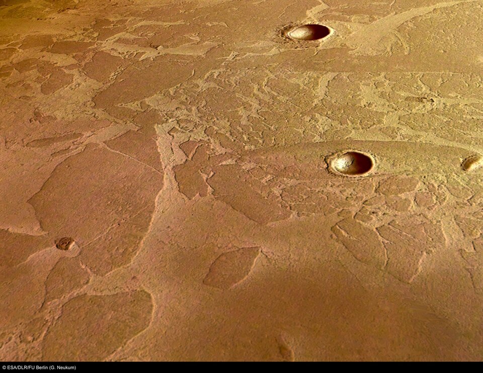
The images from the High Resolution Stereo Camera (HRSC) point towards the same conclusions. They show the Martian surface in the most exquisite detail, revealing features just 10 metres across. They clearly show extremely old Martian regions that have been eroded by flowing water. The pictures also show a huge valley, Kasei Valles, carved by a gigantic Martian glacier that persisted for a thousand million years during the time when the temperature of Mars had dropped too low for liquid water to flow across the surface.

"We see a clear link between volcanic regions and water flows," says Neukum. Wherever there has been volcanic activity on Mars, it has melted water inside Mars and let it flow to the surface. Some of these flows are recent – geologically speaking. "At the foot of Olympus Mons, HRSC sees evidence for water flows that have happened within the last 30 million years," says Neukum.
NASA’s latest spacecraft, the Mars Reconnaisance Orbiter (MRO), carries instruments that lead on from those of Mars Express. Many scientists from the teams at work on MARSIS are now working on the ASI's Shallow Radar (SHARAD) on board MRO. This is tuned to focus on the shallower layers of Mars, whereas MARSIS looks deeper. OMEGA's sister instrument on MRO is the Compact Reconnaissance Imaging Spectrometer for Mars (CRISM). This will look in more detail at minerals on the Martian surface. However, the instrument only has a small field of view, so it will need guidance. "They will target primarily the areas that OMEGA has shown to be interesting," says Bibring.
"Mars Express has provided unprecedented evidence on the history of water on Mars. Now, we look forward to new investigations that will build on this legacy," says Augustin Chicarro, Mars Express’s Project Scientist at ESA.
Note to editors
Mars Express data is still streaming down from HRSC, MARSIS, Omega but also the probe's other instruments, PFS, SPICAM, ASPERA, and MaRS. They are probing all aspects of the Martian environment – studying atmospheric gases, searching for eventual biological processes, detecting high altitude clouds and hidden volcanoes and digging into the scavenging effects of the solar wind.
For more information
Agustin Chicarro, ESA Mars Express Project Scientist
Email: agustin.chicarro @ esa.int
Gerhard Neukum, HRSC Principal Investigator, Freie Universitaet Berlin, Germany
Email: gneukum @ zedat.fu-berlin.de
Jean-Pierre Bibring, OMEGA Principal Investigator, Institut d’Astrophysique Spatiale - IAS, Orsay, France
Email: jean-pierre.bibring @ ias.u-psud.fr
Giovanni Picardi, MARSIS Principal Investigator Univ. di Roma 'La Sapienza', Italy
Email: picar @ infocom.uniroma1.it
Jeffrey Plaut, MARSIS Co-Principal Investigator, NASA/JPL, USA
Email: plaut @ jpl.nasa.gov