Satellites reveal Russian fires worst in 14 years
More wildfires have burned around the Russian capital this year than in the last decade and a half, according to sensors aboard ESA’s observation satellites. The forest and peat bog fires ignited this summer amid an unprecedented heat wave of up to 40ºC.
Working like thermometers in the sky, the Along Track Scanning Radiometer and the Advanced Along Track Scanning Radiometer on ESA’s ERS-2 and Envisat satellites measure thermal-infrared radiation to take the temperature of Earth’s land surface.
Flames reach temperatures that are detected by these sensors and confirm the presence of fire.
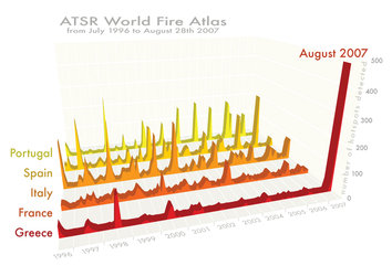
Data gathered from fires across Russia from July 1996 to the present were used to plot the number of fires occurring monthly. The region near Moscow showed around six times the number of fires this August compared to previous years.
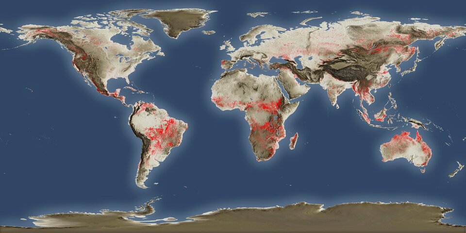
Data from these sensors are compiled to create ESA’s ATSR World Fire Atlas which is available online to users within six hours. The atlas – the longest worldwide fire record available – also provides the time, date, longitude and latitude of the hot spots.
The atlas is an important scientific resource because fires have a significant impact on global atmospheric pollution, with biomass burning contributing to the global budgets of greenhouse gases such as like carbon dioxide.
The data are used for research in atmospheric chemistry, land-use change, global change ecology, meteorology and fire prevention and management.