ESA satellite assesses damage of Norway’s largest fire
Following the extremely hot weather conditions hitting Europe, Norway experienced its biggest forest fire in the last half century earlier this month. Envisat satellite images were used in the fire’s aftermath to get an overview of the damaged area for authorities and insurance companies.
Extreme heat, dry conditions and strong winds quickly spread the fire in the cities of Mykland and Froland in the southern county of Aust-Agder, dampening fire-fighters attempts to squelch the blaze. Before being brought under control by more than 150 fire-fighters, aided by 16 helicopters (and much hoped for rain), the fire is estimated to have destroyed around 3000 hectares.
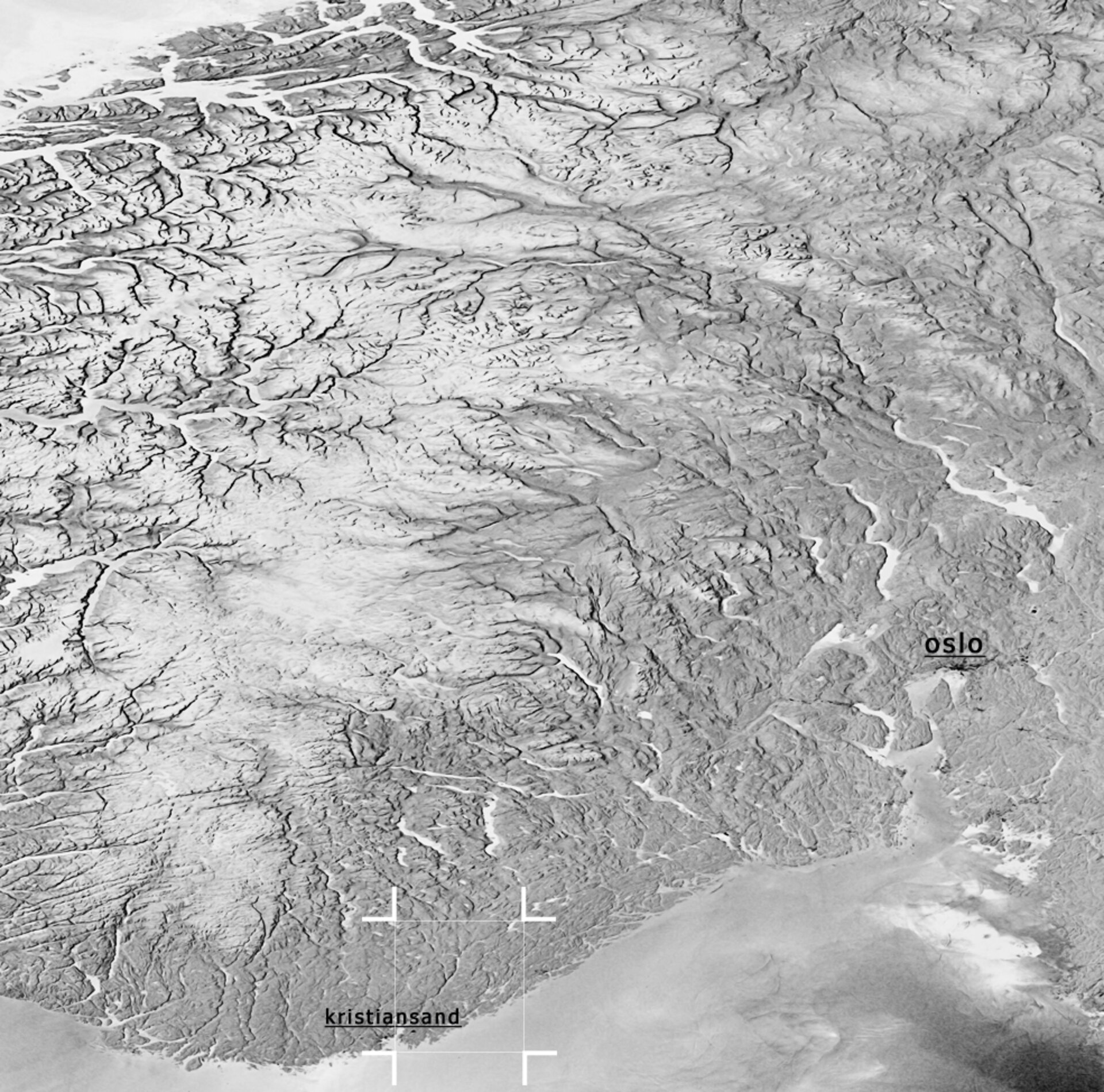
To assess the full extent of the damage, Norway’s KSAT (the Kongsberg Satellite Services) compared Envisat acquisitions taken before and after the event.
"At KSAT, we were quite surprised by how easy it was to detect the affected area in the image and to learn how extensive the damages are," Nina Soleng said. "We sent the images to the County Director of Forestry (Fylkesskogmester) of Aust-Agder County."
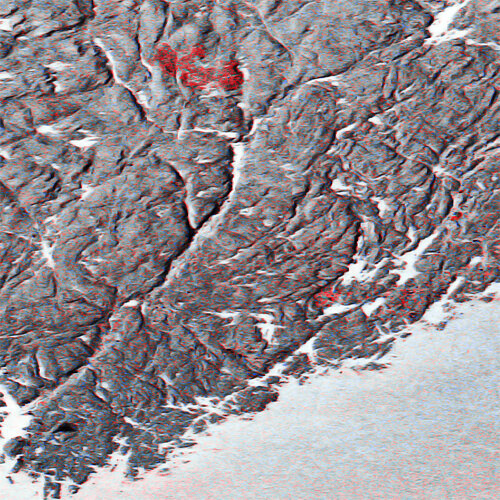
The Envisat Advanced Synthetic Aperture Radar (ASAR) image to the right was produced by combining and comparing an acquisition taken before the fire (15 May) with one taken after the fire (19 June).
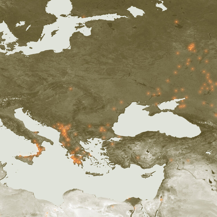
Major fires are visible from space – satellites detect not only the smoke billowing from major conflagrations but also the burn scars left in their wake. Even the fires themselves appear as 'hotspots' when the satellites’ sensors scan the Earth's surface in infrared wavelengths.
More than 50 million hectares of forest are burnt annually, and these fires have a significant impact on global atmospheric pollution, with biomass burning contributing to the global budgets of greenhouse gases, like carbon dioxide.
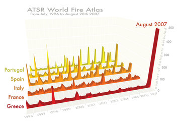
Satellites have proven to be vital tools for keeping track of fires and are able to keep forests under constant surveillance. ESA satellites have been surveying fires burning across the Earth’s surface for the last decade. Worldwide fire maps based on this data are now available to users online in near-real time through ESA's ATSR World Fire Atlas (WFA).
The WFA data are based on results from the Along Track Scanning Radiometer (ATSR) instrument onboard ESA’s ERS-2 satellite and the Advanced Along Track Scanning Radiometer (AATSR) onboard Envisat. These twin radiometer sensors work like thermometers in the sky, measuring thermal infrared radiation to take the temperature of Earth's land surfaces.
By combining satellite-derived information, such as surface temperatures, land and vegetation cover and vegetation water content, with meteorological forecasting data, such as air temperature, wind speed and rainfall, forests can be systematically monitored to assess fire risks and allow fire fighters to plan fast and efficient actions to extinguish flames.
Within the context of the Global Monitoring for Environment and Security (GMES) initiative, ESA and the European Commission (EC) have jointly demonstrated the ability of satellite-based observations to respond to the operational needs of fire fighting teams through projects such as RISK-EOS and PREVIEW.