Smelly seaweed bloom heads to Florida
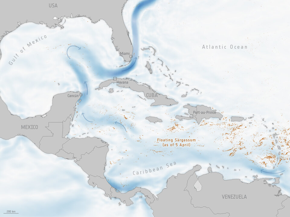
A large mass of Sargassum ‘seaweed’ circling around the Gulf of Mexico may soon wash up along the US west coast near Florida – depending on the right combination of currents and wind. The bloom, which may likely be the largest ever recorded, is so large that it’s visible from space.
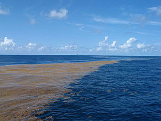
Sargassum is a leafy, rootless and buoyant algae that rafts up into large floating mats on the ocean surface. It can be found in the Sargasso Sea and was first written about by Christopher Columbus in 1492 who feared his boat would be trapped in it.
Sargassum is an important habitat for marine species providing food, refuge and breeding grounds. Like other floating marine vegetation, it absorbs atmospheric carbon dioxide – an important greenhouse gas that contributes to global warming – through photosynthesis and converts it into organic carbon.
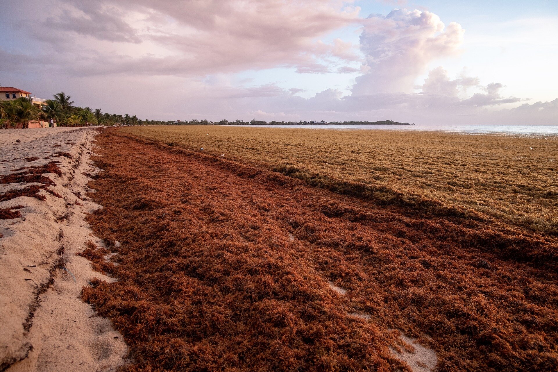
However, when tonnes of it collects along coastlines, it rots – emitting toxins like hydrogen sulphide which produces a pungent smell. These toxins can cause headaches, eye irritation and upset stomachs, depending on the quantity. Mounds of algae on beaches can harm marine ecosystems and disrupt recreation and fishing, costing communities millions.
Sargassum has formed large blooms in the Atlantic Ocean, with scientists tracking the massive accumulations since 2011. But this year’s bloom could be the largest ever, collectively spanning more than 8800 km from the shores of Africa to the Gulf of Mexico and weighing 10 million tonnes.
As part of ESA’s Earth Observation Science for Society initiative, ESA works alongside CLS-NovaBlue Environment to monitor floating Sargassum using data from Earth observation satellites.
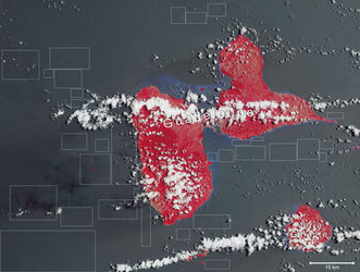
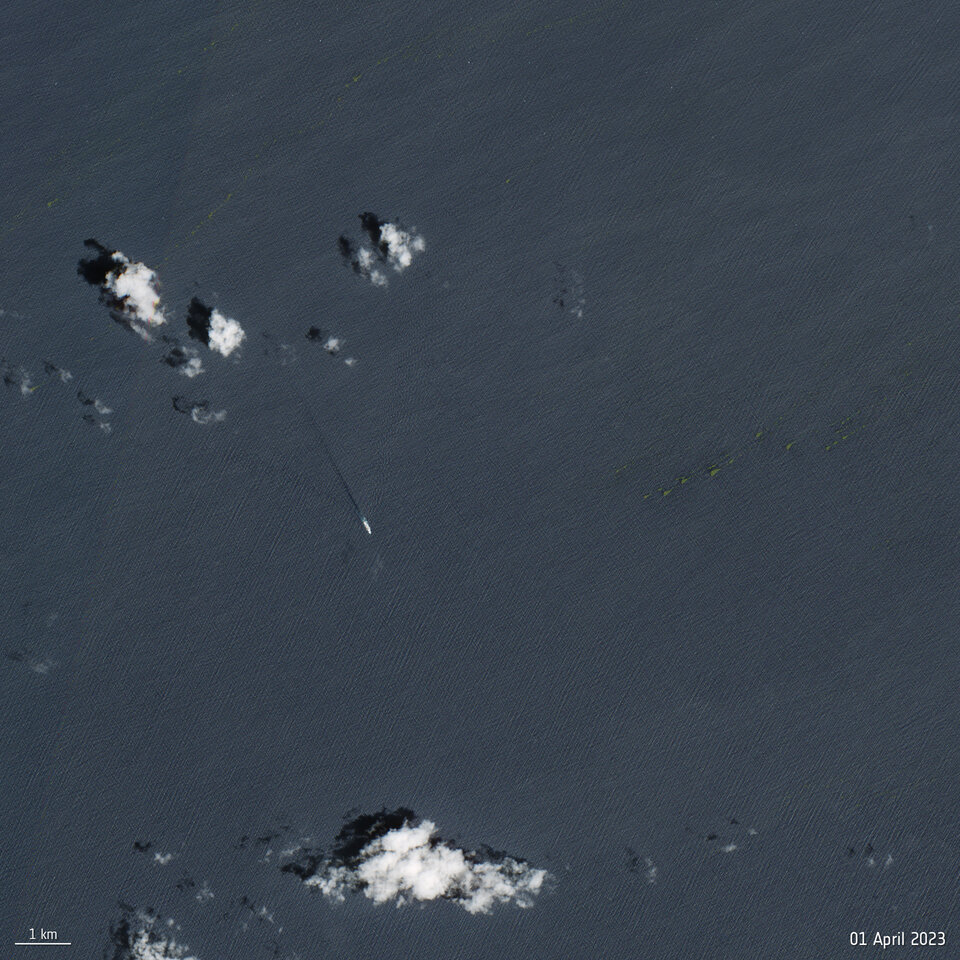
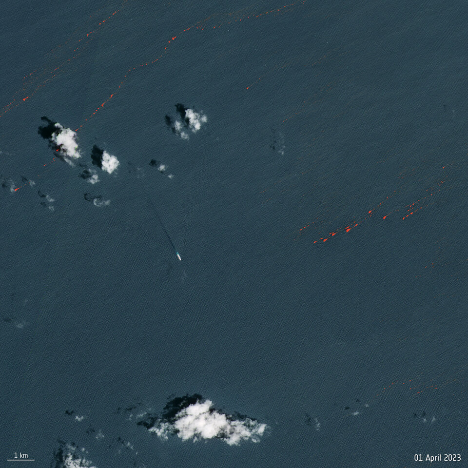
These Copernicus Sentinel-2 images show the Sargassum around 45 km off the west coast of Guadeloupe. The image on the left is a true-colour image while the one on the right has been processed using the near-infrared channel to highlight the Sargassum in bright red.
Open Image
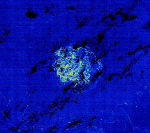
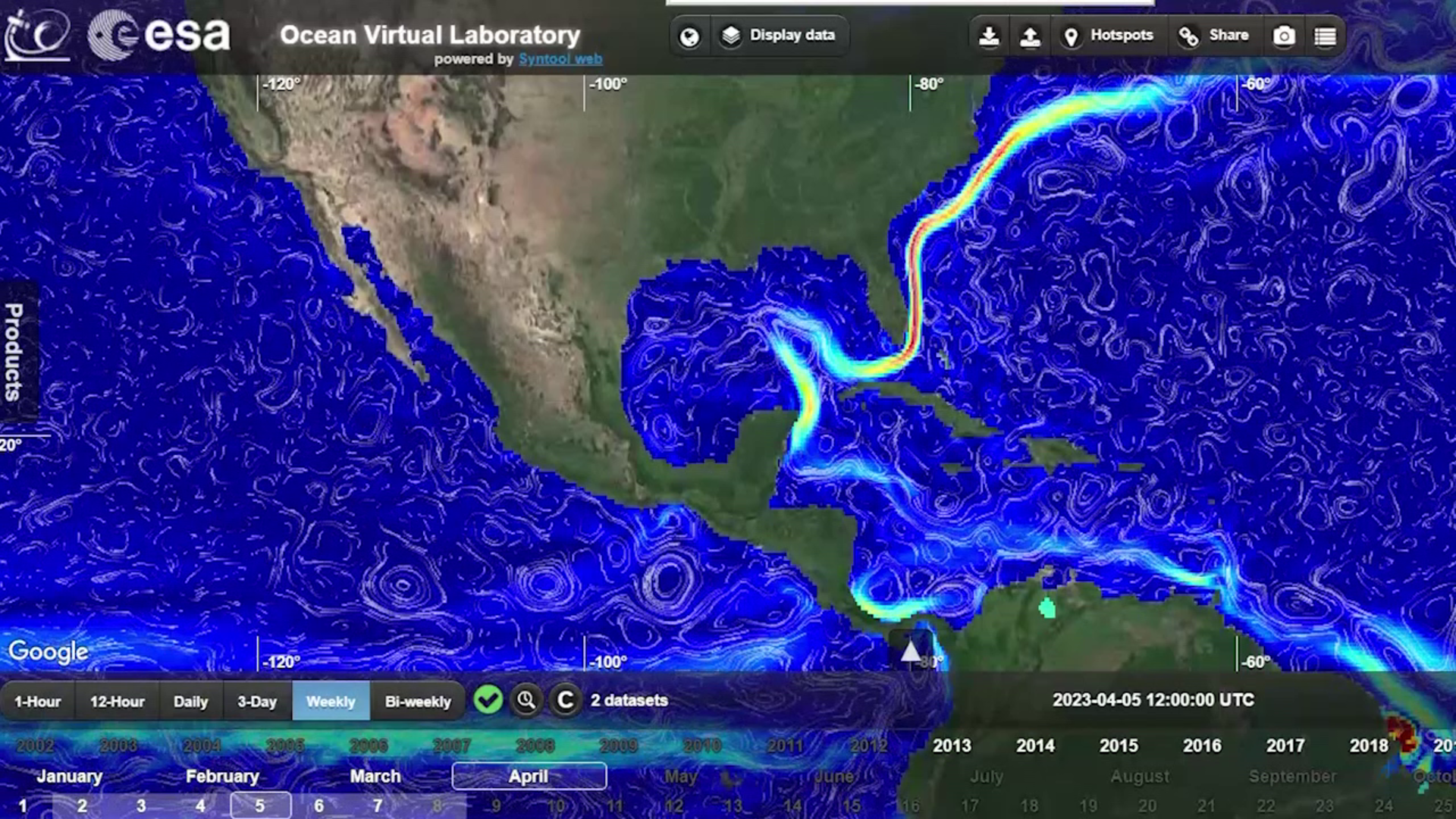
In addition, the Ocean Virtual Laboratory, which allows oceanographers to discover the world’s oceans, have been monitoring the Sargassum. The virtual lab uses more than 350 datasets, Copernicus Sentinel data, in situ measurements and numerical model outputs to provide an unprecedented view of our oceans and improve scientific understanding of ocean and coastal processes leading to the Sargassum which could soon affect Florida’s coastlines.
Since 2011, a change in the density and in size of Sargassum levels has been seen which can be monitored from space in different ways.
Multispectral satellite measurements from Sentinel-2 at 10m resolution can capture the extent and evolution of the Sargassum belt stretching across the Atlantic Ocean.
These are complemented by radar altimeter measurements from Sentinel-3 and Sentinel-6 satellites that provide access to geostrophic ocean currents. This means that can we monitor both the location, density and size of Sargassum mats as well as the trajectory of ocean currents that are leading the Sargassum westward – threatening beaches along the Florida Keys, Mexico's Yucatán Peninsula and the eastern Caribbean.

Access the video