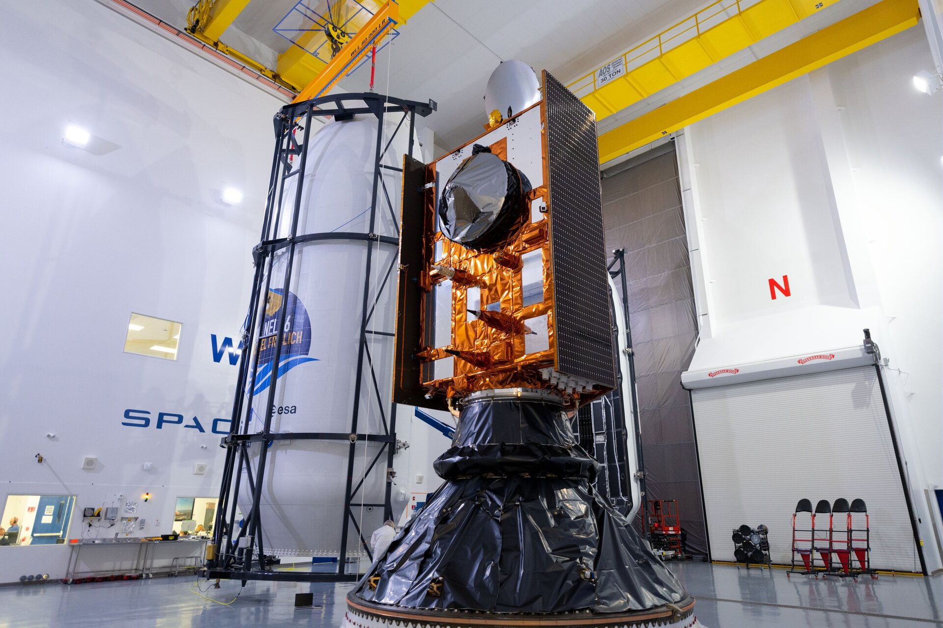
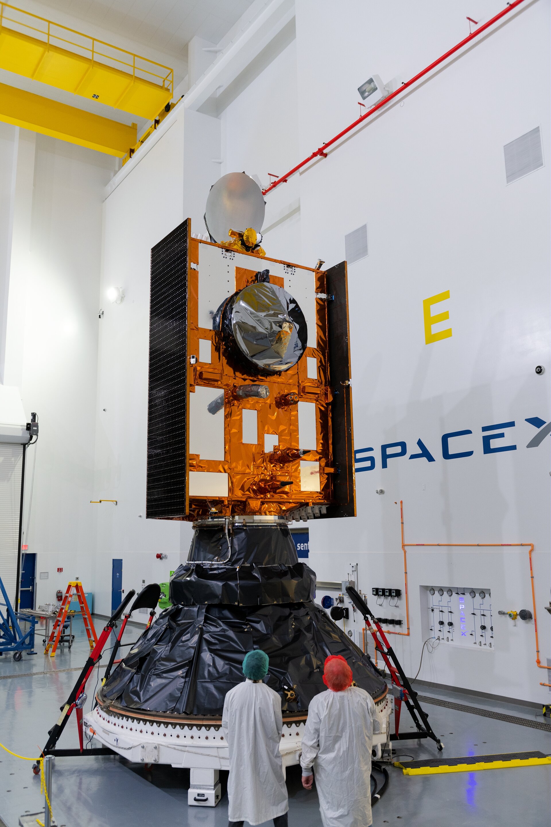
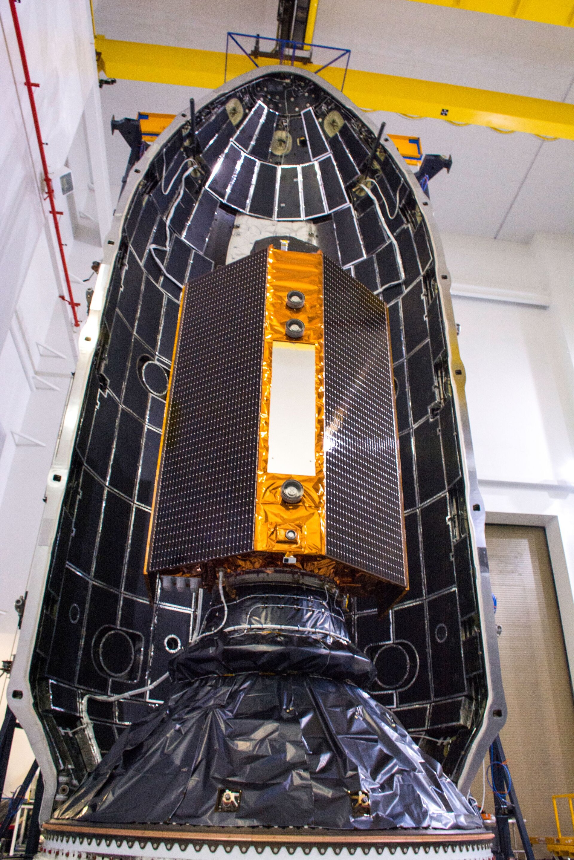
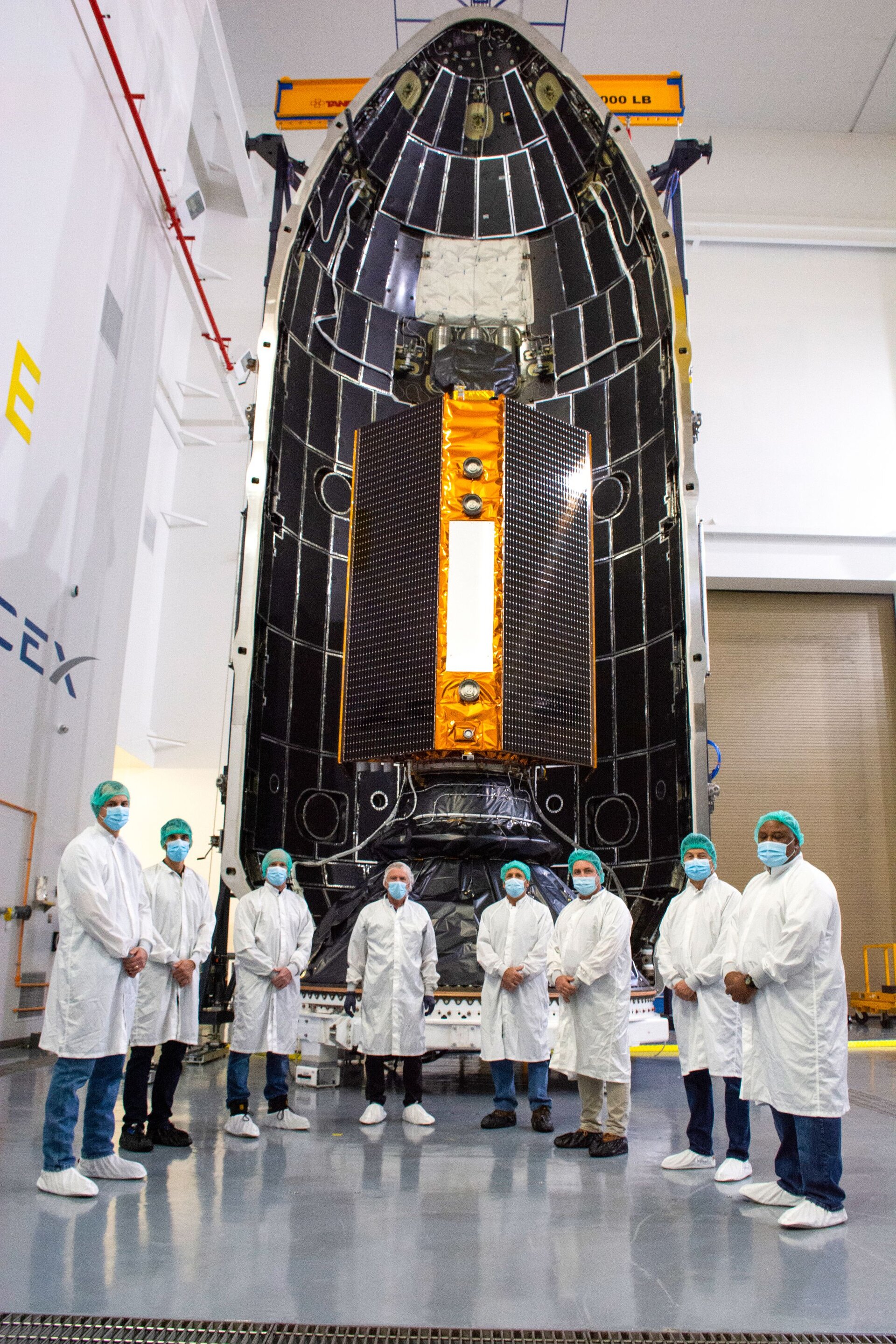
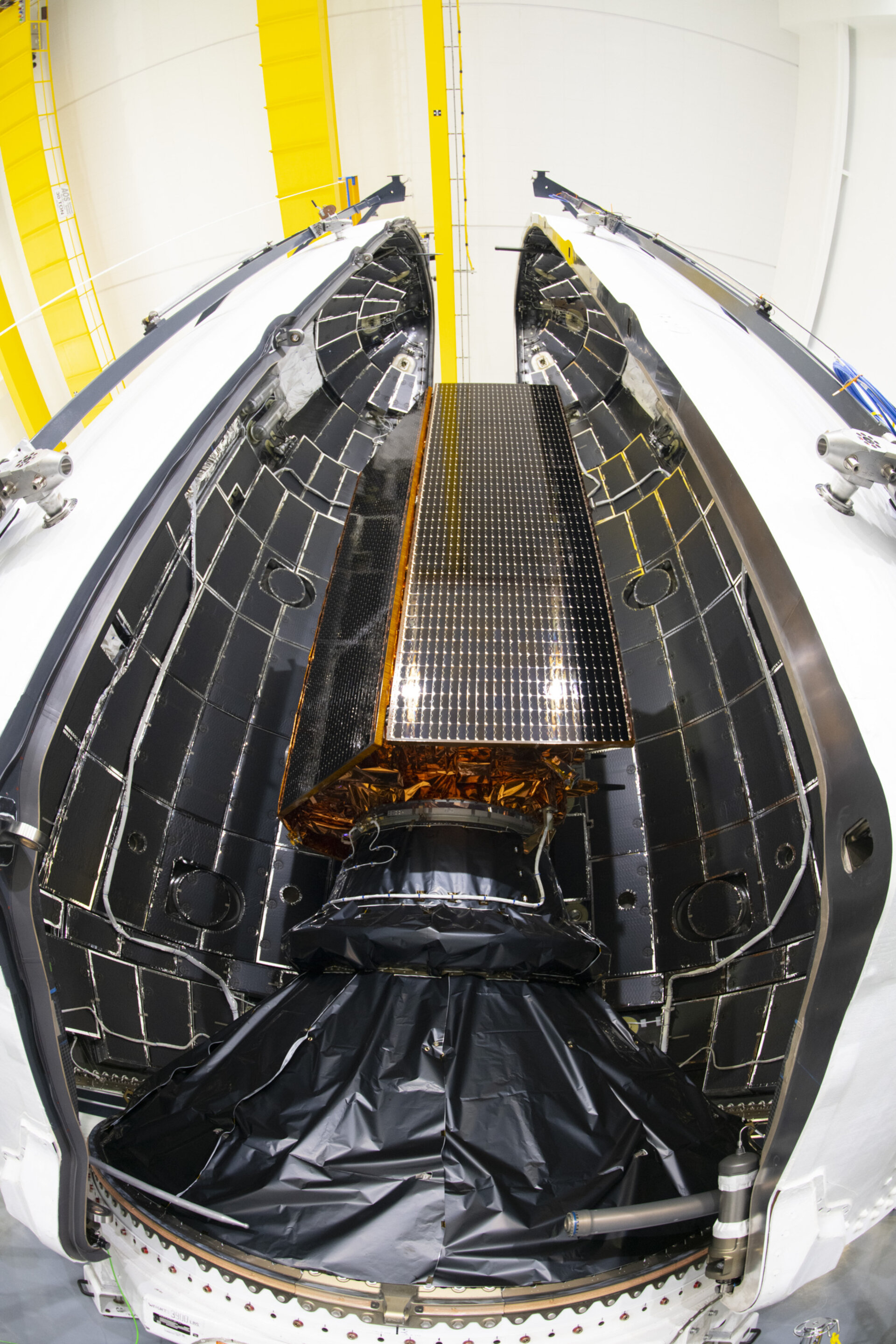
Copernicus Sentinel-6 sealed in rocket fairing
As preparations for the launch of Copernicus Sentinel-6 Michael Freilich continue, the team at the Vandenberg Air Force Base in California has bid farewell to the satellite as it is sealed from view within the two half-shells of its Falcon 9 rocket fairing. Liftoff is now set for 21 November at 17:17 GMT (18:17 CET; 09:17 PST).
Since its arrival at the launch site at the end of September, Sentinel-6 Michael Freilich has been thoroughly tested, fuelled and joined to the launch adapter. Now safely tucked up inside the rocket fairing that will protect it during liftoff, the next steps include roll out to the launch tower and fitting to the rest of the rocket.

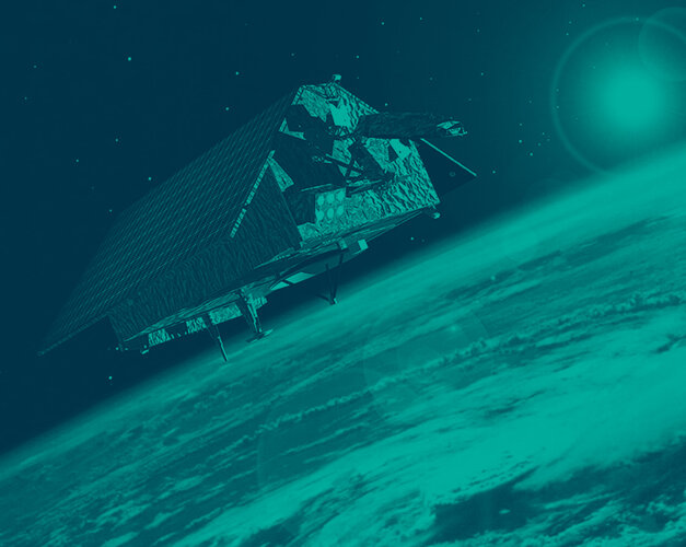
Once launched, this new mission will take the role of radar altimetry reference mission, continuing the long-term record of measurements of sea-surface height started in 1992 by the French–US Topex Poseidon and then the Jason series of satellite missions.
Sea-level rise is one of the biggest threats we face as a consequence of climate change.
Satellite data show that global mean sea level has risen, on average, by just over 3 mm every year since 1993. Even more worryingly, this rate of rise has increased in recent years. The role of Copernicus Sentinel-6 is not only to continue this critical ‘gold standard’ record for climate studies, but also to measure sea-surface height with greater precision than before.
Accurately monitoring the changing height of the sea surface over decades is essential for climate science, for policy-making and, ultimately, for protecting the lives of those in vulnerable low-lying areas.

Access the video
The Sentinel-6 mission comprises two identical satellites, Sentinel-6 Michael Freilich and Sentinel-6B, launched five years apart to supply measurements until at least 2030.
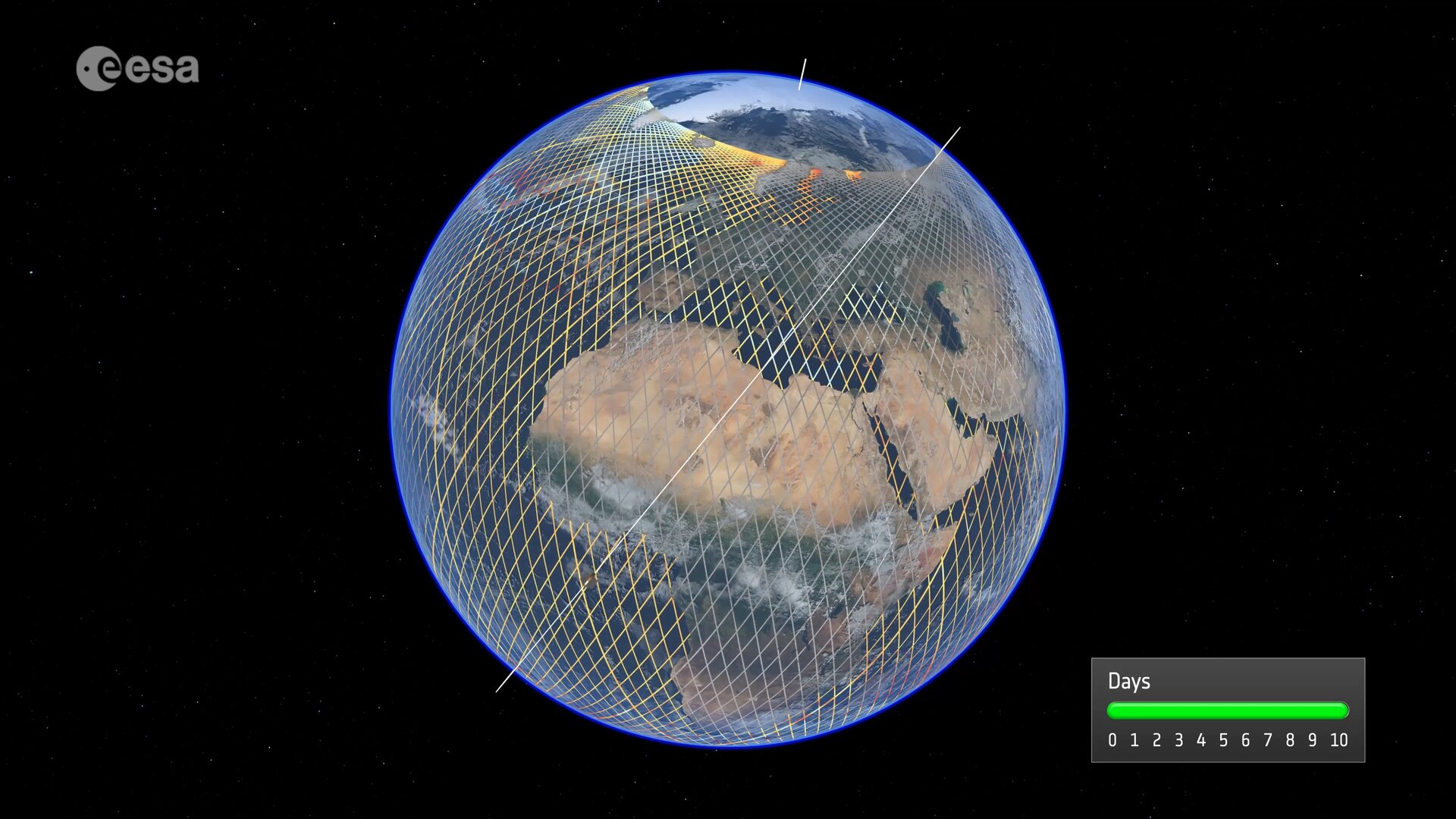
The satellites reach 66°N and 66°S – a specific orbit occupied by the earlier missions that supplied the reference sea-surface height data over the last three decades. This orbit allows 95% of Earth’s ice-free ocean to be mapped every 10 days. Sentinel-6 builds on heritage from the Jason series, ESA’s CryoSat satellite and the Copernicus Sentinel-3 mission.
Each Sentinel-6 satellite carries an altimeter that works by measuring the time it takes for radar pulses to travel to Earth’s surface and back again to the satellite. Combined with precise satellite location data, altimetry measurements yield the height of the sea surface.
Moreover, Sentinel-6 brings, for the first time, synthetic aperture radar into the altimetry reference mission time series. To ensure that no bias is introduced into the time series data, the radar instrument delivers simultaneous conventional low-resolution mode measurements as well as the improved performance of synthetic aperture radar processing that yields high-resolution along-track measurements.

The satellites’ instrument package also includes an advanced microwave radiometer provided by NASA. Water vapour in the atmosphere affects the speed of the altimeter’s radar pulses – and therefore estimates of sea-surface height. The advanced microwave radiometer accounts this water vapour to ensure that measurements are accurate.
As well as mapping the height of the sea surface to understand long-term change, Copernicus Sentinel-6 also provides data for practical ‘operational’ applications. For example, the mission measures significant wave height and wind speed, data that are used for near-real time ocean forecasting that can be used for sustainable ocean-resource management, coastal management and environmental protection, the fishing industry, and more.
The Copernicus Sentinel-6 mission is a true example of international cooperation. While Sentinel-6 is one of the European Union’s family of Copernicus missions, its implementation is the result of the unique collaboration between ESA, NASA, Eumetsat and NOAA, with contribution from the French space agency CNES.