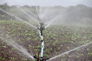
How much water do we use for irrigation?
While we know that we use more water for irrigation than for any other single purpose, watering practices are not monitored worldwide. Water needed for agriculture is expected to further increase as time goes on, so managing this precious resource as effectively as possible is imperative. Scientists have now shown that a nifty way of using information from satellites could pave the way to measuring how much water we use to irrigate, which could subsequently lead to better management.
It goes without saying that we humans are increasingly affecting many aspects of Earth’s natural balance, such as the water cycle. More than 70% of the water we currently withdraw from the surface or from underground is destined for irrigation.
The growing global population and increasing demand for food, coupled with the climate crisis, is predicted to put further pressure on freshwater resources.
Irrigation practices are scarcely monitored worldwide, which is somewhat paradoxical since this is how we predominantly interfere directly with the water cycle.
However, satellites measuring our planet from space offer unique opportunities to answer the question of how much water is used for irrigation.
A paper published recently in the journal Earth System Science Data reports on the results of ESA’s Science for Society Irrigation+ project, which aims to show how irrigation can be measured from space.
The project aims to show that by using different Earth observing satellite missions, irrigation can be mapped and measured, and seasonal timings detected.
The team, led by scientists from Italy’s National Research Council and University of Perugia, built on earlier research into using soil moisture data from satellite missions such as ESA’s SMOS and the US SMAP and information on evapotranspiration.
They used an ‘inversion technique’ to turn these relatively coarse satellite data into the first regional high-resolution irrigation water datasets.
Jacopo Dari, from the University of Perugia, said, “We developed these datasets for three major river basins that are irrigated differently and have different climatic conditions.
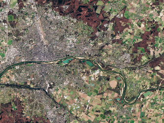
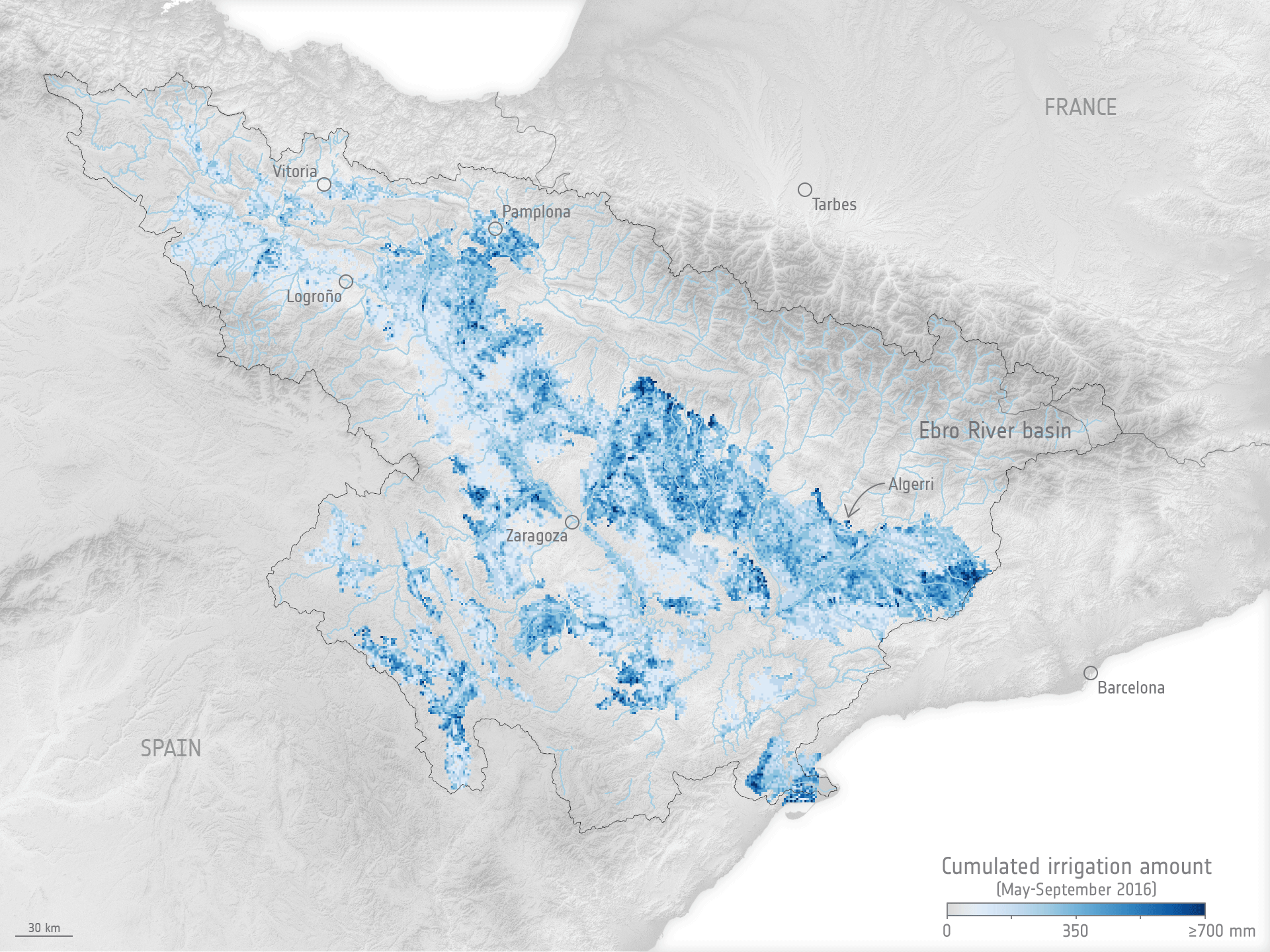
The animation above shows irrigation in the Ebro River basin in northeast Spain for May to September 2016–2020, (the 2020 estimates only run to July).
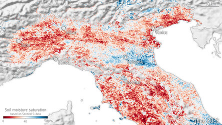
“Using data from the Copernicus Sentinel-1 radar mission and a soil-moisture inversion technique, we achieved irrigation estimates with 1 km resolution over the semi-arid Ebro river basin in northeast Spain and the wetter Po valley in northern Italy.
“Over the Murray-Darling basin pilot site in southeast Australia, which is also semi-arid, we achieve irrigation estimates of 6 km resolution using soil moisture data from NASA’s Cyclone Global Navigation Satellite System.”
The 1 km datasets over the two European regions span January 2016 to July 2020, while the irrigation estimates over the Murray–Darling basin span April 2017 to July 2020.
The datasets are available freely for download.
ESA’s Espen Volden added, “We are delighted that our Science for Society Irrigation+ project has yielded 23 scientific publications in peer-reviewed journals and the first regional-scale gridded irrigation datasets retrieved from satellite observations at a spatial resolution suitable for water resource management in agriculture.
“They could lay the foundation for developing a system for monitoring water irrigation in high-resolution from space, which is much-needed given the pressure that our freshwater supplies are under now and the fact that they will be under even more pressure in the future.”
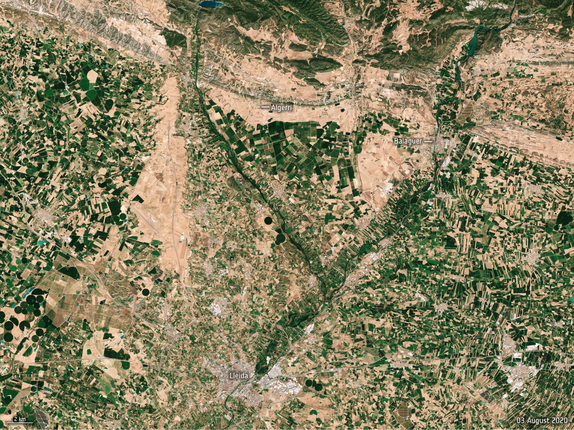
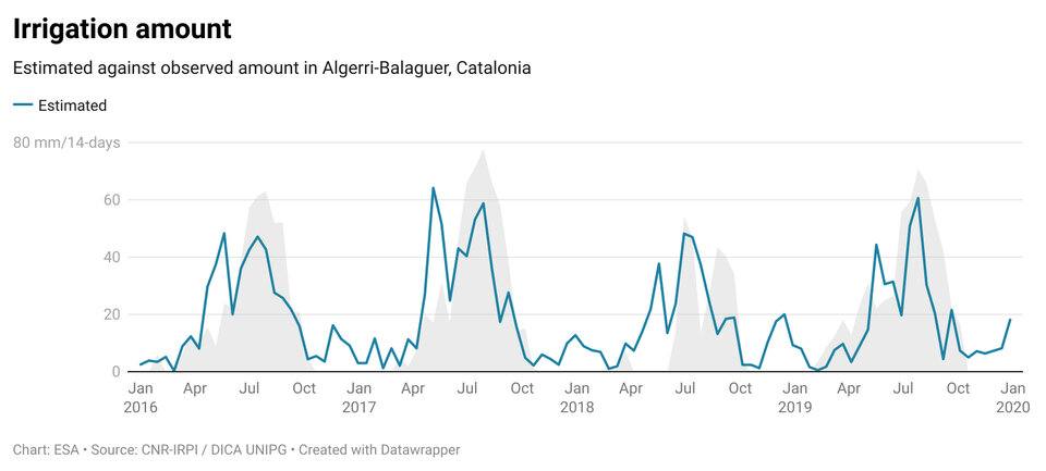
The animation above shows the Algerri-Balaguer irrigation district, in the Ebro River basin, in Spain. The background image was acquired by the Copernicus Sentinel-2 mission on 3 August 2020 and the blue slate shows what is categorised as permanently irrigated land by the Corine Land Cover 2018 dataset.