Giant A-68A iceberg loses chunk of ice
A large block of ice has broken off the northern tip of the A-68A iceberg as seen in new images captured by the Copernicus Sentinel-3 mission.
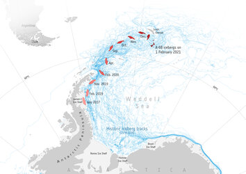
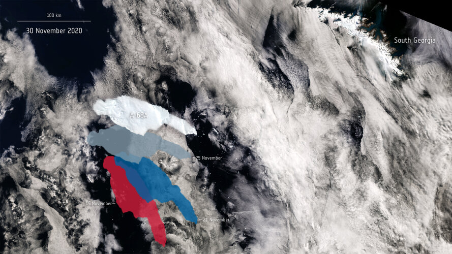
Satellite missions have been used to track the A-68A berg on its journey since 2017, when it broke off the Larsen C ice shelf in Antarctica. Over the past weeks, the A-68A iceberg has drifted alarmingly close to the remote island of South Georgia, where scientists feared that the iceberg could ground in the shallow waters offshore and threaten wildlife.

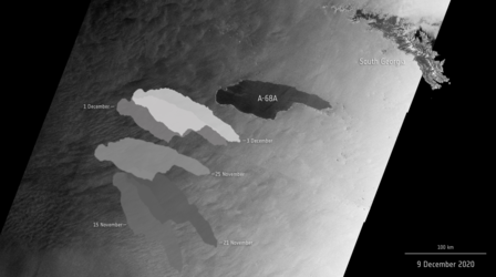
New satellite images revealed yesterday that the iceberg has spun around in a clockwise direction, moving one end of the berg closer to the shelf and into shallow waters. In doing so, the berg could have scraped the seafloor, measuring less than 200 m deep, causing an enormous block of ice to snap off the iceberg’s northern tip.
The new chunk of ice is around 18 km long and approximately 140 sq km, around the same size as Seville, Spain, and can be seen detached from the main A-68A iceberg in the images. Despite its small appearance in the images, the new piece of ice is so large it will most likely be named A-68D by the US National Ice Centre in the coming days. Two other chunks of ice that previously broke off were named A-68B and A-68C.
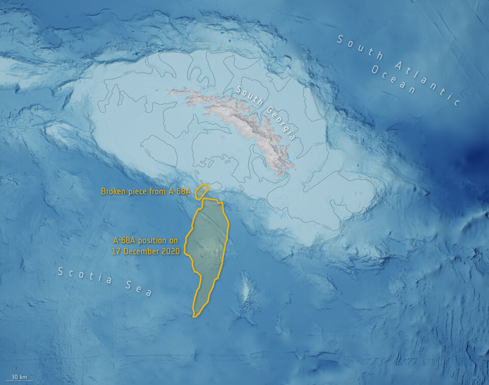
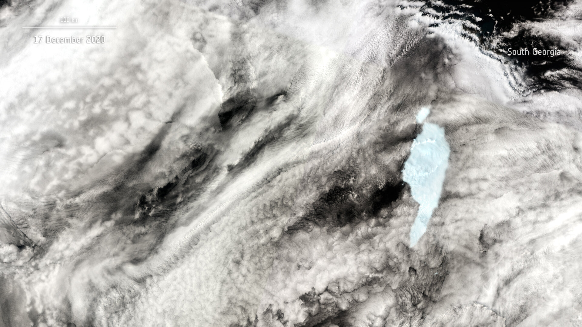
The main A-68A iceberg is now approximately 3700 sq km with a length of around 135 km. Having lost many other pieces of ice over the past weeks, A-68A has now lost its title as the world’s largest iceberg. First place now passes onto the A-23A iceberg, which is currently stuck in the Weddell Sea, with a size of almost 4000 sq km.
It is still unclear where the main A-68A iceberg will now travel. Carried by currents, it could continue its journey around the island of South Georgia as many other previous icebergs have done in the past, moving in a southeast direction, before turning north.
The map below shows the different positions of the berg over the course of its three-year journey. The map highlights that during its first two years of freedom A-68 drifted slowly, impeded by sea ice. But as it moved in relatively open waters, the pace of the iceberg increased.
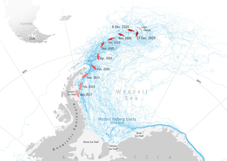
The map also includes historic iceberg tracks, based on data from a number of satellites including ESA’s ERS-1 and ERS-2 as part of the Antarctic Iceberg Tracking Database, and shows that A-68A is following this well-trodden path.
Satellite missions are being used to track the berg on its journey over the past three years. The Sentinel-1 radar mission in particular, with its ability to see through clouds and the dark, has been instrumental in mapping the polar regions in winter.
For the full A-68A story, click here.