Top 10 Earth observation stories of 2023
This year has been a whirlwind of captivating Earth observation stories and news, spanning from dramatic volcanic eruptions to powerful earthquakes to witnessing icebergs on the run. Join us as we revisit some of the most memorable stories from 2023.
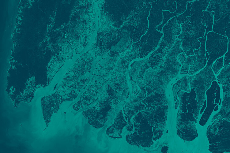
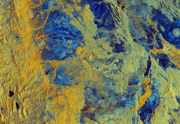
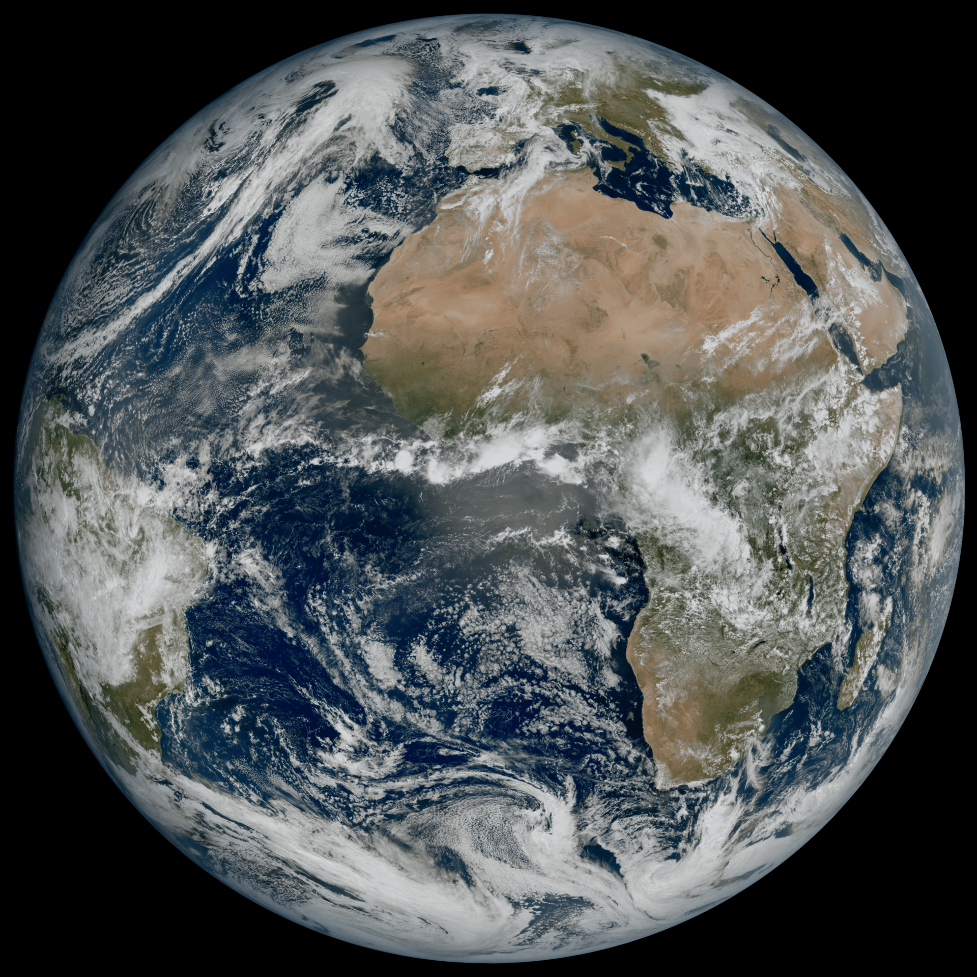
10) We celebrated 25 years of Copernicus
‘Europe’s eyes on Earth’ started in 1998 as an idea for an operational environmental monitoring programme. Twenty-five years later, Copernicus is in full swing. With seven Copernicus Sentinel satellites in orbit, along with the contributing missions, terabytes of free and open data and information services are provided daily to hundreds of thousands of users.
The data help address some of today’s key challenges such as diminishing polar ice, food security, rising sea levels, natural disasters and, of course, climate change.
To celebrate the anniversary, browse through some of the highlights brought to you by Copernicus.
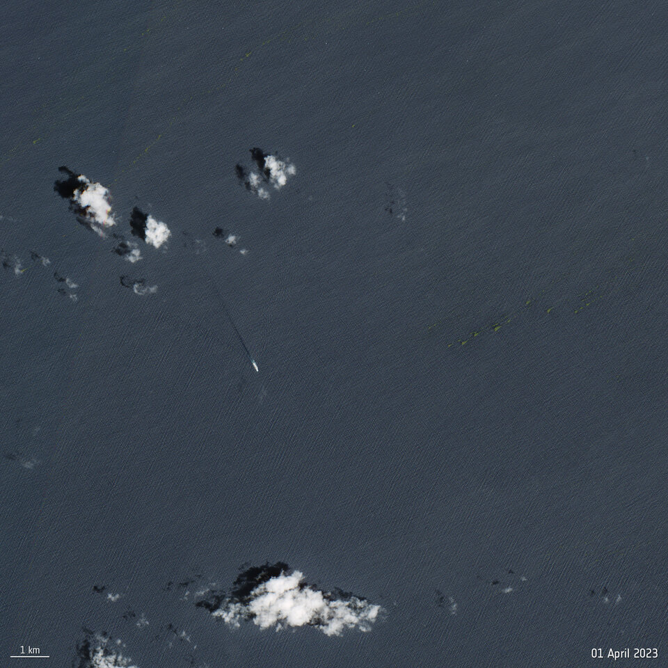
9) We spotted smelly seaweed from space
Open Image
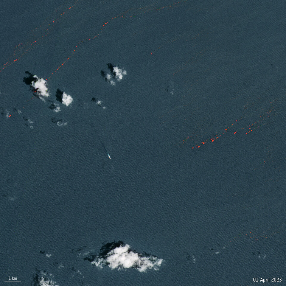
Sargassum is a large brown seaweed that floats in masses along the ocean surface. It is an important habitat for marine species providing food refuge and breeding grounds. It also absorbs atmospheric carbon dioxide through photosynthesis and converts it into organic carbon. However, when tonnes of it collects along coastlines, it rots – emitting toxins like hydrogen sulphide which produces a pungent smell.
This year’s bloom spanned more than 8800 km from the shores of Africa to the Gulf of Mexico and weighed around 10 million tonnes – so large that it was visible from space. Images from Copernicus Sentinel-2 showed the Sargassum around 45 km off the west coast of Guadeloupe.
It was predicted to be the largest ever recorded, but then unexpectedly shrunk.
Read the full story: Smelly seaweed bloom heads to Florida
8) We counted wildfires across the globe
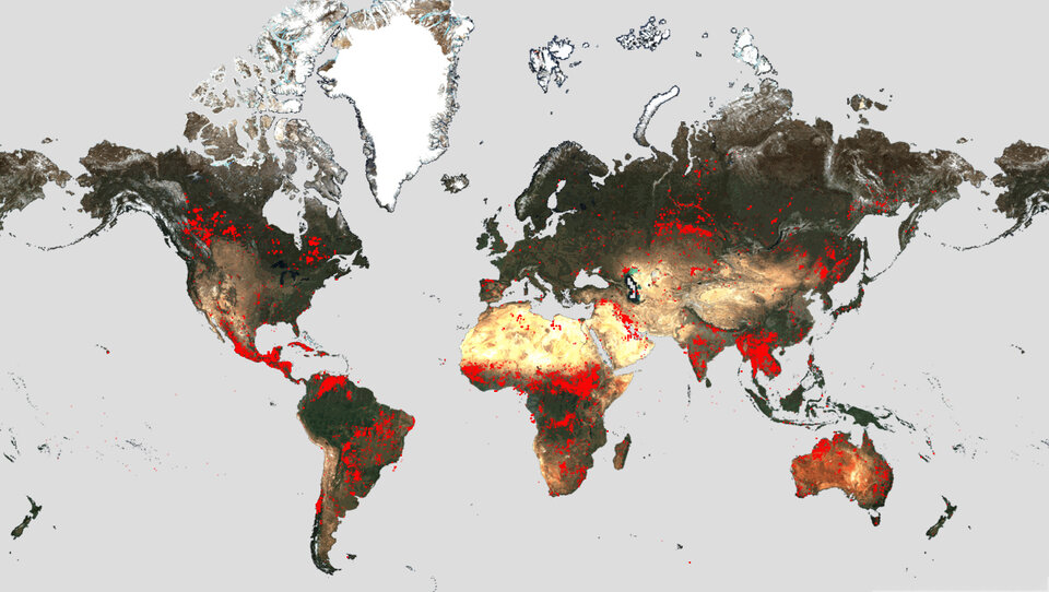
This summer, devastating wildfires spread across Greece, Italy, Spain, Portugal, Algeria and Canada – causing massive environmental and economic damage, as well as human casualties.
In light of the fires, ESA reopened its World Fire Atlas which offers insights into the distributions of individual fires taking place at both a national and global scale.
The dashboard uses night-time data from the Sea and Land Surface Temperature Radiometer (SLSTR) on board the Copernicus Sentinel-3A satellite. Working like a thermometer in the sky, the sensor measures thermal infrared radiation to take the temperature of Earth's land surfaces which is used to detect the fires.
In many of these outbreaks, the Copernicus Emergency Mapping Service was activated. The service uses satellite observations to help civil protection authorities and, in cases of disaster, the international humanitarian community, respond to emergencies.
Read full story: Counting wildfires across the globe
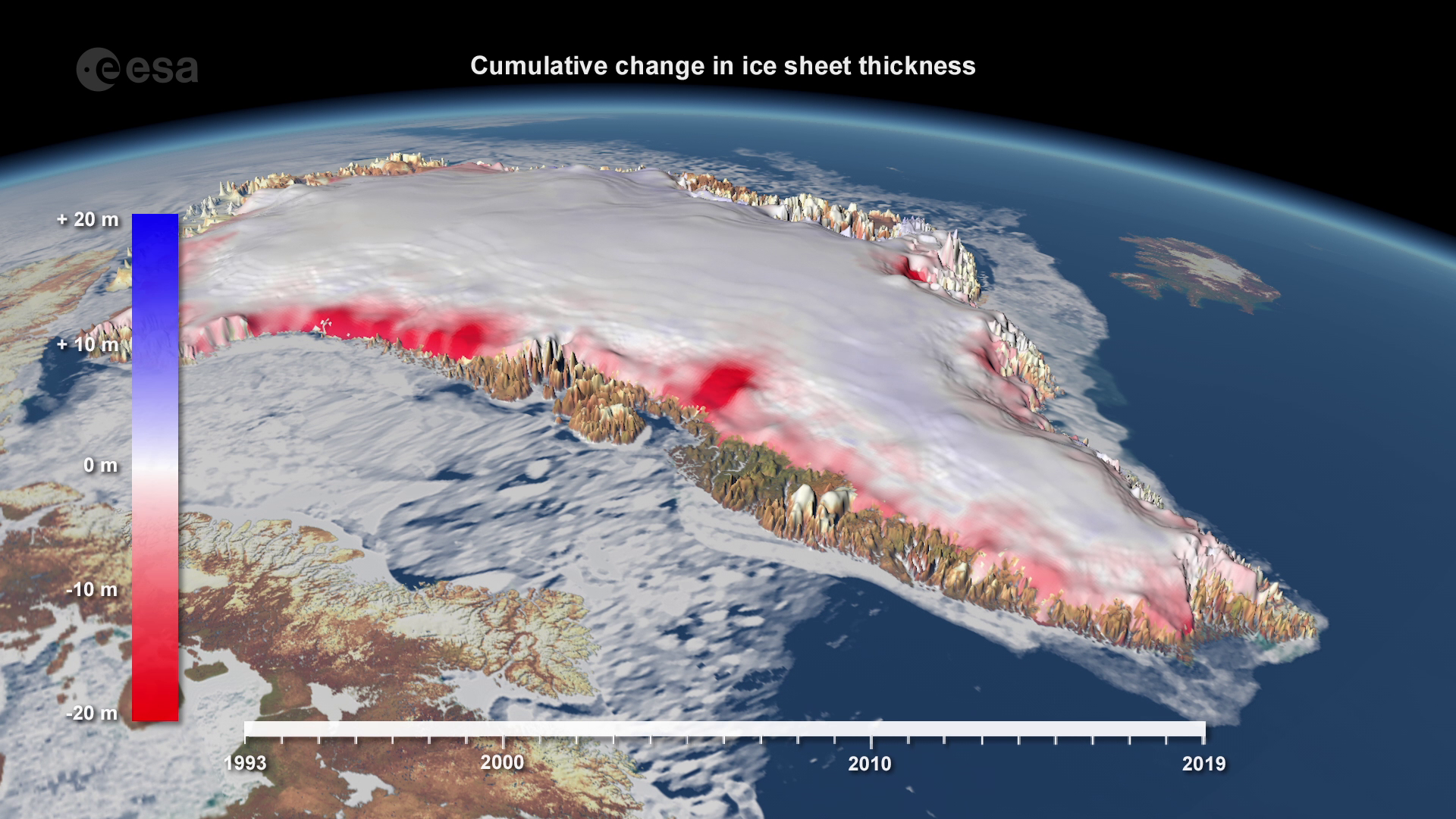
7) Ice loss from Antarctica and Greenland hit a record low

Access the video
A report from the Ice Sheet Mass Balance Intercomparison Exercise stated that between 1992 and 2020, the polar ice sheets lost 7560 billion tonnes of ice – equivalent to an ice cube measuring 20 km each side.
The polar ice sheets have together lost ice in every year of the satellite record, and the seven highest melting years have occurred in the last decade. Melting peaked in 2019, when the Greenland and Antarctic ice sheets lost a staggering 612 billion tonnes of ice.
Scientists use data from satellites such as ESA’s CryoSat and the Copernicus Sentinel-1 to measure changes in ice volume and flow, as well as satellites that provide information on gravity, to work out how much ice is being lost.
Read full story: Ice loss from Greenland and Antarctica hits new record
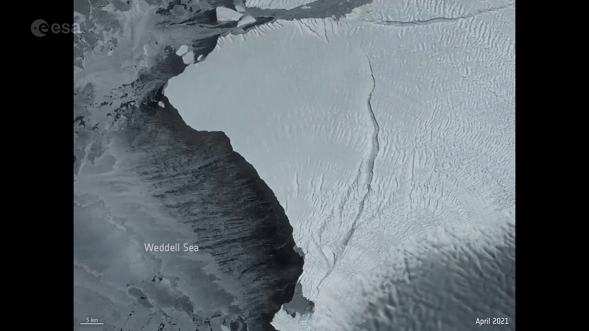
6) We watched an iceberg larger than London break free
Access the video
Glaciologists have monitored the many cracks and chasms that have formed in the thick Brunt Ice Shelf, which borders the Coats Land coast in the Weddell Sea sector of Antarctica, for years. It was only a matter of time that the A-81 iceberg would break free.
After several years of desperately clinging on, satellite imagery confirmed the enormous iceberg finally calved on 22 January from Antarctica’s Brunt Ice Shelf. The iceberg, which is around 1550 sq km – around the size of Greater London or five times the size of Malta – is currently floating near the ice edge of the Ronne Ice Shelf, about 600 km from where it calved.
Routine monitoring from satellites offers unparalleled views of events happening in remote regions. The Copernicus Sentinel-1 mission carries radar, which can return images regardless of day or night and this allows us year-round viewing.
Read the full story: Giant iceberg breaks away from Antarctic ice shelf
5) 2023 set to be hottest year on record
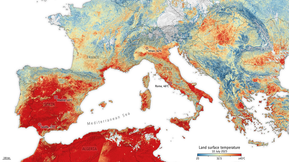
The WMO provisional State of the Global Climate report confirms that 2023 is set to be the warmest year on record. Data until the end of October shows that the year was about 1.40°C above the pre-industrial 1850—1900 baseline.
The warming El Niño event, which emerged during the Northern Hemisphere spring of 2023 and developed rapidly during summer, is likely to further fuel the heat in 2024 because El Niño typically has the greatest impact on global temperatures after it peaks.
Data from the Copernicus Sentinel-3 mission’s radiometer instrument show the land surface temperature on in July 2023. Land surface temperature is how hot the ‘surface’ of Earth feels to the touch. Air temperature, given in our daily weather forecasts, is a measure of how hot the air is above the ground.
Link to full story: Europe braces for sweltering July
4) Three Sentinel satellites mapped methane super-emitters
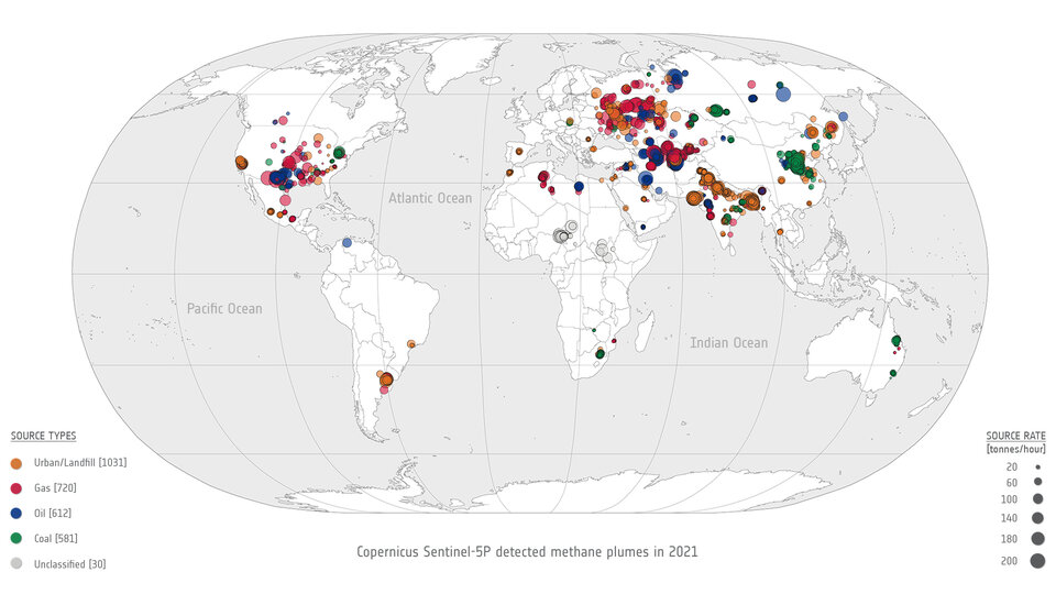
Methane is the second most important greenhouse gas contributor to climate change after carbon dioxide. Typically, methane emissions are monitored by the Copernicus Sentinel-5P satellite. But this year, scientists combined data from multiple satellites to monitor methane from space for the very first time.
Researchers from the SRON Netherlands Institute for Space Research spotted a continuous methane emission from a leaking facility using data from the Tropomi instrument on Sentinel-5P. They then used a Sentinel-2 image to zoom in on the plumes’ origins and pinpointed the exact location of the leak, while Sentinel-3 showed the leak continued for six days.
Combining the data from these satellites allows researchers to zoom in with precision, identifying, quantifying and monitoring methane sources corresponding to plumes observed in Sentinel-5P’s global scans.
Read the full story: Trio of Sentinel satellites map methane super-emitters
3) Ozone hole in 2023 was one of the biggest on record
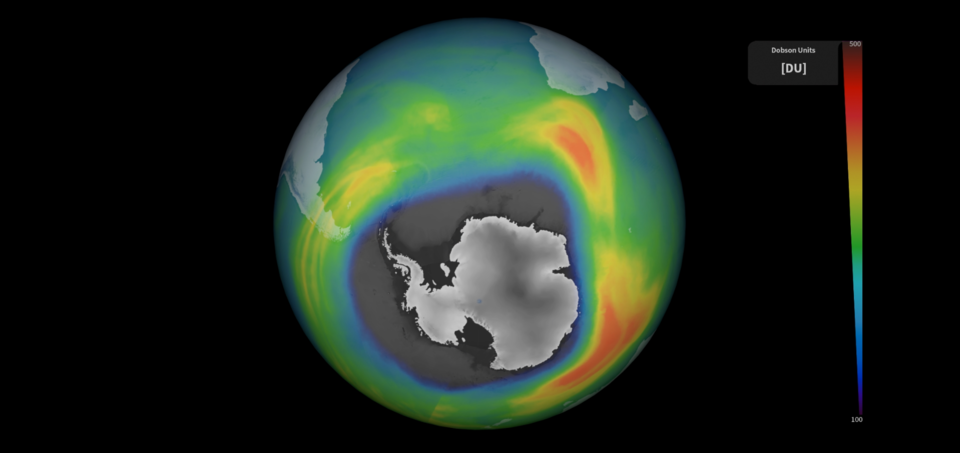
Much like the sea ice around Antarctica which grows and retreats each year, the ozone hole fluctuates on a regular basis.
Observations from the Copernicus Sentinel-5P satellite indicate that the ozone hole or ‘ozone depleting area’ reached a size of around 26 million sq km on 16 September 2023 – making it one of the largest seasonal holes ever observed. This is roughly three times the size of Brazil.
One possible reason for this year’s unusual ozone patterns could be associated with the eruption of the Hunga Tonga-Hunga Ha'apai in January 2022, which injected massive quantities of water vapour into the stratosphere. Despite the large seasonal growth this year, the ozone hole is still decreasing in size overall. Scientists currently predict that the global ozone layer will reach its normal state again by around 2050.
Read the full story: Ozone hole goes large again
2) We said goodbye to a historic mission – Aeolus
Access the video
This year we said goodbye to the Aeolus wind mission – one of ESA’s most successful Earth observation missions. As an Earth Explorer, the satellite was designed as a research mission and to demonstrate new space technology.
Surpassing scientific expectations and exceeding its planned life in orbit, the Aeolus wind mission reentered Earth’s atmosphere on 28 July at around 21:00 CEST above Antarctica. This was the first-of-its-kind assisted reentry and set a new standard for the safe reentry of satellites and space debris mitigation.
Read the full story: Aeolus: a historic end to a trailblazing mission
1) We entered a new era of satellite meteorology
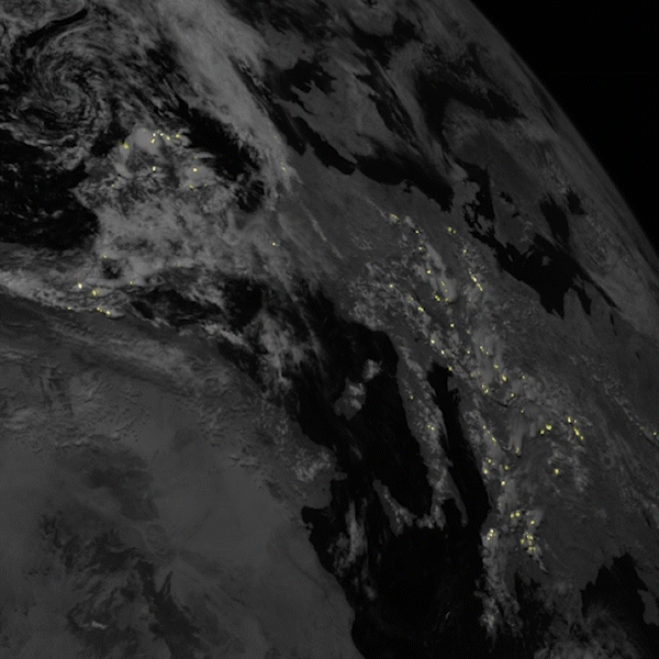
The Meteosat Third Generation Imager not only delivered its first view of Earth this year, but also provided us with striking animations of lightning – confirming its capability of revolutionising the detection and prediction of severe storms.
The Meteosat Third Generation Imager-1 is the first of six satellites that form the full MTG system. When fully operational, the system will provide critical data for short-term and early detection of potential extreme weather events over the next 20 years.
Its first image of Earth revealed a level of detail about weather over Europe and Africa not previously possible from 36 000 km away. Just a few months later, the satellite’s Lightning Imager was switched on. The Lightning Imager is the first-ever satellite instrument capable of continuously detecting lightning across Europe and Africa and its capabilities promise to revolutionise the detection and prediction of severe storms.
Read the full stories: New weather satellite reveals spectacular images of Earth and European satellite strikes lightning