• → European Space Agency

      • Space for Europe
      • Space News
      • Space in Images
      • Space in Videos
    • About Us

      • Welcome to ESA
      • DG's News and Views
      • For Member State Delegations
      • Business with ESA
      • ESA Exhibitions
      • ESA Publications
      • Careers at ESA
    • Our Activities

      • Space News
      • Observing the Earth
      • Human Spaceflight
      • Launchers
      • Navigation
      • Space Science
      • Space Engineering
      • Operations
      • Technology
      • Telecommunications & Integrated Applications
    • For Public

    • For Media

      • Media
      • ESA TV
      • Videos for professionals
      • Photos
    • For Educators

    • For Kids

    • ESA

    • Space Science

    • Our Universe
    • About Space Science
    • ESA's 'Cosmic Vision'
    • Science missions
    • Mission navigator
    • Target groups
    • For Media
    • For Scientists
    • For Kids
    • Multimedia
    • Science images
    • Science videos
    • Animations
    • Downloads
    • Sounds from space
    • Resources
    • Reference section
    • Services
    • FAQs
    • Glossary
    • Help
    • Portal terms of use
    • Comments
    • Follow us
    • RSS feeds
    • ESA Sci on Twitter
    • ESA Space Science Images on Flickr
    • ESA 3D on Flickr

    ESA > Our Activities > Space Science

    Echus Chasma

    Echus Chasma, nadir view
    14 July 2008

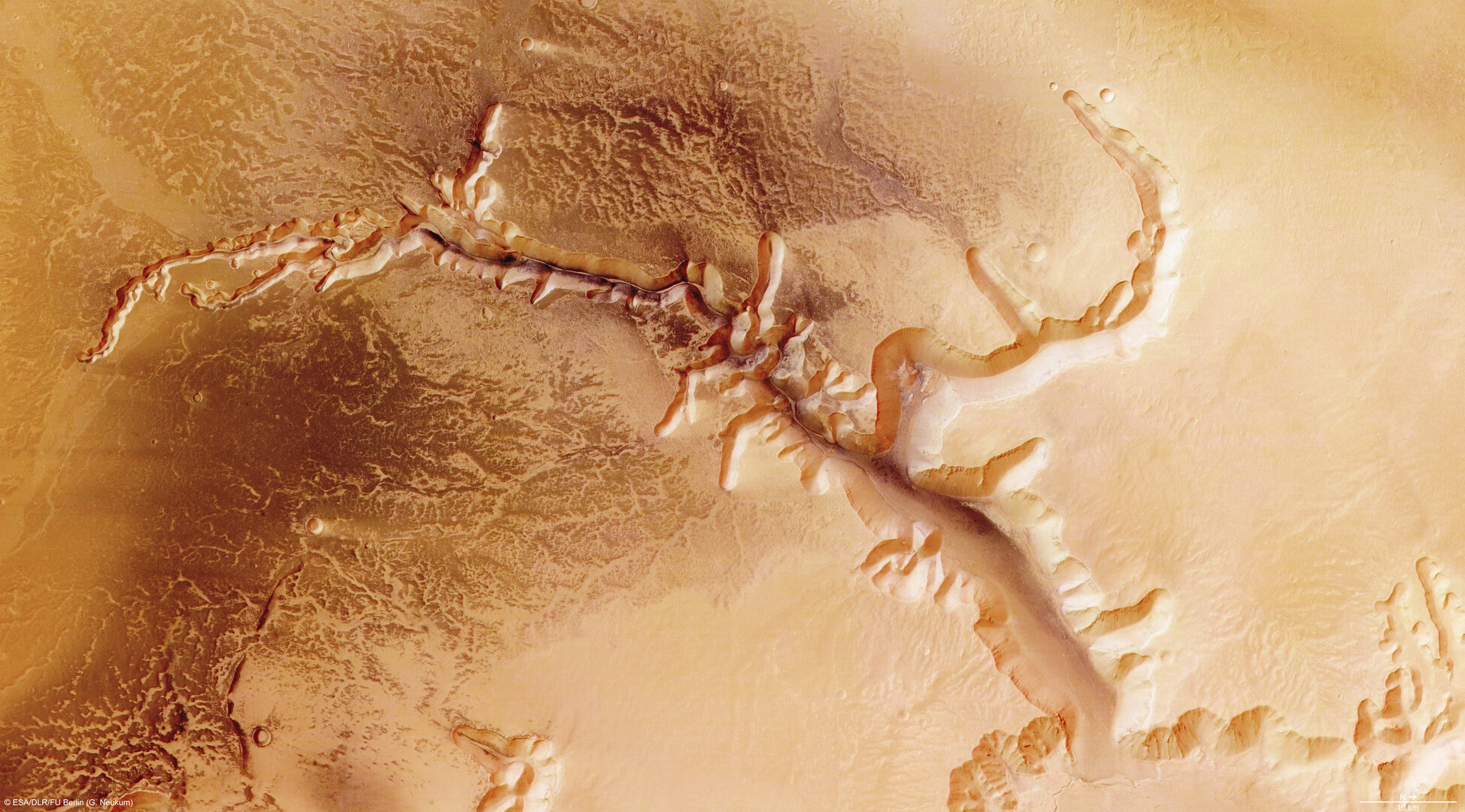
    The High-Resolution Stereo Camera (HRSC) on board ESA’s Mars Express has returned images of Echus Chasma, one of the largest water source regions on the Red Planet.

    The data was acquired on 25 September 2005. The pictures are centred at about 1° north and 278° east and have a ground resolution of approximately 17 m/pixel.

    Echus Chasma context map
    Echus Chasma context map

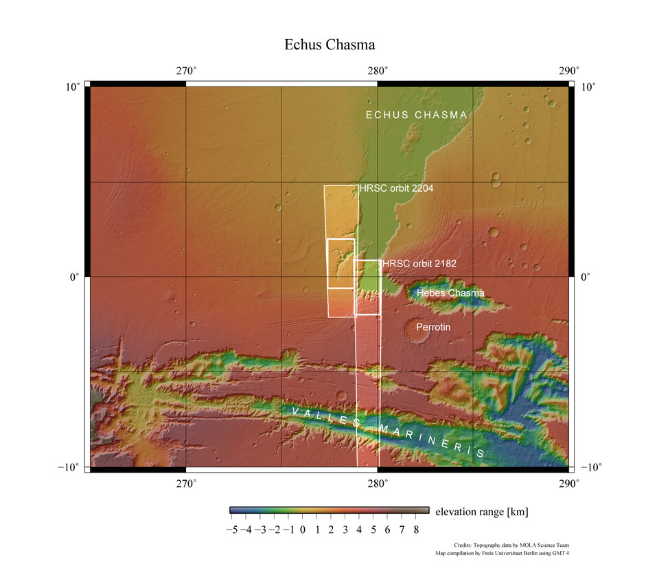
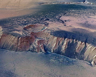
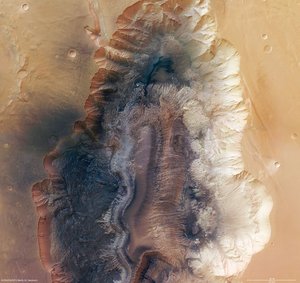
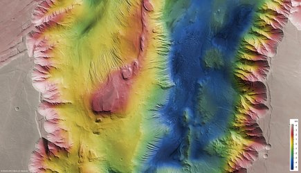
    Echus Chasma is an approximately 100 km long and 10 km wide incision in the Lunae Planum high plateau north of Valles Marineris, the ‘Grand Canyon’ of Mars. Echus Chasma is the water source region of Kasei Valles, which extends thousands of kilometres to the north, and its southern-most part.


    Perspective view of Echus Chasma
    Perspective view of Echus Chasma

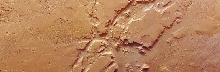
    Echus Chasma is bounded to the west by the Echus Chasma plateau which lies about 4 km above the Echus Chasma floor. On the plateau are deeply incised valleys which connect to the Echus Chasma valley.

    Echus Chasma
    Echus Chasma

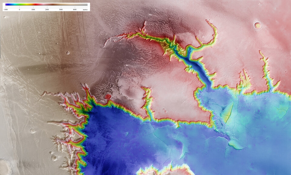
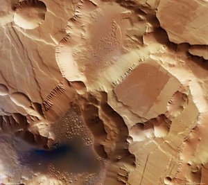
    The images of the Echus Chasma plateau show valleys that are about 10 km long and 1000 m deep. The main valley, Kasei Valles, is about 4 km in depth. The smaller valleys, also called sapping canyons, originate from the discharge of groundwater.

    Echus Chasma, annotated nadir view
    Echus Chasma, annotated nadir view

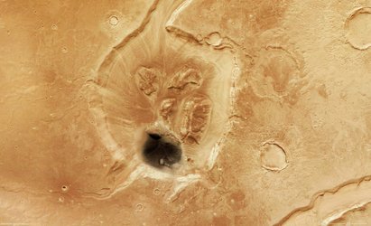
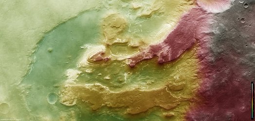
    One possible indication for volcanic activity in the past is be a sickle-shaped, about 25-km long dike in the centre of the image (feature 2 in the annotated image). Dikes are rock formations of volcanic origin. They are formed when magma rises up through fissures in the overlying rock or penetrates existing rock layers. The magmatic rock is usually resistant to weathering and is able to endure erosion.

    Echus Chasma, perspective view
    Echus Chasma, perspective view

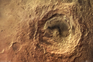
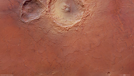
    Two impact craters with a diameter of approximately 8 km are located south-east of the dike. The eastern crater was partly eroded as the valley formed. A large portion of the crater collapsed into the valley and its debris was removed.

    Echus Chasma, perspective view
    Echus Chasma, perspective view

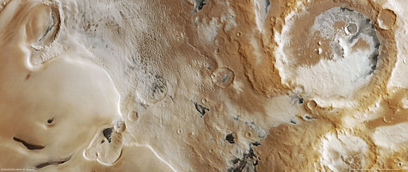
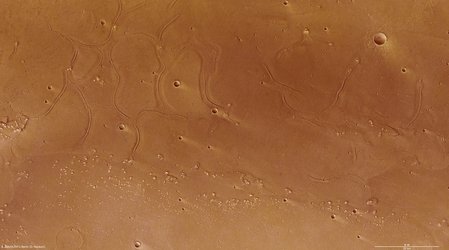
    The dark material shows a network of light-coloured, shallowly incised valleys. They look similar to drainage networks known on Earth.

    For more images, see page two

    Rate this

    Views

    Share

    • Currently 5 out of 5 Stars.
    • 1
    • 2
    • 3
    • 4
    • 5
    Rating: 5/5 (1 votes cast)

    Thank you for rating!

    You have already rated this page, you can only rate it once!

    Your rating has been changed, thanks for rating!

    431
    Tweet
    • Mars Express image browser
    • Related articles
      • Echus Chasma
        • Echus Chasma, page two
          • Crater in martian valley Mamers Valles
            • Hebes Chasma, a trough in the Grand Canyon of Mars
              • Icy Promethei Planum
                • Deep valleys of Candor Chasma
                  • ESA presents Mars in 3D
                    • Traces of the martian past in the Terby crater
                      • Noctis Labyrinthus, labyrinth of the night
                        • Hummocky and shallow Maunder crater
                          • The mysterious ridges at the mouth of Tiu Valles
                            • Impact Craters in Tyrrhena Terra
                              • Tectonic signatures at Aeolis Mensae
                              • Related links
                              • High Resolution Stereo Camera
                                • Behind the lens...
                                  • Frequently asked questions
                                  • For specialists
                                  • ESA Planetary Science archive (PSA)
                                  • NASA Planetary Data System
                                  • HRSC data viewer

    Connect with us

    • RSS
    • Youtube
    • Twitter
    • Flickr
    • G+
    • Facebook
    • Livestream
    • Subscribe
    • App Store
    • ESA Science Twitter

    Follow ESA science

    • LATEST ARTICLES
    • · Rare merger reveals secrets of gal…
    • · Watching for hazards: ESA opens as…
    • · ESA astronaut Timothy Peake set fo…
    • · Space drives e-mobility
    • · Proba-V opens its eyes
    • FAQ

    • Jobs at ESA

    • Site Map

    • Contacts

    • Terms and conditions