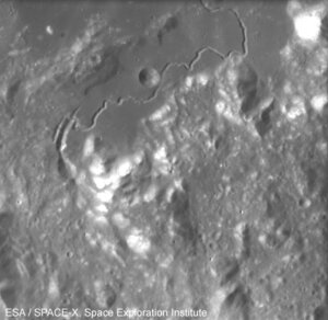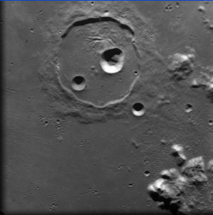
Highlands and Mare landscapes on the Moon
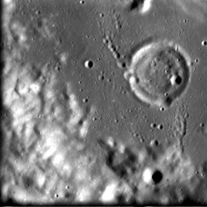
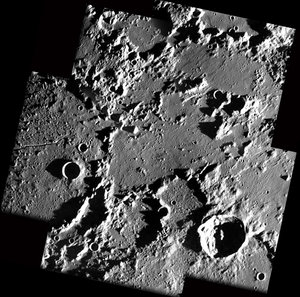
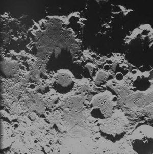
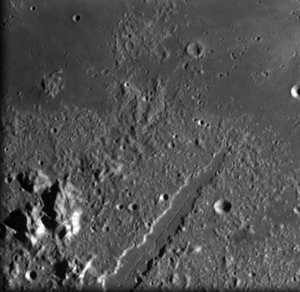
These two images, taken by the advanced Moon Imaging Experiment (AMIE) on board ESA’s SMART-1 spacecraft, show the difference between lunar highlands and a mare area from close by.
The first image, showing highlands, was obtained by AMIE on 22 January 2006, from a distance of about 1112 kilometres from the surface, with a ground resolution of 100 metres per pixel. The imaged area is centred at a latitude of 26º South and at a longitude of 157º West.
The second image, showing a mare, was taken on 10 January 2006, from a distance of about 1990 kilometres and with a ground resolution of 180 metres per pixel. The geographical coordinates of the area are 27.4º North latitude and 0.8º East.
Already when looking at the Moon with the naked eye, it can be seen that there are bright and dark areas on its surface. Centuries ago, the dark areas were called 'maria', presumably assuming that the observer would be seeing water oceans. Today we know that there is no liquid water on our satellite. However, telescopic observations showed that the maria are very flat, and are very different from the so-called highlands. The highlands are heavily cratered and mountainous.
We have learned that the maria are relatively young areas on the Moon which were generated after very large impacts penetrated the crust of our Moon and excavated basins. During later volcanic episodes, liquid magma came to the surface and filled these basins. When it cooled down and solidified, it formed the large flat areas we can still see now. As this happened in comparatively recent times, the number of impact craters is far less than in the highland areas.
From the two AMIE images it is possible to see how highlands present a very irregular topography and many craters, while the mare area is comparatively flat and shows a much smaller number of craters.
For more information:
Jean-Luc Josset, SPACE-X Space Exploration Institute
Email: jean-luc.josset @ space-x.ch
Bernard H. Foing, ESA SMART-1 Project Scientist
Email: bernard.foing @ esa.int