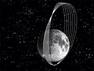
Lunar West Side Story - the SMART-1 Movie
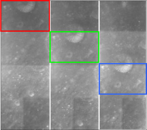
This video was compiled with a sequence of images taken by the advanced Moon Imaging Experiment (AMIE) on board ESA's SMART-1 during a full lunar orbit, when the spacecraft was flying over the west 'side' of the Moon.
AMIE obtained these images on 29 December 2004, flying over the west edge of the Moon around 70º West longitude. SMART-1 was on an orbit ranging between 1000 kilometres distance (perilune, over the South pole) and about 5000 kilometres distance from the Moon (apolune, over the North Pole).
From these distances, a series of images could be obtained with some overlap between them, that allowed to build a mosaic during a good part of the orbit.
It is possible to note that the images are mirror-inverted. The spacecraft attitude direction is also slightly changing along the orbit.
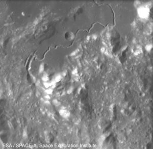
The beginning of the series shows close-up views of the old highlands areas at the edge of the Orientale basin. Then it is possible to see the edge of Oceanus Procellarum, a Mare area in Sinus Roris (from 30º to 50º North), and the Northern highlands with some conspicuous craters.
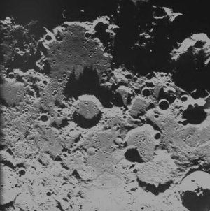
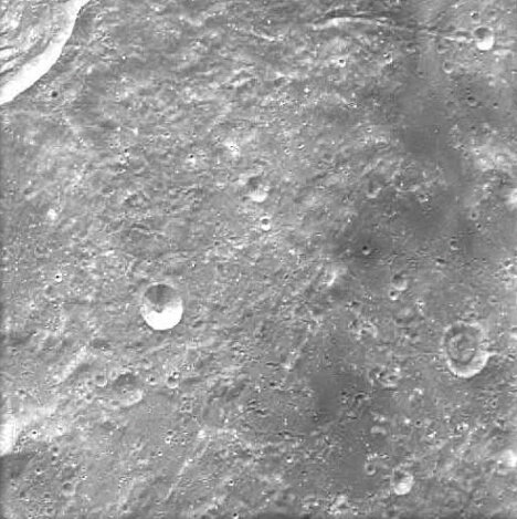
Elongated ejecta debris from the giant Orientale impact basin – image 25

Like a target ring bull's-eye, the lunar mare Mare Orientale (the 'eastern sea') is one of the most striking large scale lunar features. This impact basin is located on the extreme western edge of the visible side of the Moon, and it is difficult to see from Earth.
Basin ejecta begins just outside the Montes Cordillera and extend up to 500 kilometres beyond the base of the mountains. This ejecta feature has a rough texture and contains linear patterns that point back at the centre of Orientale.
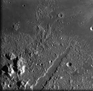
Edge of Oceanus Procellarum – images 52-56
Oceanus Procellarum, Latin for 'Ocean of Storms', is the largest of lunar maria, and it is situated on the western edge of the visible side of the Moon. In this image, it is the flat area on the right hand side.
Oceanus Procellarum extends over 2500 kilometres along its north-south axis and covers an area of about four million square metres. Its name derives from the old superstition that its appearance during the second quarter was bringing bad weather.
Like all lunar maria, this area was formed by ancient floods from volcanic eruptions that covered the region in a thick, nearly flat layer of solidified magma. Unlike the other lunar maria, however, Procellarum is not contained within a single well-defined impact basin. Minor bays and seas such as Mare Nubium and Mare Humorum (to the South) lie around its edges. To the northeast, Oceanus Procellarum is separated from Mare Imbrium by the Carpathian Mountains.
Oceanus Procellarum was the landing site of the lunar probes Surveyor 1, Surveyor 3, Luna 9 and Luna 13, and Apollo 12.
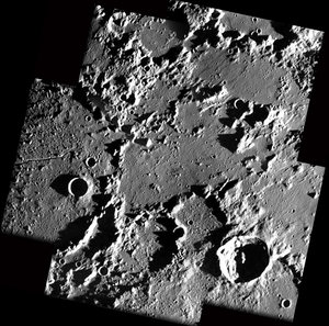
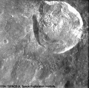
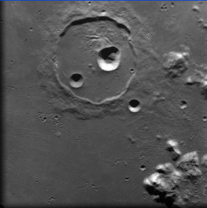
Pythagoras crater – images 115-119
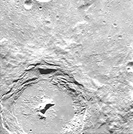
The Pythagoras crater is centred at 63.5° North latitude and 62.8° West longitude. Its diameter is about 130 kilometres and it is about 5 kilometres deep.
The rim of this crater is very well preserved. It presents a wide terrace system and a slight rampart around its external part. It is possible to observe that Pythagoras has a hexagonal form. The crater’s floor is flattened, but with an irregular and hilly surface.
There is evidence of landslides around the periphery, while in the centre it is possible to see a sharp, mountainous rise with a double-peak that rises one and a half kilometres above the floor of the crater.
The crater was named after Pythagoras (582-507 BC), the Greek mathematician and philosopher who believed that everything was related to mathematics and thought that everything could be predicted and measured in rhythmic patterns or cycles.
Carpenter crater - image 125
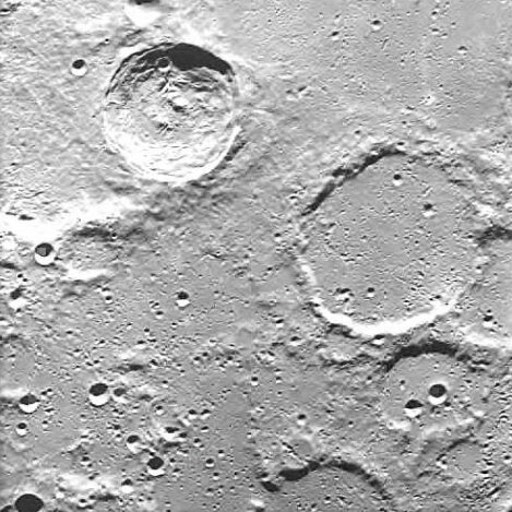
The Carpenter impact crater is located in the northern part of the Moon, at 69.4° North latitude and 50.9° West longitude, and it is visible in the upper left part of the image. Carpenter is 2.6 kilometres deep, and its diameter is 59 kilometres.
In geological terms, Carpenter is a young lunar crater, much younger than the surrounding crater formations – as one can see from its features that have not been significantly eroded by new impacts. Its inner wall displays an appearance of slumping (especially along the eastern face) and presents some terraces. The outer rim presents a small crater along the south-southeastern inner wall. The interior floor within the slopping inner walls is quite flat, but it shows irregular features such as small bumps and hills. Near the middle it is possible to see an unusual double peak formation, with a smaller peak offset to the west and a larger ridge offset to the east.
The crater is named after James Carpenter (1840-1899), British astronomer at the Royal Observatory in Greenwich. In 1871, together with the engineer James Nasmyth, he produced a book about the Moon titled 'The Moon: Considered as a Planet, a World, and a Satellite'. The book contained images of plaster models of the lunar surface taken from different angles - more realistic than the images that could be achieved by telescope photography at that time.
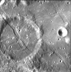
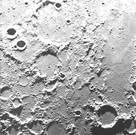
Poncelet crater – image 127

Poncelet is an eroded formation 69 kilometres wide - the remains of a lunar crater that is located near the northern limb of the Moon at 75.8° North latitude and 54.1° West longitude. It is visible at the bottom of the image, slightly decentred to the left.
Its interior has been flooded with lava, and it presents many tiny craters. The outer rim is a low, circular ridge which breaks towards south and northeast (in this image, the South is up).
Mouchez crater - image 133
Mouchez is an 81-kilometre wide formation - the remnant of a lunar crater that is located near the northern limb of the Moon. It is centred at 78.3° North latitude and 26.6° West longitude (visible at the top of the image, slightly decentred to the left), to the north of Philolaus crater.
As visible in the image, almost the entire eastern rim of this crater is missing, and the remaining arc is heavily eroded. Also visible at the bottom-right of the image is the Gioja crater (in this image, the South is up).
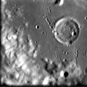
Gioja crater – image 135

Gioja is a lunar crater that is located in the vicinity of the north pole of the Moon, at 83.3° North latitude and 2° East longitude (centre of the image, slightly decentred towards the bottom). Because it lies close to the Northern limb, it is difficult to observe it from Earth (in this image, the South is up).
Gioja is 2.9 kilometres deep and 41 kilometres wide (diameter). It is attached to the southern rim of the larger, low-wall Byrd crater. The highest point of the Gioja crater's rim is situated at northwest, where it has been reinforced by the rim of the Byrd crater and by other old formations no longer visible. The interior floor is nearly flat, with a ridge going from the middle to the north-northeast rim. The inner floor is also marked by tiny craters, such as the pair visible near the west-northwestern inner wall.
The Gioja crater is named after Italian marine pilot and inventor Flavio Gioja (14th century) that perfected the sailor's compass.