Ensimmäiset Marsin suunnistuskartat
ESAn Mars Express -luotaimen kameralaitteiston tutkijat ovat koonneet saamistaan kuvista ja korkeustiedoista ensimmäiset "suunnistuskartat" Marsin pinnasta. Tuoreissa kartoissa on tarkat korkeuskäyrät ja geologisten muodostelmien nimet, ja niitä voidaan käyttää hyvänä lähtökohtana Marsin pinnan tutkimuksessa – sekä luonnollisesti pinnalla patikoidessa, kunhan sen aika on tulevaisuudessa.
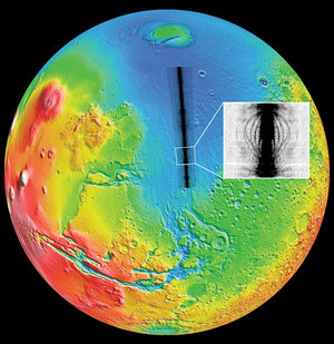
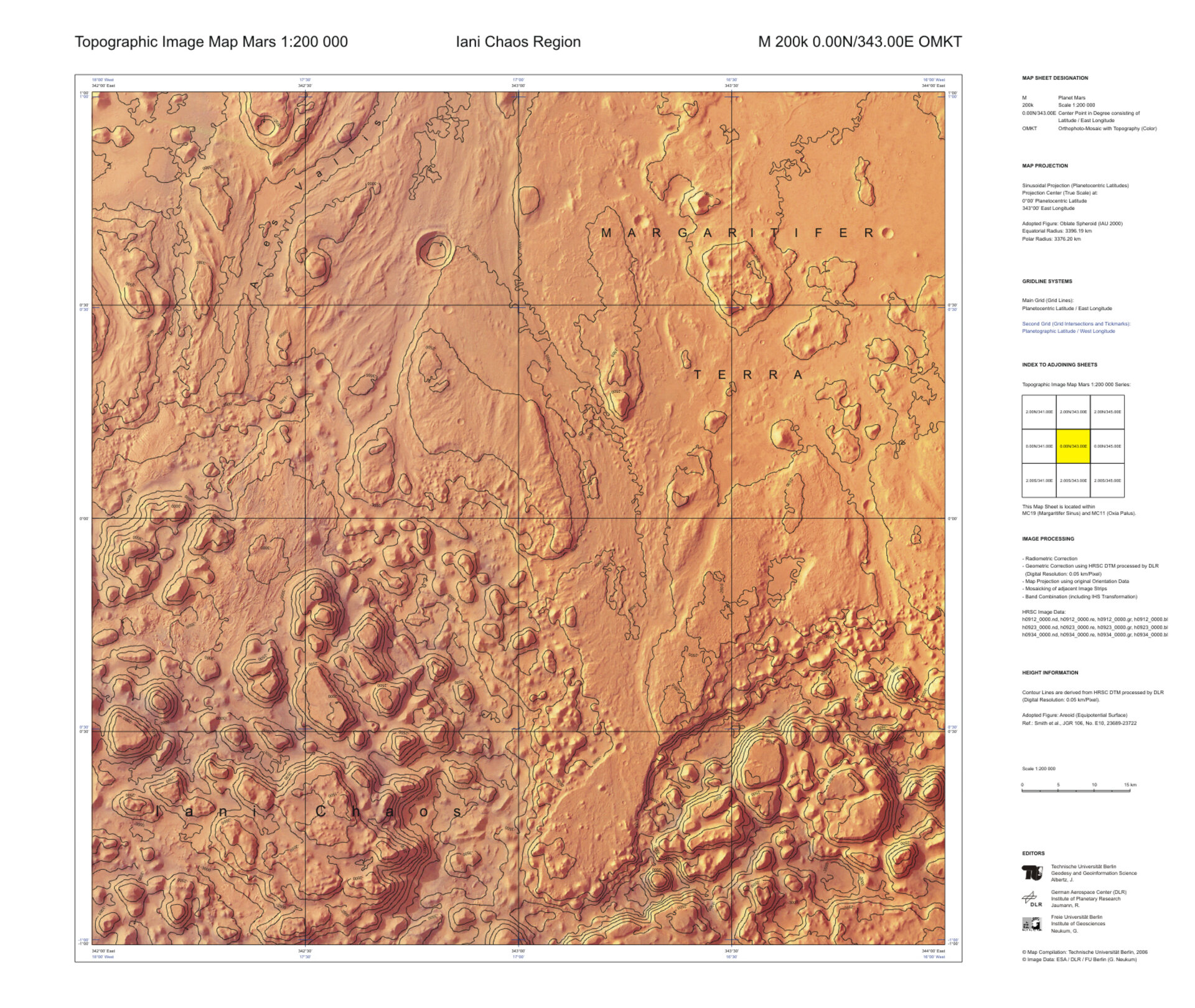
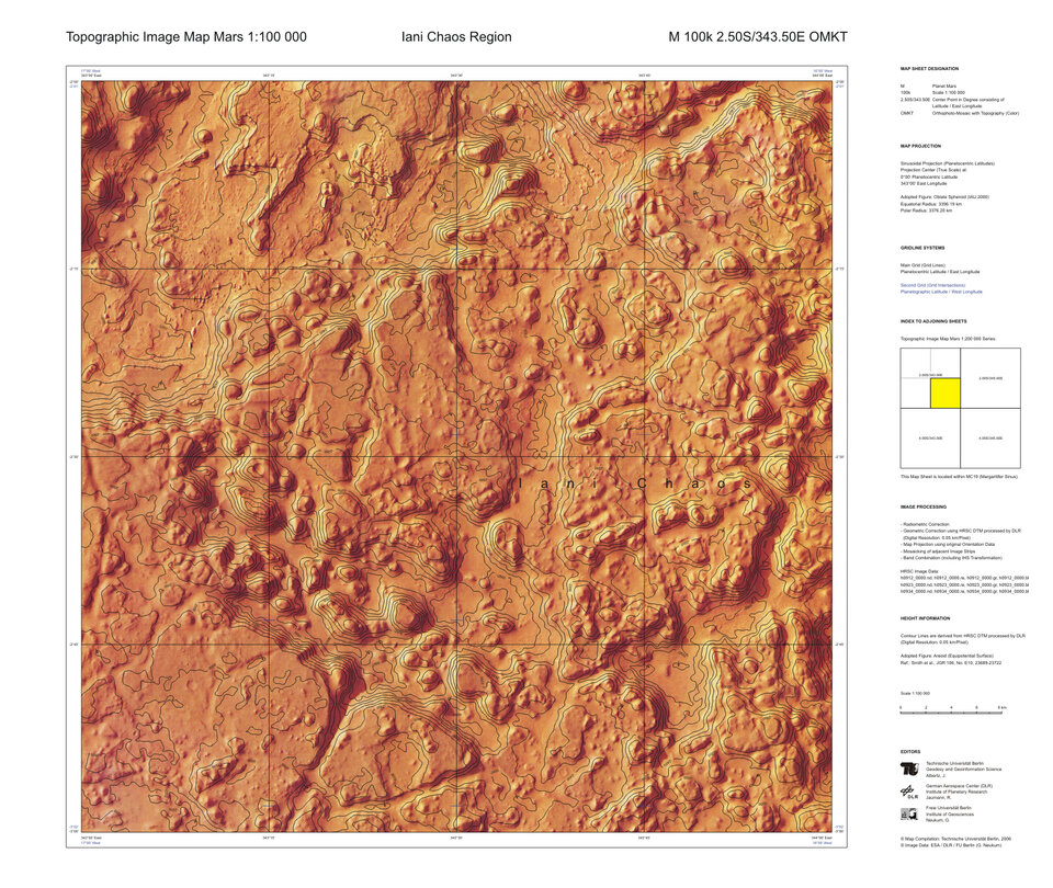
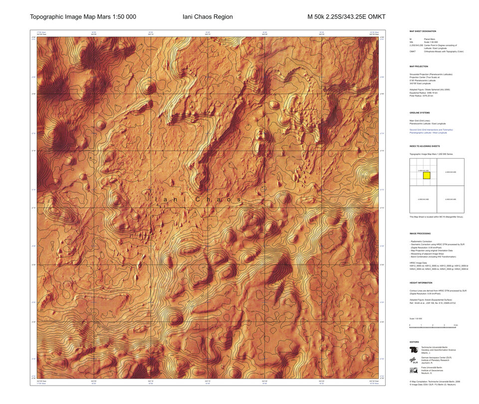
Retkeilyssä, suunnistuksessa ja maanrakennuksessa käytettäviä topografisia peruskarttoja vastaavat kartat esittävät toistaiseksi vain Iani Chaos -aluetta Marsin pinnalta. Kartoissa on tarkat korkeuskäyrät osoittamassa maaston korkeusvaihteluita.
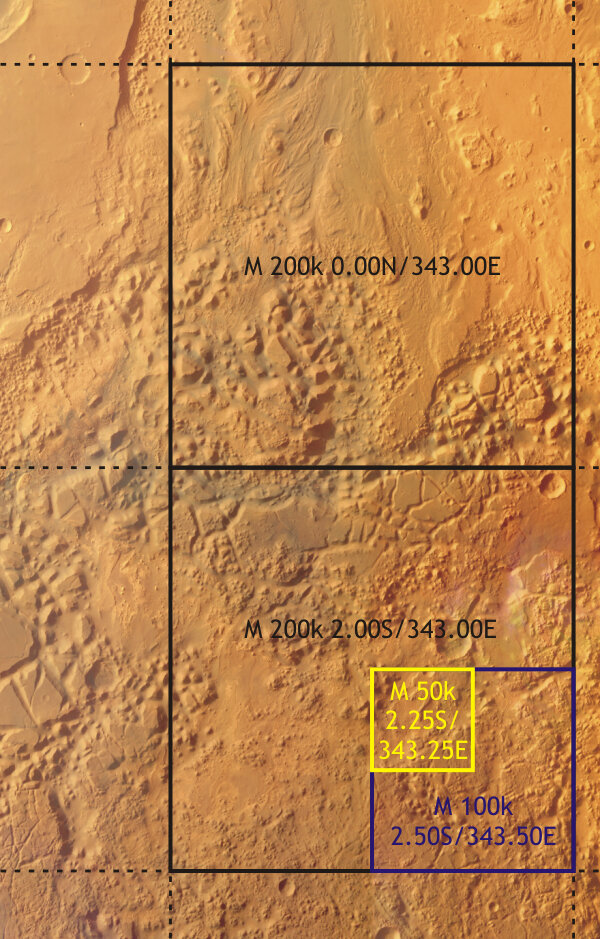
Käyrät on liitetty yhteen Marsin pinnasta otettujen suurtarkkuuskuvien kanssa. Kuvat on otettu Mars Express -luotaimen HRSC-suurtarkkuusstereokameralla, ne on muutettu digitaaliseen muotoon ja niistä on koottu kolmiulotteinen malli Marsin pinnasta (HRSC Digital Terrain Model). Mallin pohjalta on tehty sarja erilaisia topografisia karttoja, joiden mittakaavat ovat välillä 1:200 000 - 1:50 000.
Uudet kartat on tehty HRSC-kameran päätutkijan, Berliinin vapaan yliopiston professorin Gerhard Neukumin johdolla yhteistyössä Saksan kansallisen ilmailu- ja avaruuskeskuksen DLR planeettatutkimusinstituutin kanssa. Mukana työssä ovat olleet J. Albertz ja S. Gehrke Berliinin teknisen yliopiston geodesian ja geoinformaatiotieteiden instituutista.
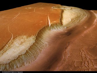
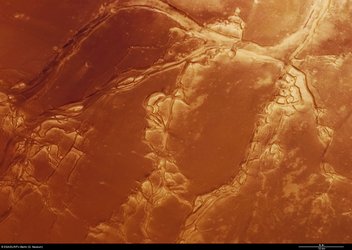
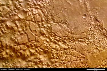
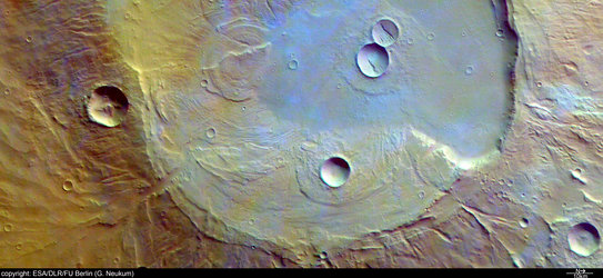
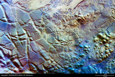
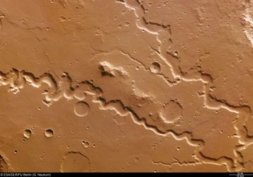
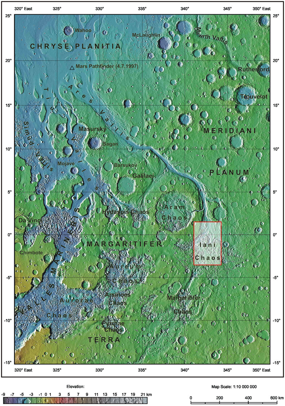
Tutkijat valitsivat Iani Chaos -alueen karttojen kohteeksi, koska se on pinnanmuodoiltaan hyvin kiinnostava. Tämä lähellä päiväntasaajaa sijaitseva painautuma-alue on täynnä yksittäisiä kohoutumia ja kukkuloita, jotka muodostavat kaottisen koko maiseman täyttävän kuvion.
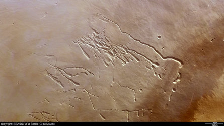
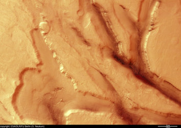
Kaikki kuvissa näkyvät kivisaarekkeet ovat todennäköisesti jäänteitä hyvin vanhasta Marsin pinnasta. Muodostelmien väleissä olevat alueet ovat vajonneet alas, kun pinnanalaiset onkalot ovat romahtaneet ajan kuluessa. Alun perin onkalot ovet todennäköisesti olleet täynnä jäätä, joka on kuitenkin sulanut Marsin sisäisen vulkaanisen lämmön vaikutuksesta. Sulanut vesi virtasi Ares -laaksoon (tunnetaan nimellä Ares Vallis), kohti Marsin pohjoisia alankoalueita, jolloin tyhjentyneiden onkalojen katot romahtivat alat ja synnyttivät Iani Chaoksen sellaisena kun se nyt nähdään.

Korkeuskäyrät auttavat hahmottamaan nopeasti ilman apuvälineitä pinnan morfologian kuvista. Suurimmassa osassa kartoista käyrät on piirretty 250 metrin korkeusjaon mukaan. Käyrien lisäksi kartoissa on pituus- ja leveyspiiriviivat ja nimet niille maantieteellisille kohteille, joille on annettu nimi,
Kartat osoittavat hyvin kuinka erilaisiin tarkoituksiin HRSC-stereokameran keräämiä tietoja voidaan käyttää. Mars Express jatkaa edelleen työtään, jotta pian koko Marsin pinta on kuvattu korkearesoluutiokuvin; silloin tiedoista voidaan piirtää haluttaessa topografiset kartat koko planeetalle. Tämä synnyttäisi 10372 yksittäistä karttalehteä, jos kukin kartta kattaisi saman suuruisen alueen Marsin pinnasta. Karttojen mittakaava olisi 1:200 000.
Toistaiseksi vain muutamia karttoja on tuotettu saksalaisen rahoituksen avulla. Koko Marsin kattavan kartaston tekeminen vaatii koko Euroopan laajuista yhteistyötä, mistä ollaan parhaillaan neuvottelemassa.
HRSC-kameran tieteelliseen ryhmään kuuluu kaikkiaan 45 apulaistutkijaa 32 tutkimuslaitoksesta, jotka ovat kymmenessä maassa. Suomesta mukana ryhmässä on Oulun yliopiston fysikaalisten tieteiden planetologian osasto Jouko Raitalan johdolla.
Lisätietoa
Gerhard Neukum, HRSC-kameran tieteellisen ryhmän päätutkija, Freie Universität Berlin
Sähköposti: gerhard.neukum @ fu-berlin.de
Agustin Chicarro, ESA, Mars Express -lennon päätutkija
Sähköposti: agustin.chicarro @ esa.int
Jouko Raitala, Oulun yliopisto
Sähköposti: jouko.raitala@oulu.fi
Puh: (08) 553 1945